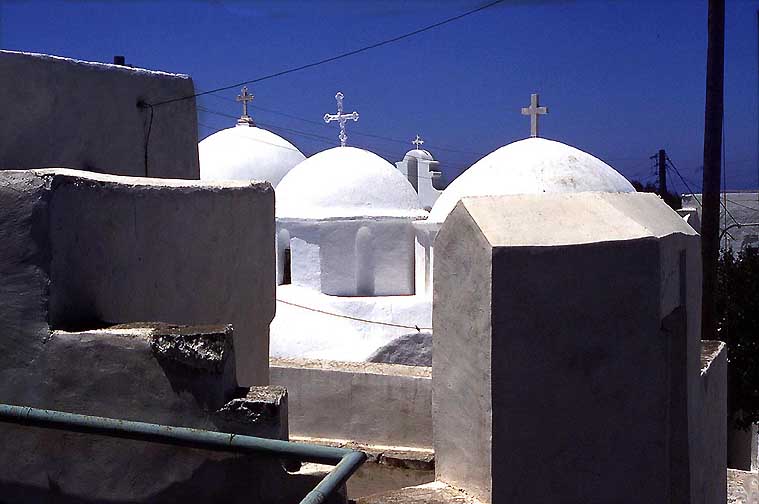
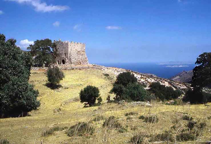
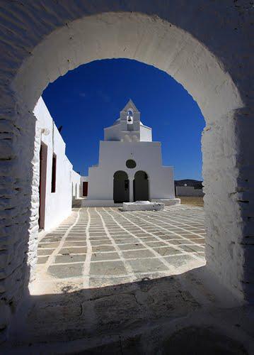
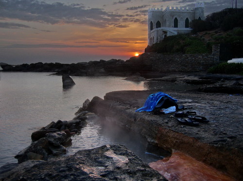
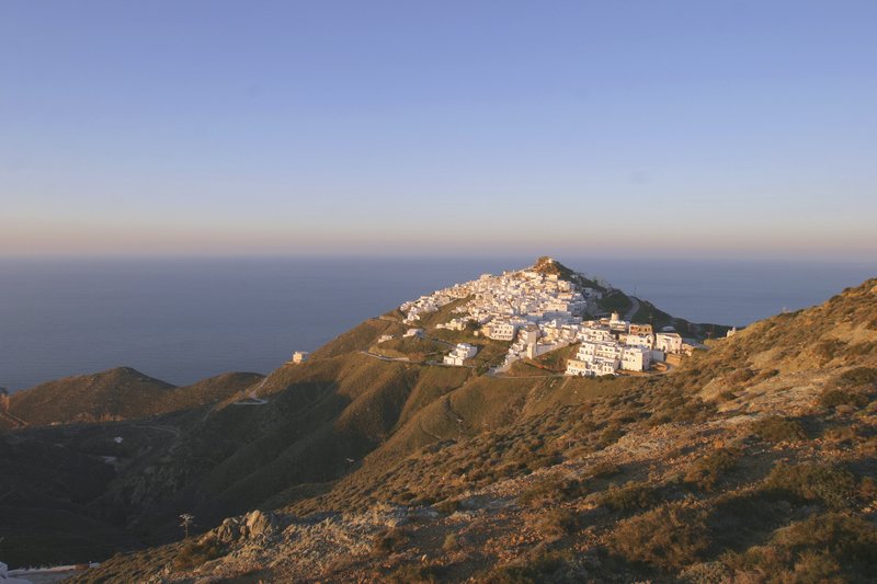
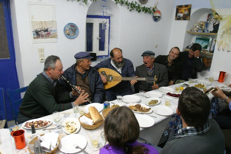
Amorgos, The Domes of the Chora ready to rise to Heaven
A
Guide to the Aegean Islands
2012
The Cyclades
When
I picture the Greek Islands, I think of the Cyclades. This may be a
limition, but that is where Barbara and I have been and returned to
many times between 1971 and 2005. They harbor the white and blue
villages above a bare seascape where even a palm tree is an eye
sore.
I will briefly describe the islands I know (and
provide links to their websites). However, I have not been back since
2005 and many of our old haunts have deteriorated so as to be no
longer attractive.
In the second part I'll search the internet for
“undiscovered” islands where the old ways have not died out –
and to my surprise, there are many!
In this search I have made
copious use of Matt
Barrett's website and Panoramio's photos in Google-Earth.
Our Islands
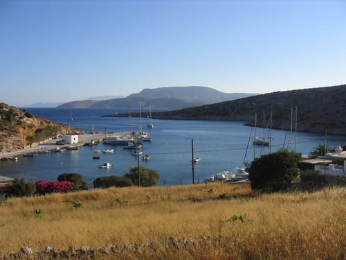
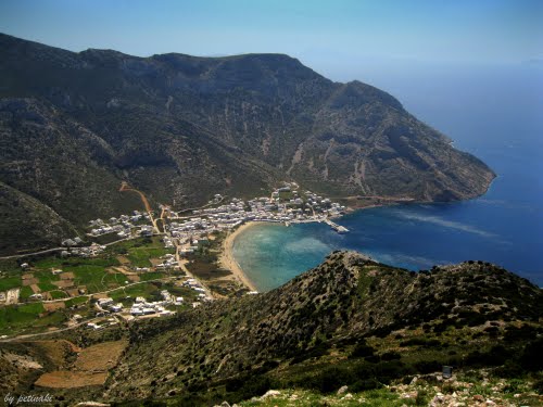
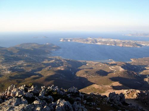
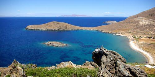
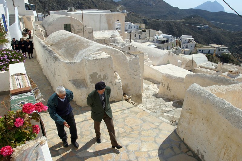
Amorgos
Google-Maps
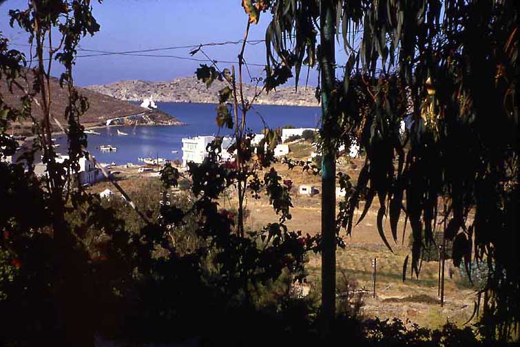
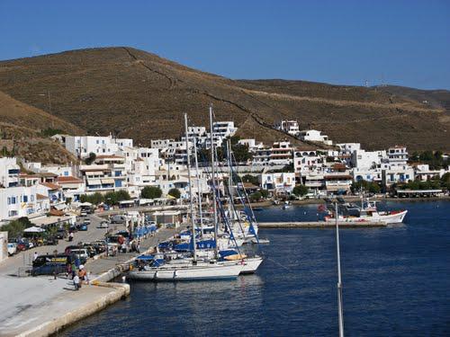
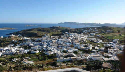
Amorgos,
The Domes of the Chora ready to rise to Heaven
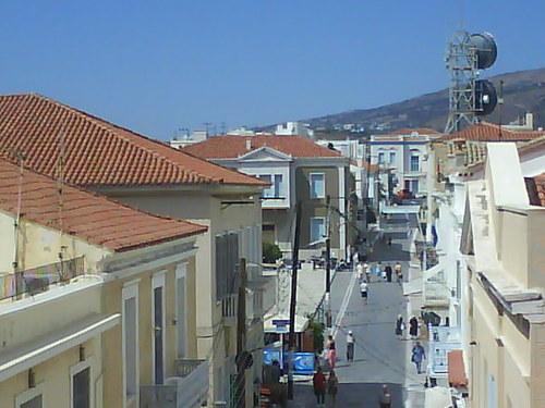
Amorgos
is our favourite Cycladic Island.: 5 hours by boat from Naxos and 10
from Pireus. It is far enough from the tourists and the cruise ships
to be visited only by the few who know and seek the solitude of an
unspoiled Greek island. There are no great, sandy beaches and no
hotels deserving the name, but there are plenty of private rooms and
eateries available in Katapola and a few in the Chora and in
Egiali.
It is a long spiny island with many hiking trails and an
11th-century monastery. It was the home of most celebrated Cycladic
sculptures (3000-1700 BC) in the museums of the world.
More
see on Rolfs
Amorgos Website
For an expanded GE kmz-file for Amorgos click
on "Hiking
on Amorgos"
Naxos
Google-Maps
Naxos,
Moni Christos Fotodoti (8th
cent) and the Lesser
Cycladic Islands in the distance
Besides
Amorgos we have explored Naxos for many years and love it.
More
see on Rolf's
Naxos Website
For an expanded GE kmz-file click on "Hiking
on Naxos"
Paros
Google-Maps
Paros,
the Bay seen from the Moni of the Anargyroi high above Paroikia
The
people of Paros are soft-spoken and love beauty - compared to those
on "Cretan" Naxos. While Naxos is endowed with many
Byzantine chapels Paros has one magnificent Byzantine cathedral - the
oldest church in Greece (326 AD).
More
see on Rolf's
Paros Website
|
|
|
There
are actually about a dozen “little Cyclades”, but only three are
inhabited in our times: Irakliá, Apáno Koufoníssi, and Schinoússa.
Donoússa is separate and has a larger permanent population. They are
barren but are strikingly different from one another, each with their
particular tourist clientele – though none now rank as
undiscovered, and all of them, given limited accommodation, are no-go
areas from mid-July to September 1, unless you have a rooms
reservation – or are happy to camp out. Athens agencies are
unlikely to be able to help with advance hotel reservations, except
on Páno Koufoníssi and Skhnioússa which have some luxury
complexes. But a room can often be found. Apáno Koufoníssi also has
the best beaches, with Donoússa not far behind; Mountainous Irakliá
has the best walking, with Donoússa running second. Accommodation
can be on the cheap side, but dining out is definitely not – little
islands do not mean little prices. While all four have a bank ATM
apiece, best not rely on these but come equipped with plenty of
cash.
I have gone by ferry through these islands, but have
never got off the boat.
For more on these islands see Marc
Dubin's Guide to the Little Cyclades
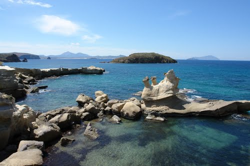
Keros
and Dashkalio Island
The latest
archeological sensation
Keros,
the Kavos excavation site in the foreground, Dashkalio Island in back
The
Keros Hoard
The now
uninhabited islands were populated during Minoan times. A hoard of
broken Cycladic Idols (2800-2300BC) were found there by looters in
the 1960s and sold to private collectors and museums by a Greek
dealer in Paris. Except for a very few the idols had all been broken
in antiquity.
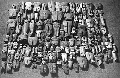
Collection
of looted fragments of dismembered figures from Kavos-Dashkalio
The
Greek authorities did nothing to stop the looting until in 2006-2008
a British team of archeologists under Colin Renfew determined that
the origin of the sculptures was at a place called Kavos-Dashkalio on
Keros and began excavating the area. The excavations were later
extended to the hump of Dahkalio Island, which was found to have been
covered by a sizable Bronze-age settlement. The excavations are still
proceeding, a final
report is expected in 2014.
It is now assumed – but not
proven – that Kavos was a ritual burial ground for sacred
sculptures – not people – from all over the Cyclades, which were
broken systematically before being interred in several pits. The
Kavos fragments “must have been deposited in the course of
ceremonies which were clearly of pan-Cycladic significance. Dhaskalio
Kavos can now be regarded as a symbolic central place, the first such
regional centre to have been discovered from the Aegean Early Bronze
Age,” Professor Renfrew reports. Polytismochoros
Islands
to Avoid:
Ios, Mykonos, and Santorini
All three are hopelessly ruined today, they have become expensive, noisy and brainless tourist traps. Unfortunately all three are among the most beautiful Cycladic Islands
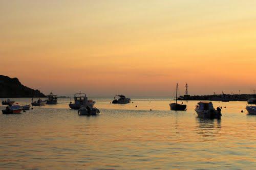
Ios
Google-Maps
Ios,
View
from our room over-looking Ios Bay, 1971
Ios
gets a nostalgic mention because we discovered it in 1971 and fell in
love with it before it slid into the abyss.
The Chora was wonderful so were the beaches. The people we met were
students (who are still friends), a US lawer practicing in Paris, a
beautiful French woman - a cultural attache of the Belgian embassy in
Paris.... all interesting, memorable people. Ten years older than
they, we never felt so young and frivolous. We stayed 2 weeks.
Five
years later we returned. - Ios had turned into the drug capital of
the Greek Islands. A terrible crowd mostly from the UK and Australia.
We gave Ios one more try, off-season in May 1994: the Chora and
its people were like walking ghosts.
I consulted Matt Barrett about the present state of this once beautiful paradise. He writes: "There was no island in Greece like Ios. And there is no place in the world like Ios today! Some might tell you, it is like Spring Break in Daytona Beach or Panama city or even Cancun, but the reality is that those places are tame compared to Ios. Ios is an all out international party of college age people that lasts from June until the end of August on one of the most beautiful of the Greek islands"
Stay away from Ios! - It is burnt out even in
off-season.
More see on
Rolf's
Ios Website
Mykonos
Google-Maps
Mykonos
1971 - “Our” beach 10 minutes from town. It is now a concrete
yacht harbor
Jet-set Mykonos needs no dress down - but it provides access to Delos, so it gets a one day reprieve.... Someday do go and see Delos. Especially, spend a day watching the sun turn from the top its island mountain - it is the magical center of the Kyklades.
Delos,
View from Mt. Kythnos on Tinos and Mykonos 1971
More see on Rolf's Mykonos-Delos Website
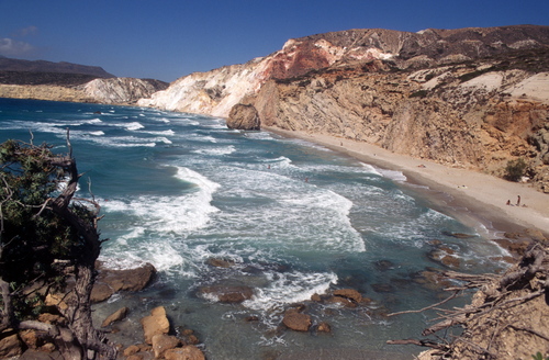
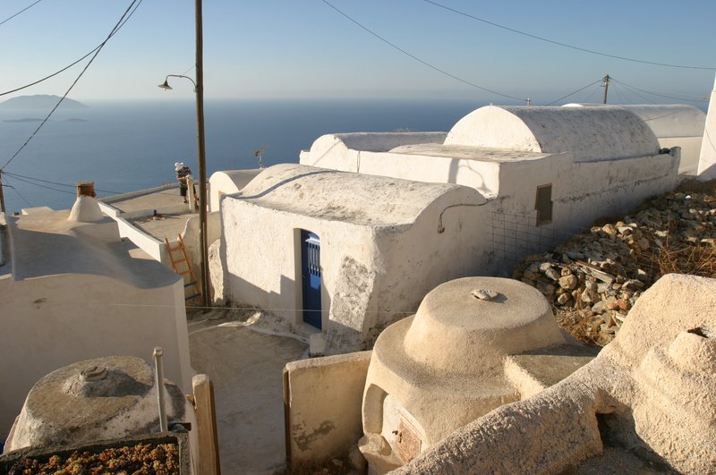
Thira-Santorini
Google-Maps
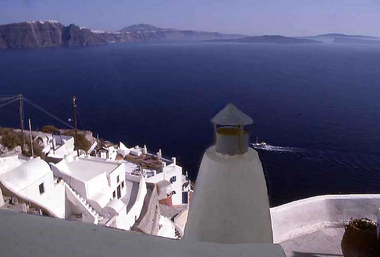
The
Caldera of Santorini with Thira town in the distance as seen from Ia
(1996)
Somehow you must see Thira-Santorini. It is the most spectacularly scenic island in the Aegean - if not anywhere: The huge caldera of a volcano to the sides of which the town and villages cling. The light, coming from the sky and reflected from the sea, is indescribably intense. - For a suggestion on how to resolve this dilemma go to Anafi further down.
Its great archeological attraction was/is Akrotiri, the true Atlantis - a Minoan town which was buried by an explosion of the Thira volcano in around 1650 BC - As of 2011 the excavation site of Akrotiri is closed, because of a fatal accident in 2005. But copies of its spectacular frescoes can now be admired in a museum in Thira/Fira town and in the Athens Nat. Archeological Museum. - We went twice on day-excursions of Santorini in 1971 from Ios and in 1992 from Crete, at which time Akrotiri was still accessible. We revisited the island in 1996 for 3 days with the Mays to never return....
More see on Rolf's Santorini Website
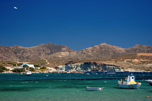
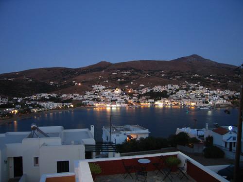
New Discoveries 2012
My search for new non touristy islands has led me to the eastern Cyclades. Between the tip of Attika and Milos lies a string of islands: Kea, Kythnos, Serifos, Sikkinos, and Kimolos, some of which Peter has seen but I never explored. I couldn't say why, prejudice? Their closeness to Athens? Their relative obscurity in my time before the 1990s? - Anyway, from a look at the Panoramio photos in Google-Earth I learned that some of them are as interesting as any of the Western Cyclades and all have better beaches.
I
tried to provide selected Panoramio photos and descriptions for each
place from Matt Barrett's website, Wikipedia, and a few other
sources, to enable you to make your
own decisions. Report back to me, if
you have been successful (rolf354@gmail.com
).
Kea
Google
Maps
|
|
|
|
Quiet
and traditional. Like going to the most remote island in the Aegean,
but it's close to Athens. The ferry
leaves from Lavrion, in
Attika (not from Pireus) an hour plus bus ride from
Athens, less from te airport. One reason why Kea has been overlooked.
Kea itself is not quite ready for prime-time international
tourism, but it is an interesting and beautiful island with a long
history. It is popular with Athenians, many of whom have summer
houses here or come for weekends - [not the most congenial
neighbours! Rolf]
The village of Ioulis is a labyrinth of
white Cycladic houses perched on the side of a mountain, with a small
main square. Because it is an island popular with Greeks there are
lots of good restaurants.
There are nice beaches, and many of them
are off the road and reachable only by hikes through beautiful
settings.
There are few boat connections from Kea to the rest of
the Cyclades, though several times a week there is a ferry to Kythnos
and Syros, where you can make other connections.
Most
foreigners come here by sailboat and stay in the small harbor of
Vourkari which has a row of fish tavernas. Kea is known for its
extensive ancient path network, which is still largely intact making
it a paradise for hikers.
From Matt
Barrett who lives in Kea.
Kythnos
Google-Maps
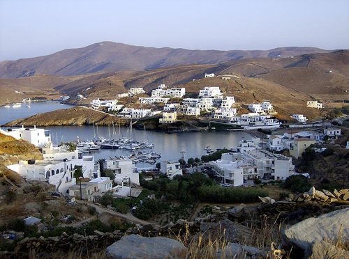
Kythnos in the Western Cyclades is a surprising island of beautiful beaches, traditional villages, hot springs, agriculture, and with a feeling that it is much futher than the short ferry journey from Pireus. Kythnos is no secret to those who stay for the night on sailboats cruising the Aegean, since the small port of Loutra is usually their first stop. But to really see the island you need time and a car.
|
|
|
In the 13th century BC, a pre-Hellenic tribe, the Dryopes, originally from Thessali migrated first to Euboea, and later to the islands, spreading to Kea, Kythnos, and beyond. The name of this hill town is a reminder of them. |
Kythnos was until recently considered to be one of the last Cycladic islands unaffected by tourism, but this is inexorably changing. Still, the island has not yet been overdeveloped, and in the more remote areas of the villages, traditional ways live on relatively unchanged.
There are two main harbours on the island, the main ferry harbour of Merichas on the W coast (which is not particularly yacht friendly) and the popular harbour of Loutra, which regularly accommodates up to 20 or so yachts on passage through the Cyclades.
|
|
|
At the
northeast end of the island lies Loutra (pop. 63), a village famous
for its hot springs, which are said to have curative properties.
Although the large tourist hotel there has been closed for several
years, the bathhouse is still functioning and visitors may use its
marble tubs for a modest fee. Alternatively you can soak where the
hot water runs in a stream into the sea at the town beach. There is a
“tub” of rocks where the sea water mixes and makes the
temperature bareable.
There are also a number of lovely anchorages
on both the E and W coast of the island which can be used in adverse
wind conditions. Kythnos is at the western fringe of the prevailing
Aegean weather system and does not normally experience quite the same
wind strengths as the islands further east.
From Matt
Barrett and Wikipedia,
which also has extensive historical information on Kythnos
(mesolithic settlement 10'000 BC, 3000BC copper smelting, the Dryopes
1300 BC, etc)
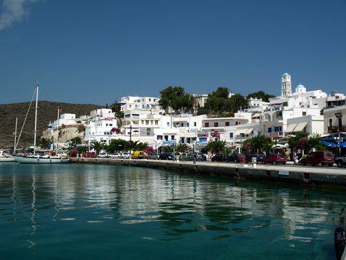
Serifos
Google-Maps
|
|
|
|
Serifos
is an island with about 1,400 inhabitants and several fine sandy
beaches. It also boasts a number of abandoned mines. The first
settlers of Serifos were Ionian Greeks from Asia Minor. The island
was fairly wealthy in antiquity because of its rich iron and copper
mines and minted its own coins. In Hellenistic times it was conquered
by the Macedonians and the Ptolemies from Egypt. During the 3rd
century AD it was taken over by the Romans who used it as a place of
exile. After the Byzantines in 1204, Serifos was taken by the
Venetians who ruled it like the rest of the Cyclades. They built the
castle of Chora. Following the Venetians it fell to the Ottomans.
In
modern times Serifos took an active role during the Greek War of
Independence in 1821 following which it became part of Greece. In
1916 there was a violent miner's strike, after which the mines
declined and were, by 1960 ,eventually abandoned. The island's
population dwindled to about 1400 inhabitants. Today tourism has
given the island a new prosperity
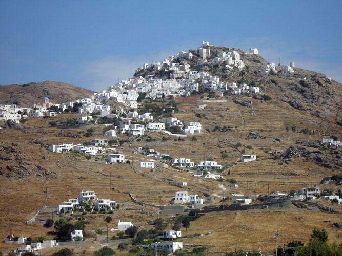
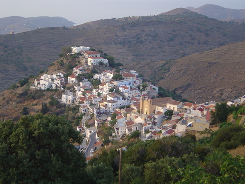
Serifos,
The Chora, (photo: Matt Barrett)
The
Chora of Serifos is one of the most spectacular in the Cyclades,
perched on the side of a mountain it overlooks the large harbor at
Livadi. The trip is about 20 minutes of hairpin turns, going back and
forth across the face of the mountain until you come to a spot where
the bus leaves you at the entrance to the lower square of the
village.
Following the signs to the Kastro one comes upon the main
square, in front of the Dimarcheo building, a carbon copy of the
town-hall in Ioulida, Kea. In fact the Chora of Serifos is very
similar to Ioulida, another Cycladic village built ampitheatrical on
top of a mountain to deter pirates. The square, called Pano Piatsa
which means upper square, is as cozy as a platia can be, with tables
from several small ouzeries and a taverna called Zorba's occupying a
good portion of it. There is also the 17th-century church of Aghios
Athanasios.
A rental car would come in very handy. Matt
Barrett
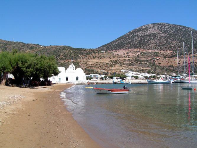
Sifnos
Google-Maps
If you are looking for that perfect Greek island with a balance of beautiful beaches, nightlife(!), white Cycladic villages, low-tourism and maybe the best food in the Cyclades, then look no further than Sifnos, where I have been going to for over thirty years. Matt Barrett and also Wikipedia
|
|
|
|
Sifnos was inhabited from at least 4000 BC. Archeological evidence indicates the island was part of Late Neolithic and Early Bronze Age Cycladic civilization. In classical times the island became very wealthy thanks to its gold, silver, and lead deposits, which were being mined there as early as the 3rd millennium BC. Proof of this is the treasury which the Siphnians built at Delphi in the 6th century BC to house their offerings. Remains of ancient mines, some dating back to prehistoric times, are still to be seen at Ay. Sostis. Remains of ancient fortifications, dating from the third millennium to the sixth century BC, have been found at Ay. Andreas, Ay. Nikitas, and Kastro. Little is known of Sifnos during the Roman, Byzantine or Turkish eras.
From Kamares, the island's ferry harbor, you can get buses to all the other villages, or you can stay here and enjoy one of the nicest beaches and some of the best restaurants on the island.
Vathy
is a beautiful little harbor with rooms for rent and excellent,
inexpensive restaurants - and a fantastic beach. The nightlife here
is quite enjoyable, because it is so small it does not take very long
to get to know people. - A good sheltered yacht harbor! (Matt
Barnett)
Many consider this the best beach on the island. Though
its strip of fine sand is narrow in parts, it's very long and on a
beautiful enclosed bay which keeps the water calm. In the past it's
been one of the least crowded of the major Cyclades beaches, but
recently this is changing with new development. (Wikipedia)
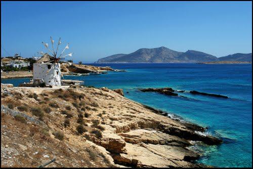
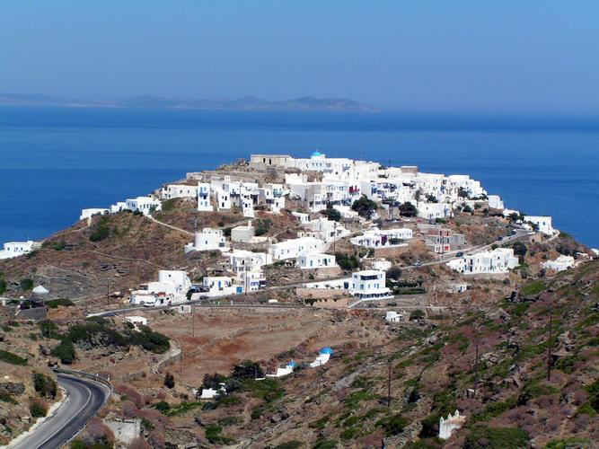
Kastro is the medieval island capital and is worth seeing as an almost perfectly preserved medieval Cycladic town, beautiful and unspoiled. It's on a rocky hilltop right above the sea. Kastro has been inhabited for over 3000 years. To get to Kastro you can take a bus there or by car or motorbike. There is also an old footpath from below Artemona which is a beautiful walking trip in Spring due to the abundance of wildflowers and interesting plants and the fact that it is entirely downhill. - Antiparos in the distance.
Kimolos
Google-Maps
Greek
Tourist Map of Kimolos
Kimolos, the small norther-eastern satellite of Milos, lies separated from it by a narrow channel. This channel used to be an isthmus connecting the two islands. On this isthmus was a Mycenaean town. In antiquity the island was known as Achinousa from achinos - sea urchin. Its present name comes from “kimolia” - chalk which was mined there.
|
|
|
|
The island has only 720 inhabitants living in three villages: Mesa Kastro, Exo Kastro, (sometimes these two are referred to as Chora or simply as Kimolos) and Psathi, the little harbor. The place has been dominated by the Venturis family who have become very successful owners of ferry boats
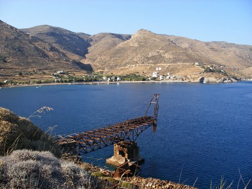
Milos
Google-Maps
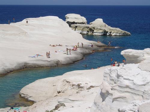
Milos is a volcanic island with spectacular rock formations and hot springs. Bikes or a car are useful if not essential. This is a beautiful island with fantastic beaches like Paliochori, Hivadolimni and the tiny cove of Sarakiniko, one of the most interesting places to swim.
|
|
|
|
At Sarakiniko beautiful smooth white chalk rocks form a long narrow inlet with a tiny beach on the end offering a safe place for children to swim and great snorkling, while the rocks let you sunbathe without getting sand all over you. A hundred yards or so to the west is the remains of a freighter that has been smashed on the rocks and is half out of the water, another great place to snorkle. Nearby are sheltered coves and tiny beaches made by lava flow. Matt Barrett
|
|
|
|
The
village of Pollonia has great swimming, restaurants and you can take
a boat to the island of Kimolos. The main village of Plaka is made up
of the cubic white Cycladic houses. The island is rich on
archeological sites including Christian catacombs, a roman
ampitheatre, venetian castles and museums. Matt
Barnett
For the history and geology of Milos see, e.g.,
Wikipedia
Andros
Google-Maps
“Andros
is a case by itself, large, very close to Athens' airport (via
Rafina). Andros should have been ‘discovered’ decades ago. This
fascinating Cycladic island meets all the criteria for being on the
list of top spots to spend the summer. It’s only two hours from
Rafina
in Attica, has dozens of stunning beaches, extravagant natural
beauty, pretty villages, museums, history, seaside tavernas - and
just about everything a place needs to attract tourists, foreign or
local.
But it neither needed or wanted them. Andros is the island
of shipowners. Some have names you’ve heard of like Goulandris and
Embirikos, others are less familiar, but they have two things in
common: a certain affluence and a desire to keep the island to
themselves.”
Read Diana
Farr-Louis' “Andros, the Enigmatic Island” where from I
obtained these quotes. She gives you the unadorned facts, but she
also gives credit to the Goulandris for the unique attractions of the
island:
The Archaeology and Modern Art museums of the Chora, both
gifts of Basil and Elisa Goulandris in the early 80s. The former,
right on the square, will not knock your socks off with gold, but it
does have a couple of memorable statues and its models of the
pre-Classical buildings at Zagora show that architecture changed
little on Andros between the 9th century BC and the 19th century AD.
The
“MOCA
Goulandris”, an outstanding Museum of Contemporary Art in
Andros Chora.
Otherwise the Chora is a disappointingly drab "little Athens" – a narrow road flanked by hardware stores, grocers and double-parked cars. As you walk down the grey marble plaques of its main street, you’ll see a town little changed since the early 20th century. Neoclassical stately homes, some a tad faded, rise on both sides, at what must have been a posh address. Some are now cultural or philanthropic institutions – the Kairis library with its exhaustive archive, the Kydonievs art gallery with an annual summer exhibition devoted to an avant-garde Greek artist, the Embirikion Old-Age Home – while one has become a chic hotel.
|
|
|
|
Batsi
has tripled in size with all manner of accommodations and places to
eat without becoming ugly; the coast between Gavrio and Batsi is
filling up with villas, maisonettes and one attractive hotel (the
Perrakis) that overlook sandy beaches which are rarely jammed even in
August. The exception, Chryssi Ammos – Golden Beach, the smallest,
shallowest and most protected, proves the rule that Greeks abhor
solitude; it attracts more Golden Youth than anywhere else on the
island. They flop onto its sunbeds, lap up the cantina’s beers and
music, and generally free up the rest of Andros’s superlative
strands for the more adventurous.
Batsi also accounts for most of
what passes as the island’s nightlife. Another reason for Andros’s
low profile is that this commodity can’t be said to exist apart
from a handful of bars and a club or two. Between the farmers who go
to bed early and the shipping crowd who entertain at home, Andros
lacks one essential ingredient in the popularity contest: decadence
and a sense of frivolity.
Moni Panachrantos south of Chora, a fortress-like monastery built in the 960s. Byzantine Andros was no backwater; it fostered both a thriving silk production and a brilliant school of philosophy as well as rich monasteries. Now, beautiful and well-endowed though it may be, Panachrantos supports just one monk but receives many pilgrims and sightseers. If you hike up there in winter, the abbot may cook you a meal of spaghetti – he loves company.
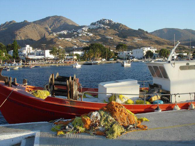
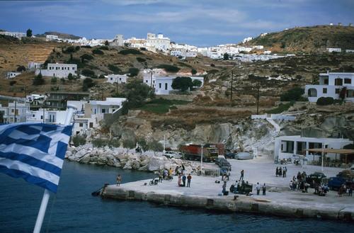
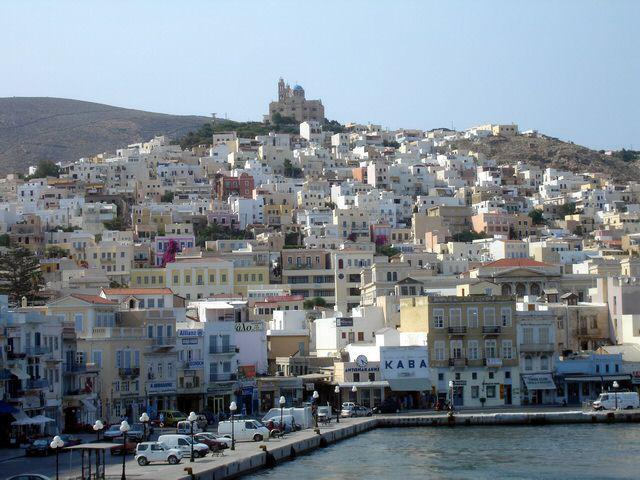
Syros
Google-Maps
|
|
|
|
The island of Syros has become a special place. The town of Ermoupolis, the de facto capital of the Cyclades has turned into one of the most architecturally facinating ports in the Mediterranean, a living museum with many beautiful old buildings, Catholic churches, an opera house, and declining shipyards – in the 1980s it used to be a working man's town....
|
|
|
|
Seaside villages like Finikas offer beautiful beaches without beach chairs and umbrellas, or the throbbing disco beat you will find blasting at some of the more popular islands. Syros is a real Greek Island, fun to visit any time of the year. Go to the west coast for Sunsets.... Matt Barrett
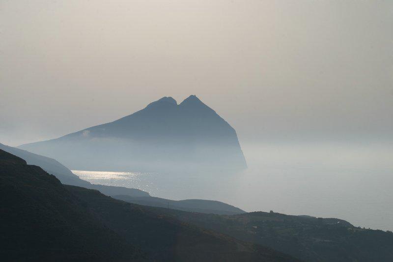
Anafi
- the
farout Island
Google-Maps
Even
Matt Barrett has only one paragraph on Anafi, but a beautiful
“official” Website
attracted my curiosity and might convince you to a visit. All photos
from the “gallery” of the Anafi website.
Anafi is a tiny
island hiding 1-hr by boat east of Santorini.
In fact Anafi may
be the inducement to pay a brief visit to Santorini: Take the big
Blue
Star Ferry “Delos” to Santorini (arr. 15:00), stay overnight
to see the sunset over the Caldera, and on the following evening
around 20:00 take either the “Artemis”
(ANEK Lines) or the “Aqua Spirit” (NEL) to Anafi. You'll
arrive around 21:30, but don't worry all the women with rooms to let
will await you at the landing.
|
|
|
|
In
spite of its small geographical size, Anafi offers archaeological as
well as mythological interests. At the monastery of Zoon Pigi, there
are ruins of a temple built as an offering to the god Apollo
Aegletos. Ruins can also be found at Kasteli. Most of the findings,
such as the statues, can now be found crammed into one small room at
the "Archaeological Museum" in the Chora.
A peninsula at
the eastern end of the island is dominated by the monolithic slit
breast of Mt. Kalamos, at 584 m among the highest in the Aegean.
Perched atop this massif is the Panaghia Kalamiotissa church, rebuilt
in large part after an earthquake in the 1950s.
Anafi is very
much an island for walking. On the old monopatti (foot paths) around
the steep hills you can walk to the other side of the island. The
most popular beaches are Kleisidi and Roukounas on the south coast.
There is even a nude beach!
|
|
|
|
But it seems that the treasure of this island are its people. Like on Karpathos they are still holding on to the old traditions, unfazed by the pretty tourists swimming at the nude beach. This is how it was on Ios in the 1970s and still was on Amorgos in 2005. - Write me what you find....