|
Santorini and Ios |
.
Santorini
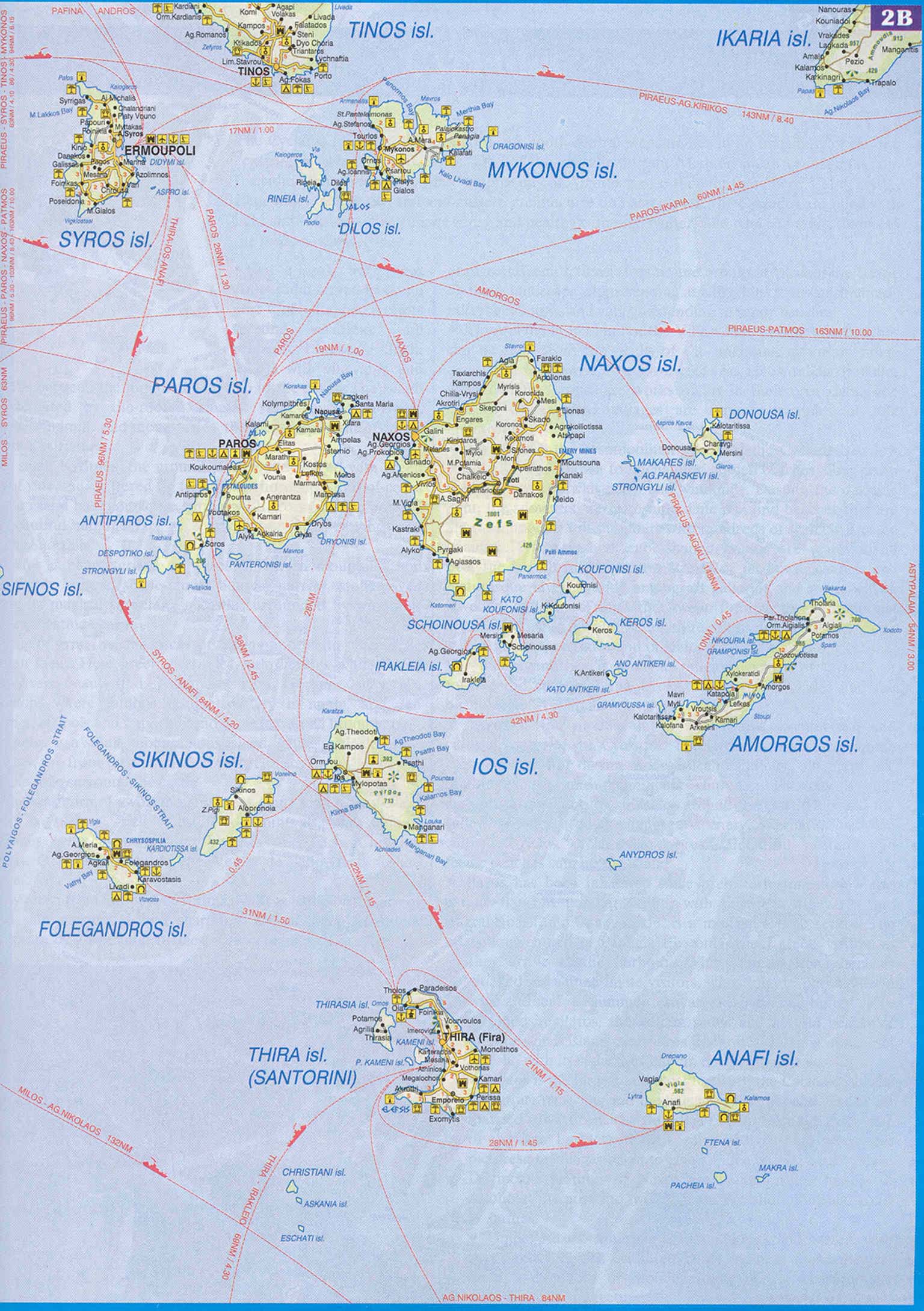
Map of the Eastern Cyclades (9 Mby)
|
|
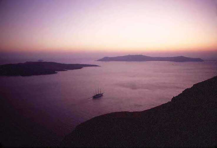
Santorini is the most dramatic of the Cyclades Islands - yet this is difficult to photograph, because the excitement is caused by a huge hole which was blown into the island by one of the biggest volcanic explosion in historical time (1450 BC.) one-hundred times larger than the Krakatau eruption in 1912 and a thousand times larger than the volcanic eruption off Indonesia a few years ago. Minoa perished in this conflagration because of the tsunami and the ash-fall from the eruption. - Cornelius took this photograph in 1985 with a wide-angle lens - it shows less than half the caldera. He took it from Fira-Thira at sunset. The black island on the left is Nea Kamenii, the central plug of the volcano. The island in the distance is Thirasia, a remnant of the western rim of Santorini before the explosion, 10 km distant. (see map above)
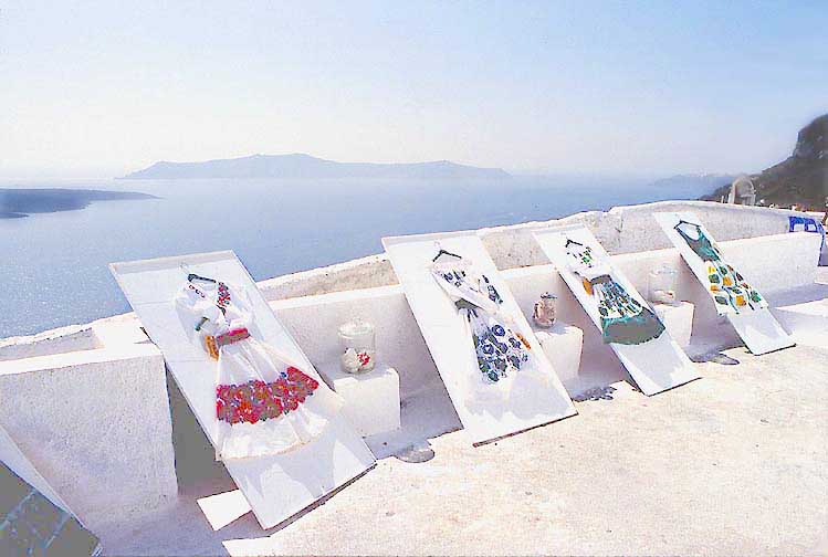
Thira-Fira, the Chora of Santorini
|
|
However, the greater difficulty of photographing Santorini is the fierceness of the light especially at noon. My eyes were tearing when I took this photo in 1982 - no film can reproduce the intensity and contrast of the light which comes from the sky and the sea in Thira.
|
|
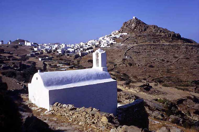
The church at Skaro, one of the most photographed buildings in Thira. The village of Merovigli in the background. (1971)
.
|
|
The path along the caldera precepice from Thira to Merovigli gives insights into the geology and the way of living in Santorini. Because the pumice is soft and easily excavated but hardens when treated with water, ....
|
|
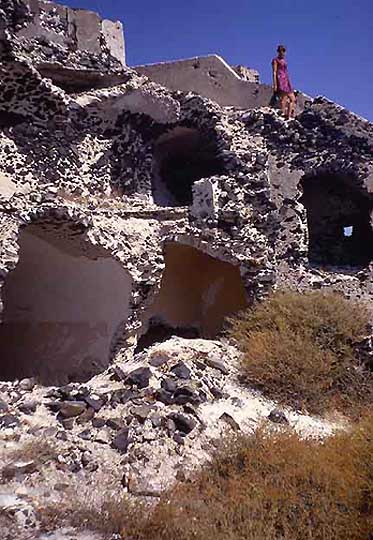
.... digging out troglytic houses was a wide spread practice. Half is inside the mountain and half outside. An earthquake in
the early 1960s destroyed much of Merovigli. The houses remained abandoned. (1971) .
|
|
Door of an abandoned house. The rim is about 250 meters above the sea at this point. (1971)
.
|
640599 HEIGHT=504 |
View from the old archeological museum at Thira (mostly not very exciting finds from the 2-4 cent AD) and the pumice quarries in the background. (1971)
.
|
|
Staircases form pure Escher designs everywhere. (1982)
.
|
|
A chapel and landing below Oia
.
|
|
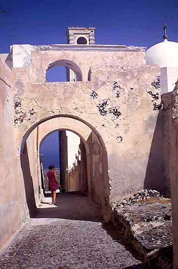
Santorini was part of the Duchy of Naxos which was Roman Catholic and Italian. To this day catholic nuns live and teach in this building in Thira. (1971)
.
|
|
Evening view of Thira, taken by Cornelius in 1985.
..
The Minoan Town of Akrotiri
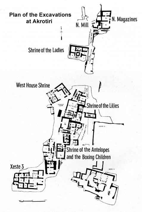
Map of the Akrotiri Excavation site
|
|
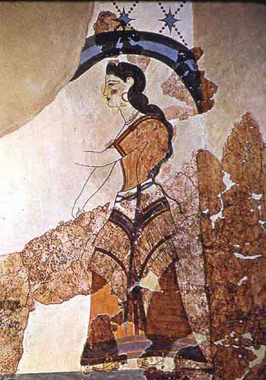
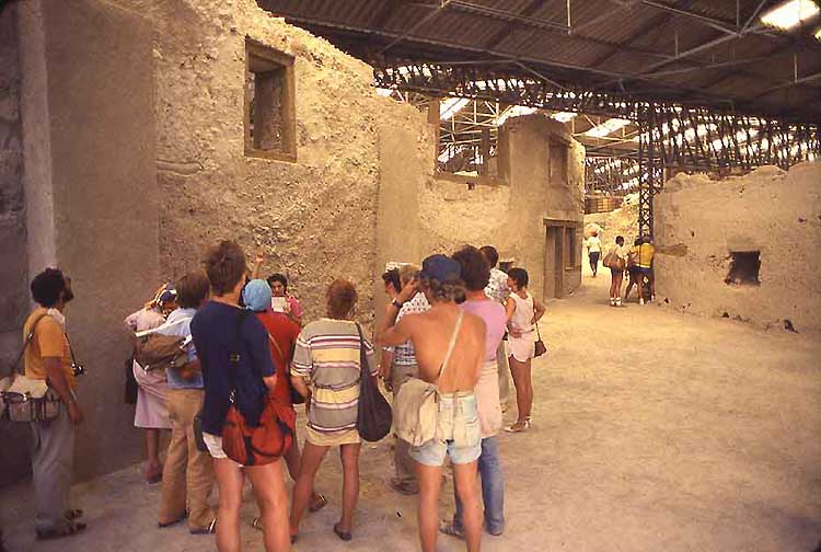
Akrotiri is an archeological site in the northern part of the island. One can watch the excavation during certain times of the day. The Minoan town now lies buried under 60 m of tephera. Only a small part has been excavated by Prof. Marinatos and his daughter during the past 30 years, but what they found is extraordinary. Four rooms with frescoes of a sophistication unsurpassed by contemporary (1450 BC) wallpainting in Egypt and elsewhere in the Mediterranean and Near East. Ms Marinatos believes these rooms (except for one) were shrines. The remaining one was part of the house of a seafaring merchant. (See Map of Akrotiri) Apparently the town was deserted by its inhabitants at the time of the eruption. No dead nor furniture was found as in Pompei.
.
|
|
View of the excavations (under a canopy).
.
|
|
|
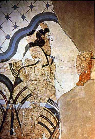
Two priestesses in a shrine which was used for the initiation of young women. The flounced skirts and exposed breasts are typical of Minoan priestesses of the Great Goddess.
.
|
|
Perhaps this is the most striking room decorated with blue monkeys, who undoubtedly, were not indigenous to the islands. This reproduction has been reconstructed more than the other frescoes. They used to be exhibited at the Archeological Museum in Athens. A new Museum has been created in Akrotiri in 2004, part of the Athens show (second floor) has been closed, part has been rearranged. I do not know where these wallpaintings are now.
.
|
|
|
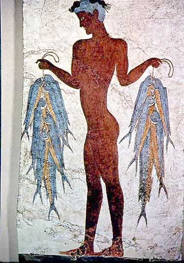
Boxing children and a fisherman with his catch.
.
|
|
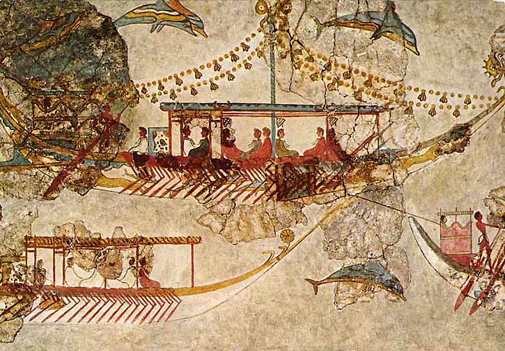
Sophisticated boats in the harbor of Thira, wall fresco from the seafarer's house. I believe Marinatos who argued that Thira is Atlantis.
.
|
|
Abstract spring time lilies in a shrine room.
.
|
|
In 1982 we visited Santorini on a day excursion with Norm Cohen by boat from Herakleion in Crete. Norm in the yellow shirt, far left, was a colleague of mine at Aerospace Corp. - To reconstruct and stabilize the adobe walls the excavators poured concrete into the cavities left by the burnt out wooden beams and door frames.
.
.
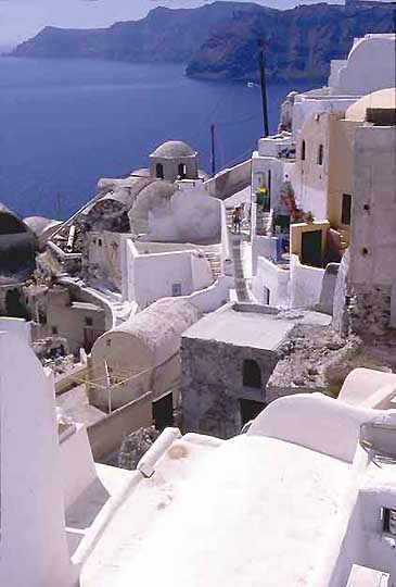
Oia
|
|
On the other, northen end of the main island lies Oia (pronounces "ee'a". Partly destroyed by an earthquake in the 60s it has now become a highly exclusive, ultr-modern community of hotels and apartments: beautiful, tasteful, and expensive.
.
|
|
Entry to a restaurant. The phallic mushroom is a collapswed umbrella....
.
|
|
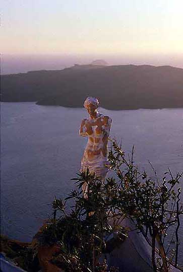
Aphrodite by the Sea in front of Nea Kamenei.
.
|
|
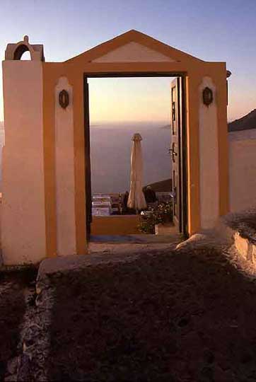
A chapel turned part of a guesthouse.
.
|
|
View of the caldera, the main island, and Thira seen from Oia.
.
|
|
Leaving the Santorini caldera on the highest deck going north to Ios Island.
Ios
.
|
|
In the early 1970s Ios was one of the prettiest, lovely islands. The Chora of Ios, in the saddle to the left and the quaint harbor were most beautiful. We spent 3 heavenly weeks there mostly in the nude. Word spread and a few years later Ios had become the drug haven of Greece. Loudspeakers booming Jazz or Beethoven from the hills above the harbor, dance and jazz clubs drumming it up during the nights, hundreds of drunk, brawling young Englishmen crowding the Chora. We spent 2 days there in 1976 staying in Mylopotas. Then we fled, not to return until 1994 in Spring. The Chora and its people were burnt out. Maybe one could still stay in Manganari in the south or in Agh. Theodoti - but all of these far-away places are now connected by asphalted roads. Ios, as we knew it, is no more.
.
|
|
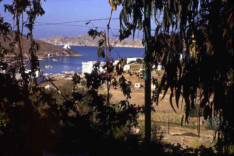
View from our Pensione half-way between the Habor and the Chora. Mosquitoes were a plague in this August/September 1971.
.
|
|
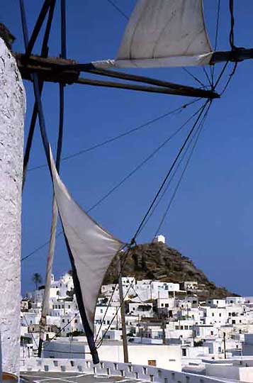
A windmill - the old owner would show foreigners the wooden mechanism and in climbing the ladders invariable use the opportunity pinch the ladies in their derriers (a rare happening in the Greek islands) - and the Chora with the "castro". On the left is the only palmtree on Ios - maybe in the Cyclades........
.
|
|
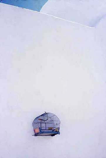
A cage with a song bird hanging on the wall of a church. (1994)
.
|
|
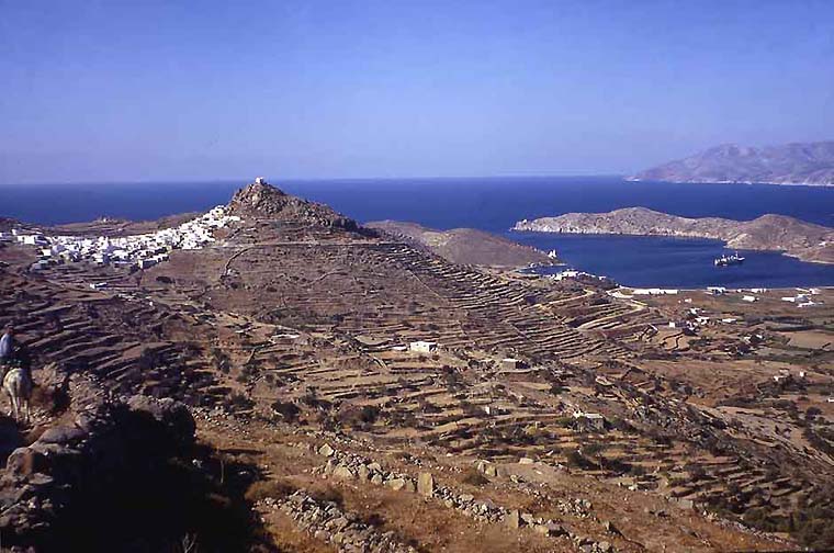
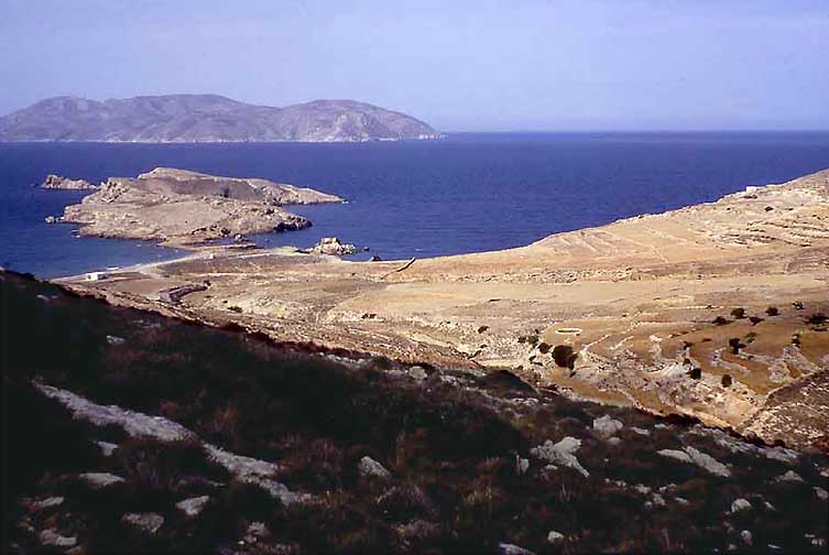
The Chora from rhe monopati (donkey path) to Aghia Theodoti (1971)
|
|
Koumbari Beach north of the harbor in the early morning.
.
|
|
Another view of Koumbaru Beach
.
|
|
A long hot walk along the southwest coast took us and three friends to Klima Beach.
.
|
|
And Kritikos (sic!) ran his kaiki to Manganari three times a week (1971, in those days this was the only connection to Manganari). Kritikis, in the center in a khaki suit, was a yound ambitious man then. He now has a shipping firm and owns half of the commercial ventures in Ios.
.
|
|
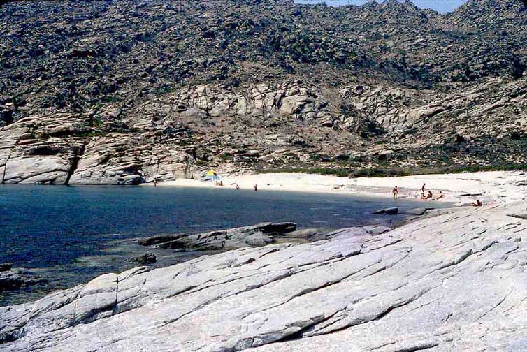
The big bowl containing Manganari Beach. A truely heavenly day.
..
|
|
After a two-hour hike across the center of Ios we arrived at Aghia Theodoti, 5 or 8 houses, a few shy people and one neurotic American expatriate from a US Naval Test Station in the Moave Desert.... A lonely and beautifully unspoiled, pastoral place: a woman and her daughter were washing their oriental rug in the sea....
.
|
|
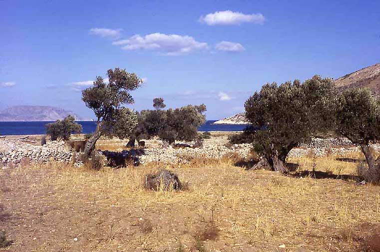
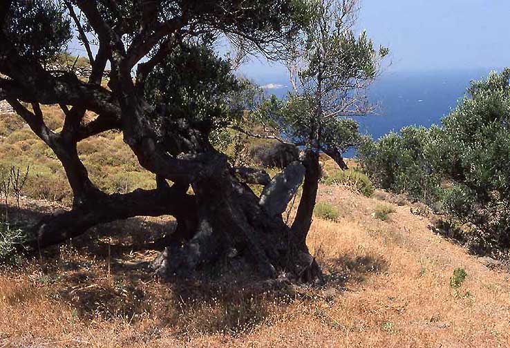
Aghia Theodoti, olive triees hundreds of years old.
.
|
|
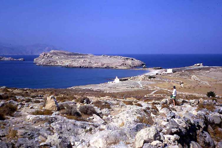
Barbara looking down on Aghia Theodoti Bay (1971)


