.
|
Grand Canyon |
The North Rim
|
|
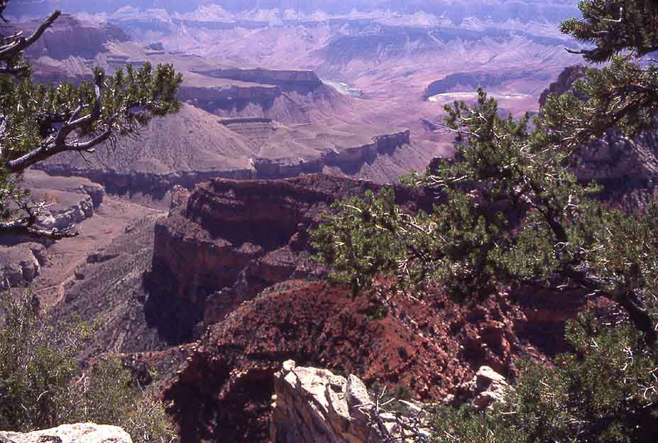
The only view of the Colorado River proper from the Grand Canyon North Rim (Point Royal). It is difficult to photograph Grand Canyon — and it is even more difficult to show anything new that has not already appeared in hundreds of professional picture books. This is especially true of its views from the South Rim, which is overwhelmingly large. Its size and proportions are beyond human conception. Still, you have to see it to believe this verdict. The North Rim is more intimate, less crowded — but inaccessible after late September. Its altitude is 2500 m! I'll let most pictures — taken over many visits — stand for themself, words will not tell much more.
|
|
|
|
|
|
|
|
|
|
In 1981 we traveled with Cornelius and a group of children from Germany - children of two German friends - for four weeks all over the Southwest, a difficult trip. The country was too big for them, they became bored and unruly. Here we are resting at the edge of the North Rim.
|
|
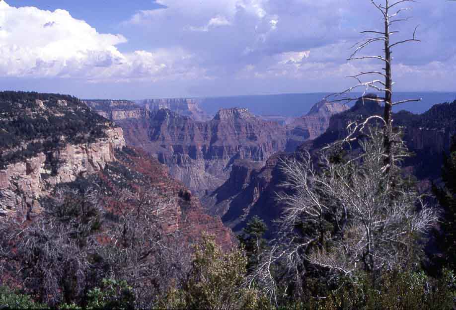
The cliffs of the South Rim, 500 m lower and more than 50 km away, at the horizon.
.
|
|
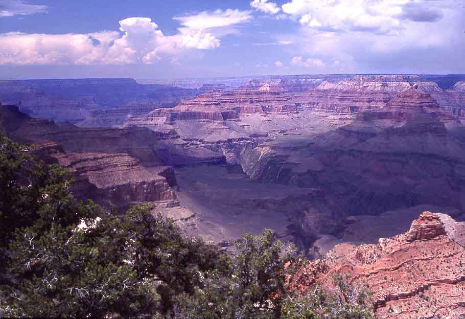
The Bright Angel Canyon leading into the Colorado at the foot of the South Rim in the distance.
The South Rim
|
|
Mather Point(?) . A road runs the length of the accessible South Rim with many vista points. During the high season in the summer traffic and parking along this road are now strictly controlled. You may be forced to take the shuttle bus and/or walk (recommended by Barbara!) along the edge.
|
|
|
|
|
|
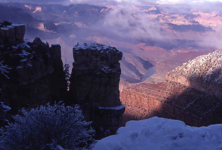
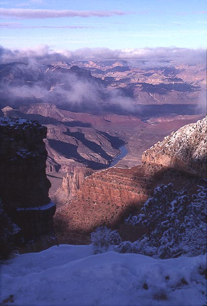
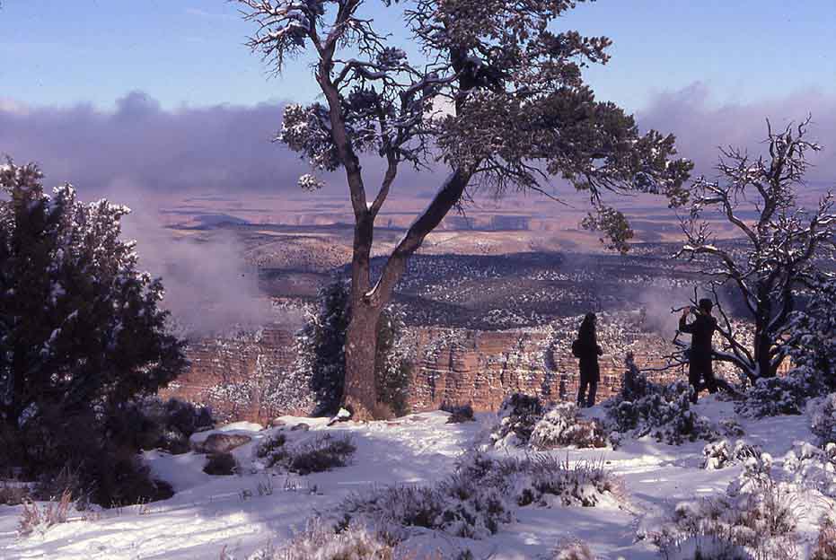
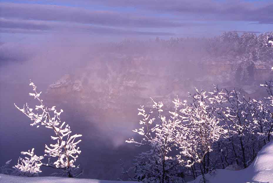
The South Rim on New Year's Day 2002
|
|
On New Year's Day, coming from a visit to New Mexico, we followed a sudden inspiration and drove to the South Rim. This late afternoon in the snow became one of the most beautiful - and special - experiences of that trip and of Grand Canyon.
|
|
|
|
|
|
|
|
Late light.
|
|
Fog rising near Desert View Point on the eastern most end of the Rim Road.
.
|
|
Near Hopi Point on its western end.
Havasupai
|
|
Our troops resting on the way to Supai (1981). Downstream of the National Park the Havasupai Indians, who live in one of the side canyons, have a separate reservation. A 150-mile detour from Gran Canyon Village via Williams leads to Hulapai Hill Top, where you have to leave the car and walk down into the canyon (about 2 hrs down). Reservations for entry and primitive accomodations in Supai must previously be made by telephone. This is one of the very special places in North America. We did this 3-day trip with the children in 1981. Climbing back to the car was an ardent hike of 2 to 3 hours best done before sunrise. Still, it was worth it.
|
|
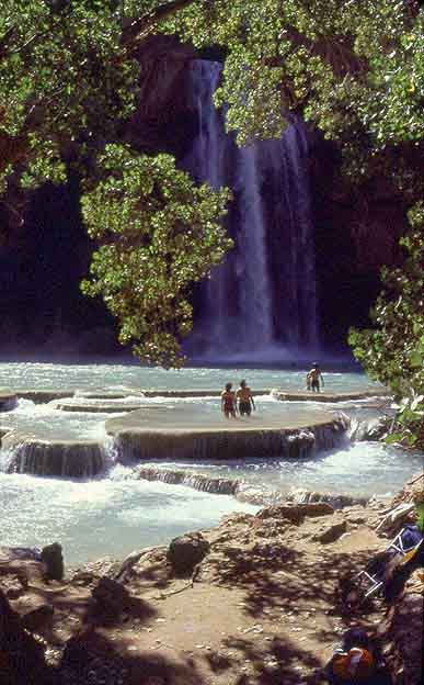
Below Supai are a magical collection of travertine basins and...
.
|
|
...a waterfall where we spent an afternoon swimming. For once the children were happy and occupied!
.
|
|
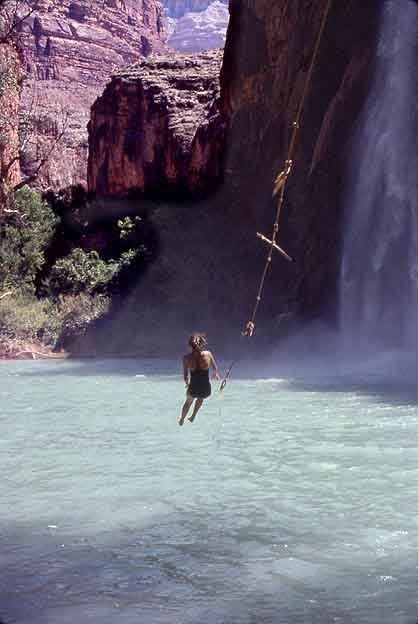
Carola flying into the cool water with the aid of a rope tied to a tree....
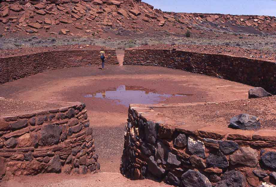
San Francisco Mountains and Wupatki National Monument
|
|
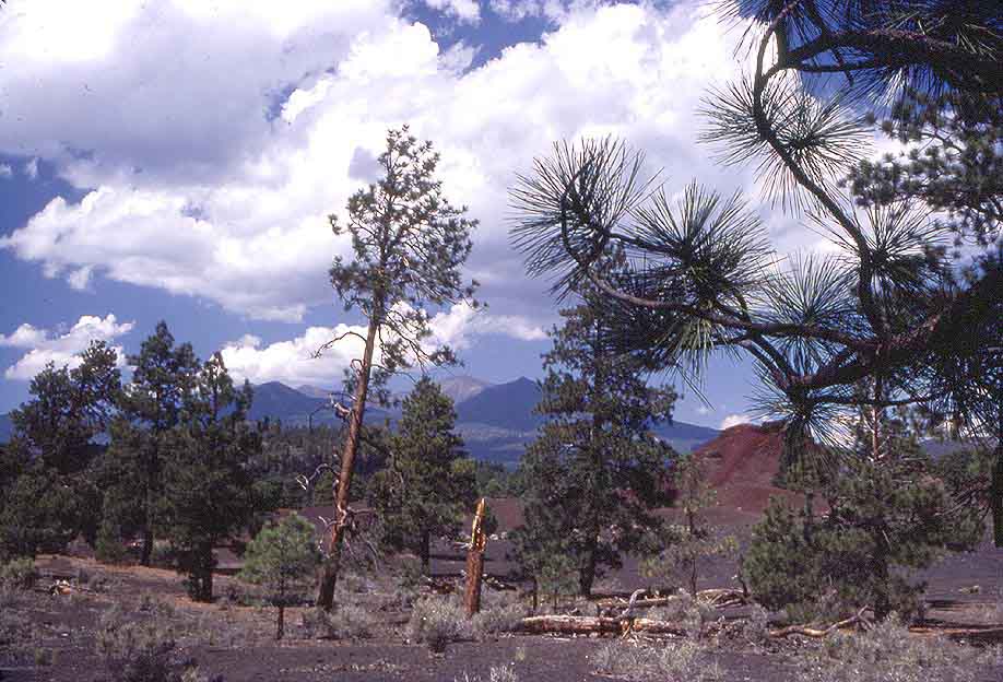
The volcanic San Francisco Mountains near Flagstaff. On a short detour between Grand Canyon and Flagstaff through the San Francisco Mountains lie the ruins of an Anasazi Indian pueblo which once was inhabited by a way-ward clan from northern Mexico, very different people with a much higher cultural level than the New Mexican Hopis. See also Chaco Canyon in Indian Land.
|
|
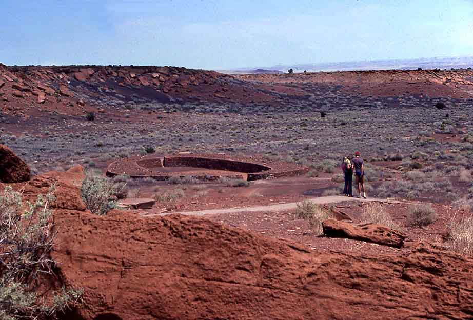
Wupatki Indian Ruins.
.
|
|
The center piece is an oval ball court unknown in all other Southwestern Indian settlements.
.
|
|
Close-up of the ball court (1981).