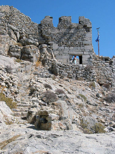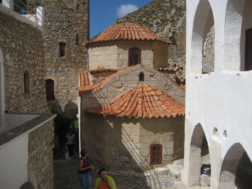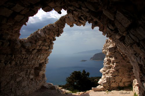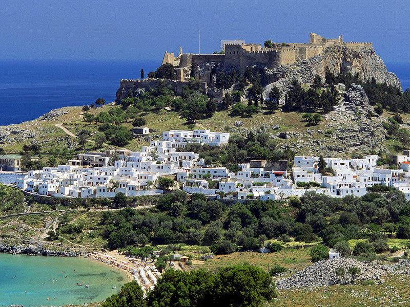
Lindos, Rhodes, The Castle of the Knight Templars
A
Guide to the Aegean Islands
2012
The Dodecanese
Lindos,
Rhodes, The Castle of the Knight Templars
The
Dodecanese is marked by the Order of the Knights
Templars who replaced the Byzantines in
Rhodes in 1309. They built the town of Rhodes and survived the Fall
of Constantinople until 1522 when Rhodes fell to a large army under
Suleiman the
Magnificent. Henceforth
the Ottomans controlled the Dodecanese for 400 years.
In 1911
after the Italian-Turkish
(Lybian) War and the
demise of the Ottoman empire the
Italians occupied the islands. Italian colonists were settled in the
Dodecanese in the 1930s by the Fascist government of Benito
Mussolini. By 1940 the number of Italians settled in the Dodecanese
was almost 8,000, concentrated mainly in Rhodes. In 1947, after the
Second World War, the islands came into the possession of Greece: as
a consequence most of the Italians were forced to leave and all of
the Italian schools were closed. However, their architectural legacy
is still evident, especially in Leros and Rhodes.
Use the links to Google Maps and enable their “Photos”
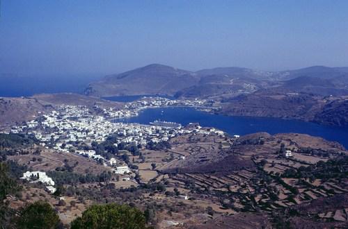
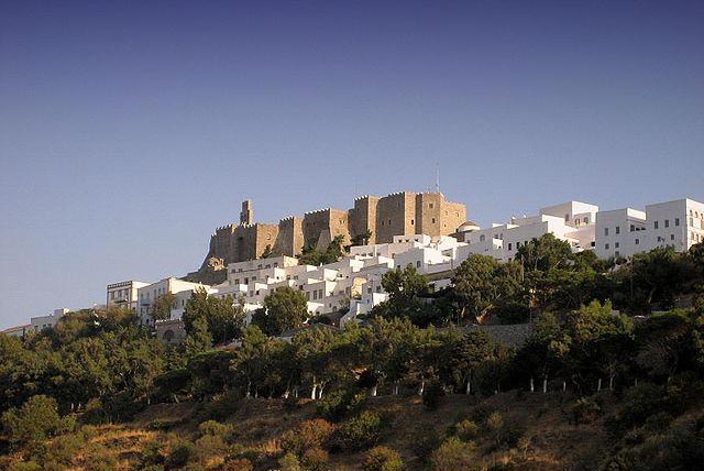
Patmos
Google-Maps
For
most visitors Patmos is a
spiritual Island
Pilgrims from all Christian denominations come to Patmos to pray at the places of St. John's Apocalypse. They arrive in droves at Skala and hike up the steep hill to the Cave where John had his vision of the End of Time and on to the fortified castle of his Monastery in the Chora. Skala and Chora are crowded, but there are a few beaches in the north and extreme south of the island where one can find cheap rooms and solitude (Livadi, Petra, Grikos)
|
|
|
|
The Apocalypse of John
Still
the Apocalypse, its interpretation, authorship and history are a
multifaceted subject, which should interest anyone, if only for the
influence it had on Christian imagination and art since very early
times.
Traditional
theory holds that John the Apostle—considered to have written the
Gospel and the Epistles of John—was exiled to Patmos during the
reign of Domitian (90-100 AD), and there wrote his Revelations. Not
everyone agrees, some modern scholars consider John the Apostle, John
of the Epistles, and John of Patmos three different persons and that
the Apocalypse was written in 60 AD.
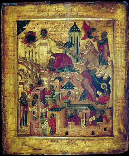
St.
John receiving (upper right) and writing the Apocalypse (Russian
Icon,17th cent)
In
addition East and Western Christian doctrines look at the text in
radically different ways. Eastern Orthodoxy treats the text as
describing present day events as a prophecy of events to come, for
which the contemporaneous events were a form of foreshadow. It
rejects attempts to determine, before the fact, if the events of
Revelation are occurring by mapping them onto present-day events,
taking to heart the Scriptural warning against those who proclaim "He
is here!" prematurely. Instead, the book is seen as a warning to
be spiritually and morally ready of the end of time, whenever they
may come ("like a thief in the night"), by God's choosing,
not something that can be precipitated nor trivially deduced by
mortals.
The
Book of Revelation is the only book of the New Testament that is not
read during regular services by the Eastern Orthodox Church. The
whole Book of Revelation is read on “Apocalypse Night” on Bright
Saturday
(6
days after Easter).
This and gnostic interpretations of the
Apocalypse are discussed in an interesting article in Wikipedia
Lipsi-Lipsoi
Google-Maps

The
harbor of Lipsi
Lipsi is one of the small islets between Patmos
and the coast of Turkey. Despite it being relatively unknown there is
some package tourist activity there and just showing up because you
assume you will find a room may be unwise in July or August.
There
is really only one town which is the port. With a number of good
tavernas in town, a few hotels and a dozen beaches within walking
distance and a few ouzeries on the waterfront, this may be the quiet
island you are looking for - if you can get there
|
|
|
|
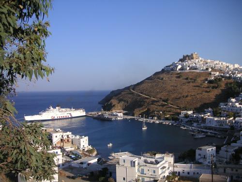
Astypalea
Google-Maps
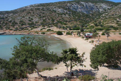
Astypalea
should be a Cycladic island, craggy, bare and bone dry.
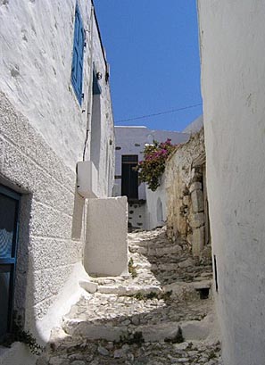
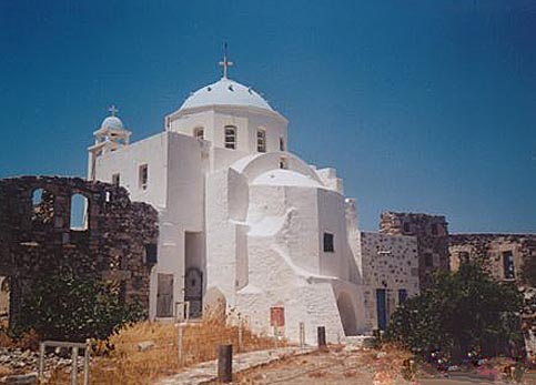
It looks like two seperate islands connected by a narrow isthmus. Most of the visitors are Greeks. The island is more like a Cycladic island than the Dodecanese chain which it is a part of. A labyrinth of white geometric houses in a village crowned by a Venetian castle. Many coved beaches. It is remarkable that the island does not attract more tourists. Named Stampalia by the Italians, it is a true Greek island with 1,238 residents in 2001.
During the Middle Ages Astypalea belonged to
the Byzantines until 1207, when - in the aftermath of the Fourth
Crusade - it became, until 1522, the fiefdom of the Querini, a noble
Venetian family. The Querini built a castle that is still in place
and added the name of the island to their family name: Querini
Stampalia.
Astypalea became Turkish in 1522, and the Ottomans kept
it until 1912, with only two interruptions: from 1648 until 1668,
during the War of Crete, when it was occupied by Venice, and from
1821 to 1828 when it joined the insurgents during the Greek War of
Independence.
It was occupied again by the Ottomans in 1828.
On April 12, 1912, (during the Libyan War) a detachment of the
Italian Regia Marina landed on Astypalaia, which thus became the
first island of the Dodecanese to be occupied by Italy. From there
the Italians landed on Rhodes. The island remained under Italian
governance until World War II (1943) when - in a last operation - the
Germans threw the Italians and British out! In 1947, together with
the whole Dodecanese, it joined Greece
|
|
|
|
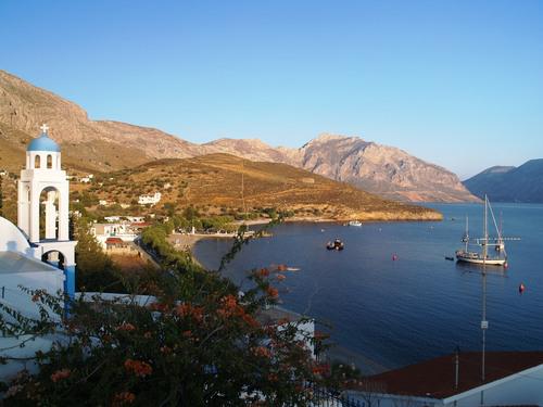
Leros
Google-Maps
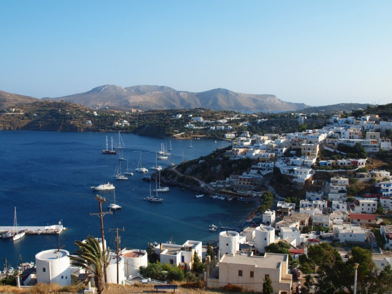
Leros,
Yacht harbor Panteli
Leros is the Greek base for sailing trips along the coast of Turkey and the Dodekanese islands. There is a daily boat from Pireaus which makes an overnight trip and then continues on to the other larger Dodecanese islands. There is also a daily flight from Athens in the summer.
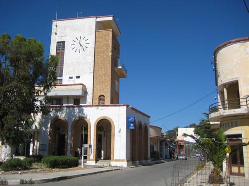
Main
Street of Portolago
The
main port of Lakki is one of the best examples of Rational Art Deco
Architecture. It was designed by Mussilini's architects in 1923-
(though in defiance of the dictator, the capital was moved to the
village of Aghia Marina).
The Italian regime actively attempted
to Italianize the Dodecanese, by making the Italian language
compulsory, giving incentives to locals to adopt the Italian
nationality, and clamping down on Greek institutions. In the 1930s a
new model town, Portolago, was built by the Italian authorities. It
is one of the best examples of Italian Rationalist architecture. The
Greeks later renamed it Lakki.
During the 31 years that the
Italians remained in Leros, they set up a great plan to build and
fortify the island, since its strategic position and its large
natural harbours (the largest of which, Lakki, is the largest deep
water harbour in the Mediterranean Sea), made it an ideal naval base.
The naval base at Lakki, ensured that the Italians had control over
an area of vital interest to the Allies (the Aegean, the Dardanelles
and the Near East). Mussolini, who called Leros "the Corregidor
of the Mediterranean", saw the island as a crucial base for the
Italian domination of the eastern Aegean Sea, and even built a
mansion for himself in the town of Portolago, today a heroic
ruin.
More, especially about its infamous post-WWII history
in Wikipedia
Aghia
Marina, the capital of Leros from the Venitian castle
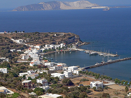
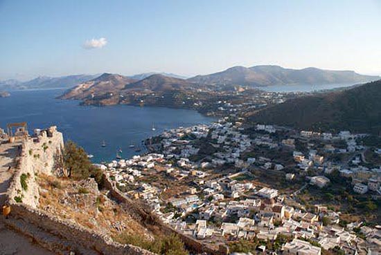
Kalymnos
Google-Maps
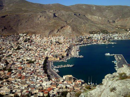
Pothia
the harbor of Kalymnos
Kalymnos
is the spongefishermen's island. The main port of Pothia is lined
with cafes and is, as home to Greece's spongefishing fleet, a working
town. There is a sponge museum there too. There are resort beaches
around the island and several other small ports and towns worth
visiting. There are small excursion boats from Pothia to the small
islands of Nera and Pserimos and from the resort town of Myrties to
Telendos where there are rooms to rent, tavernas and beaches.
People
who visit regularly rave about Kalymnos. Kalymnos is connected by an
almost daily boat from Pireaus to the other major islands of the
Dodecanese chain and also a ferry and hydrofoil to Samos. There may
even be an airport there by the time you read this. It takes around
12 hours by ferry from Pireaus and a little less on the Blue Star
Lines. See Gill
Collins' review of Kalymnos
|
|
|
|
Nysiros
Google-Maps
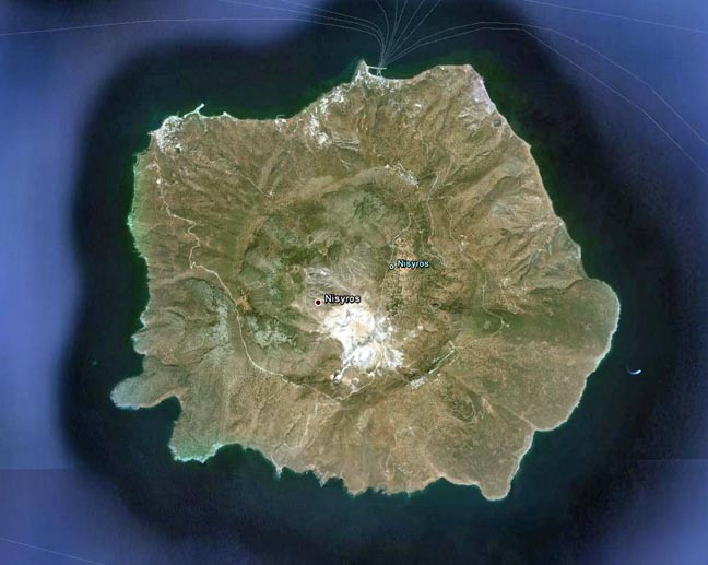
The
Caldera of Nysiros Island (Google-Earth)
The
island of Nysiros is – like Santorini, Milos, Kos, Methana, Gyali -
a dormant volcano. They are all a result of the collision of the
African and the Anatolian with the Eurasian
tectonic plate. The volcano attracts many
visitors, it has created some bizarre landscapes.
The best
illustration of the Caldera is actually the above satellite image
taken from Google Earth. The caldera is large (4 km diamter) so that
surface photographs only show part, most often the white, lowest
Stefanos Crater.
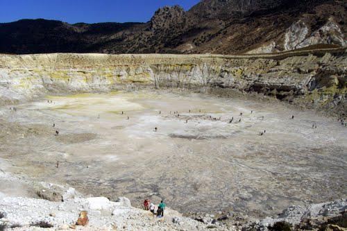
The
bottom of the Stafanos Crater
|
|
|
|
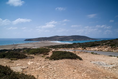
An excellent island for hiking. The colorful port of Mandraki is host to an ancient acropolis, a monastery and a black stone beach. There is a thermal spa at Loutra. The villages of Nikea and Emporeios sit on the rim with spectacular views of the caldera.
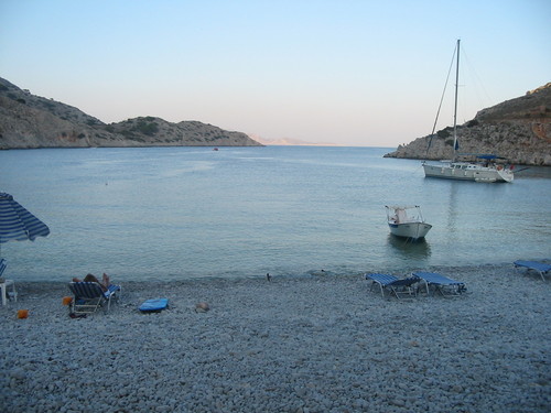
Tilos
Google-Maps
Tilos,
Aghios Antonios the old harbor seen from the castle above Megalo
Chorio
Another forgotten island with great hikes, deserted villages, dramatic landscapes, a spectacular monastery, a medieval castle and uncrowded beaches. There are plenty of places to stay in Livadia and camping is permitted on the beaches.There are several ferries a week to Kalymnos, Kos, Kastellorizo, Rhodes and Simi as well as a hydrofoil twice a week. For the past 16 years, Tilos, has banned hunting and has as a result become a paradise for birds, some of them rare or endangered. Matt Barnett
|
|
|
|
Pottery
and stone tools discovered in Kharkhadió indicate human activity on
Tilos in the early Neolithic period 8000 BC-7000 BC, along with a
large caché of dwarf (1.20-1.60 m tall) elephant (!) bones, carbon
dated to 4000-7000 BC (some now in the museum). Masseti (2001)
suggests coexistence of these animals with humans, possibly into the
historic period.
The island flourished during the classical era,
minting its own coinage and being famed for clothing and perfumes. In
the 7th century BC, colonists from Tilos and Lindos settled in Sicily
and founded the city of Gelas.
From the turn of the 4th century BC, for the next 200 years, Tilos
was subject to the Seleucid Empire, Caria and then Ptolemaic Egypt
under the influence of Rhodes, until in 200 BC, the island was
incorporated in to the Rhodian confederacy. The island was conquered
by the Romans in 42 BC. Archaeological finds from Roman and
early-Christian times demonstrate the prosperity of the island until
the great earthquake of 551 AD.
The Knights of Saint John took
control of Tilos from 1309, restoring the Byzantine castles, and
building new ones in order to defend against pirate raids. It was
evacuated in 1470 as the Ottomans began the Siege of Rhodes and
control passed to Suleiman I in 1522 when Rhodes fell.In 1523, Tilos
was occupied by the Ottoman Empire and the island was put under the
privileged administrative and tax system known as "maktou."
Ottoman rule lasted until May 12, 1912, when Italian sailors
landed in the bay of Eristos during the Italo-Turkish War. Tilos then
became part the Italian possession of the “Isole Italiane
dell'Egeo.” After the Italian Armistice in September 1943, Tilos
was occupied by German troops, and in 1948 it joined Greece together
with all the Dodecanese islands. Since 1948, the population of the
island has declined rapidly, as many Tilians migrated to the United
States or Australia. Wikipedia
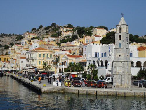
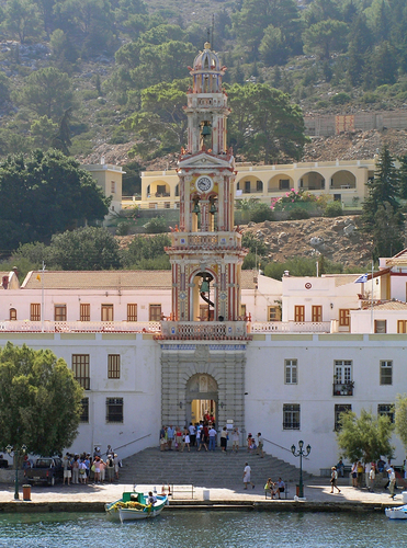
Symi
Google-Maps
Symi
Island from Datca on the Turkish coast
Beautiful bays and pebbled beaches, best reached by small boats that ply frequently between Symi and Rhodes. Many people come for the day to wander around the beautiful town. There are several ferries a week to Kalymnos, Kos, Rhodes and Tilos as well as a hydrofoil twice a week. There are a couple ferries a week to Pireaus. Matt Barrett
|
|
|
|
Kos
Google-Maps

Tourist
map of Kos
After
Mykonos and Santorini Kos is touristically the highest developed
island in the Aegean: It boasts 9 Five Star and 12 Four Star hotels
in addition to numerous Three Stars, night clubs, discos, bars, and
restaurants.... Hyppokrates was born here, international,
medical conventions are therefore a major business on Kos.
With
its long sandy beaches, a balmy climate and many historical sites it
should be a heaven for foreign tourists. There are 5 flights to
Athens and to a number of international destinations: Frankfurt,
Rome, Moscow.
Unfortunately this boom was supported by
international bulk tour operators whose business collapsed during the
2008-2010 crash. Many of the hotels went broke, are empty, or for
sale.
Read the full 2010 review of Kos by Marc
Dubin
|
|
|
|
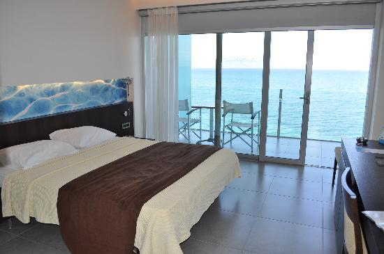
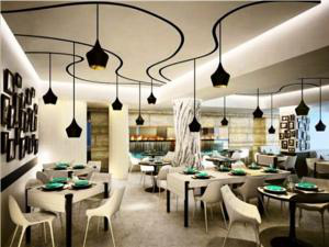
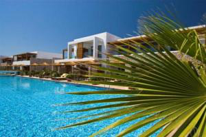
Here is a sampling of hotels, all charge less than $200/double in the Spring of 2012 - so maybe you are tempted.....
Rhodes
Google-Maps
Rhodes the city of the Knights
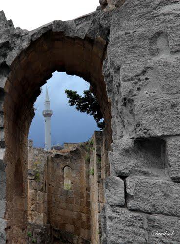
Minaret
seen from the ruins of the Castle of the Knights
Rhodes
is a major tourist attraction for the seekers of sunny beaches. While
many of its beaches are gravel, not sand; the island can boast 300+
sun days in a year. Consequently, you will stumble into tourists and
hotels and beaches full of deck chairs for rent, into shops and
restaurants that cater to these tourists. It can be overwhelming at
times.If
this bothers you, Rhodes is probably not for you. Still,
there are some areas where mass tourism has not yet penetrated too
much. And there are advantages too, accommodation on Rhodes itself
can be purchased for relatively low prices, and most of the locals
speak at least English and German and often some other languages,
like Swedish, French, Turkish, Italian or even Finnish. Look for
bays, beaches frequented by Greeks and areas at or beyond
Lindos
From Wiki
Travelguide
More
about Rhodes city and its history: Matt
Barrett
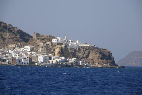
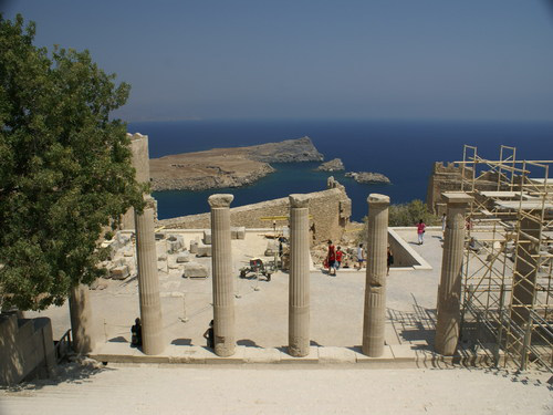
Lindos
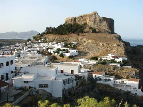
Lindos
and its acropolis
Lindos
is the tourist capital of the island. Often described as a quaint
island village, in reality it is a resort with a small village at its
center. The beach is excellent but crowded during a summer that seems
to last around 8 months.
The village itself is cycladic in style
and the home to many famous and not so famous artists, musicians and
normal people who were lucky enough to be here early.
The
Acropolis of Lindos is the most well known of all ancient sites in
the Dodekanese and can be as crowded as the Acropolis of Athens
sometimes.
Lindos was the original capital of the island,
established around 2000 BC and has been home to everyone from the
ancient Greeks, the Byzantines, the Franks and the Turks, including
Saint Paul and the Knights of Saint John who refortified the castle.
The village itself is closed to automobiles and is a labyrinth of
tiny streets and alleys.
There are several large
self-contained luxury hotels on the outskirts of town, with more on
the way.
From Matt
Barnett
|
|
|
|
Rhodes town, Lindos, Kameiros, and Monolithos are the main archeological attractions (see Google Maps). Prasonissos, the most western point of Rhodes is as far away as you can get from the international bustle. Try kite surfing there.
Kameiros Archeological Site
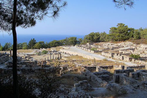
Overview
of the excavation site from the Acropolis hill.
The site is well
visible in Google Maps
During
the prehistoric period the area was inhabited by Mycenaean Greeks.
The city itself was founded by Dorians. The temple foundations were
begun at least as early as the eighth century BC. The earthquake of
226 BC destroyed the city and the temple. The earthquake of 142 BC
destroyed the city for the second time.
The Greek city was
built on three levels. At the top of the hill was the Acropolis, with
the temple complex of Athena Kameiras and the Stoa. A covered
reservoir having a capacity of 600 cubic meters of water—enough for
up to 400 families—was constructed about the sixth century BC.
Later, the Stoa was built over the reservoir.
The main
settlement was on the middle terrace, consisting of a grid of
parallel streets and residential blocks. On the lower terrace are
found a Doric Temple, probably to Apollo; the Fountain House, with
the Agora in front of it; and Peribolos of the Altars, which
contained dedications to various deities. From Wikipedia
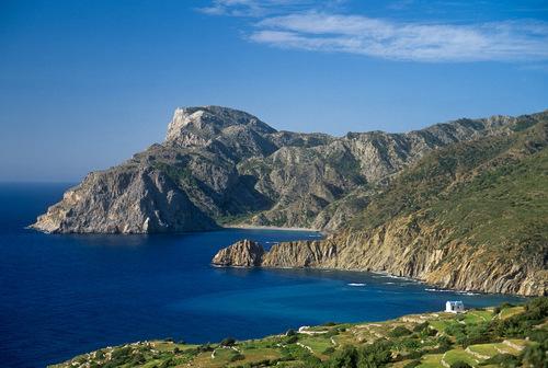
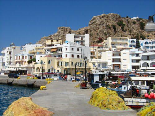
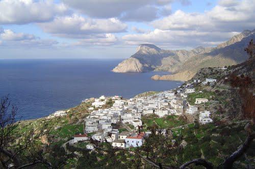
Karpathos
Google-Maps
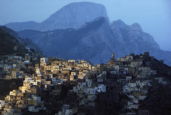
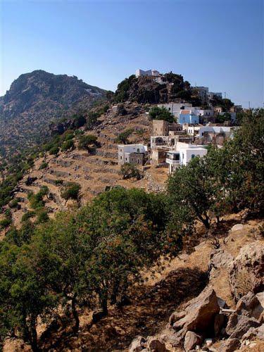
Karpathos,
The Mountain Village of Olympos
photo James Stanfield, Nat.
Geographic, 1983
Karpathos
is a very special island. A wild wooded mountain spine with a nearly
separate northern and southern half. 140 km from Rhodes or 180 km by
air from Crete, it once upon a time was the most inaccessible island
in the Aegean. Now there are two harbors and a new airport.
Conventionally counted among the Dodecanese Islands – although
the Italians seem not have liked this rocky place and left few
traces. It has long been famous for its northern very traditional
mountain village of Olympos, which was isolated for centuries.
Do
come here to watch, listen and learn. - The local tourism
organization, Karpathos.org
maintains
an informative website – not very elegant, but with a gallery of
photos and many comments critical of the frivolous, young Karpathian
generation and the tourists who together threaten the island's
conservative lifestyle......
The western side of the island is
rocky while the other is more fertile and green. The mountains
seperate the two sides. Many nice beaches some with hotels and
restaurants but tourism has not gotten out of hand...yet.
There
are two ports Karpathos-Pigadia (south) and Diafani in the north.
Pigadia is the island's despoiled capital. It has now numerous
hotels, restaurants and cafes on a noisy waterfront run by
repatriated American-Karpathians.
There are only a couple of
ferries a week from Pireaus and perhaps one or two a week to Rhodes,
Crete, Santorini, Milos, Kassos, Halki, Paros, and Naxos. There
is now an airport (Olympic Airways), and most people come here that
way.
The North
|
|
|
|
The South
|
|
|
|