The Stones of Greece
The Peleponnisos
Korinthos
Google-Map
Heraion
Perachora****
9th cent - 146 BC
At
the tip of the Geranium Peninsula
across from Corinth

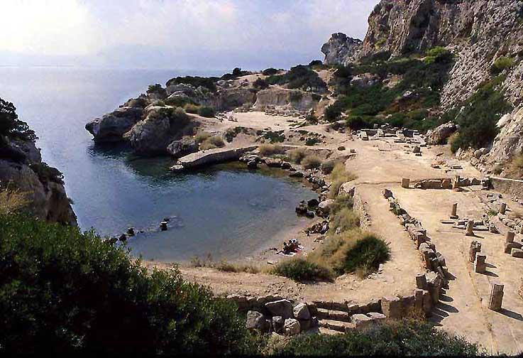
The Heraion Akraia and its small harbor, RWFG 1991
The Heraion of Perachora was a sanctuary of the goddess Hera situated in a small cove of the Corinthian gulf at the end of the Perachora peninsula. In addition to a temple of Hera of unusual construction and antiquity, the remains of a number of other structures have also been found, including a L-shaped stoa, a large cistern, dining rooms, and a second potential temple.
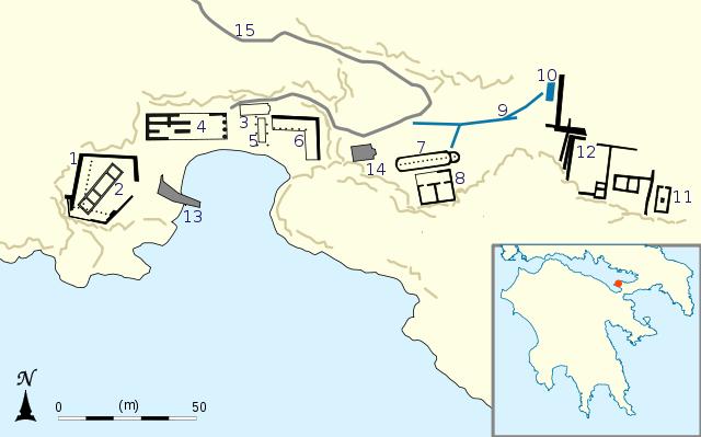
1.West court, 2.Roman house, 3.Apsidal structure, 4.Temple of Hera Akraia, 5.Altar, 6.L-shaped stoa, 7.Apsidal cistern, 8.Dining rooms, 9.Water channels, 10.Sacred pool, 11.Temple of Hera Limanaia, 12.Walls, 13.Modern jetty, 14.Modern chapel, 15.Modern footpath
Cult activity at the site continued from perhaps the 9th century BC to 146 BC, when the Roman general Mummius sacked Corinth during the war with the Achaean League. In the Roman period, domestic structures were built on the site, indicating that the area was no longer a sanctuary. This site is significant for the study of the origins of Greek temple architecture and rural cults.
There is a legend recounted by Euripides that Medea buried her
murdered children at a sanctuary of "Hera Akraia" as she
fled from Corinth. This may be a reference to this site. Herodotus
tells the story of Periander stripping the clothes off of the
Corinthian women at a sanctuary of Hera. In the 1st century AD, the
Greek historian Strabo wrote that there was an oracle associated with
the sanctuary
Text and Plan Wikipedia
Archaia
Korinthos***
6500
BC-300 AD
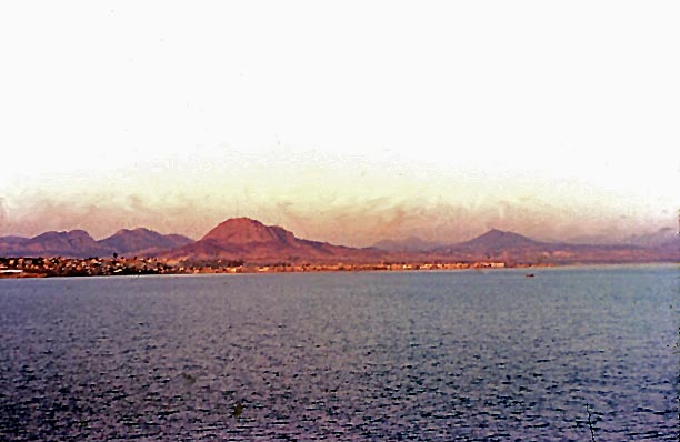
Sunrise over Akro-Korinth waiting to enter the Corinthian Canal, RWFG 1953
Neolithic pottery finds suggest that the site of Corinth was occupied from at least as early as 6500BC, and continually occupied into the Early Bronze Age, when, it has been suggested, the settlement acted as a centre of trade. However, there is a dramatic drop in ceramic remains during the Early Helladic II phase, and only sparse ceramic remains in the EHIII and MH phases; thus it appears that the area was very sparsely inhabited in the period immediately before the Myceanaean period. While pottery dating to the Mycenaean period is negligable at the site of Corinth, there was a settlement on the coast near Lechaion which traded across the Corinthian Gulf; the site of Corinth itself was likely not heavily occupied again until around 900BC, when it is believed the Dorians settled there.
Some ancient names for the place, such as Korinthos, derive from a pre-Greek, "Pelasgian" language; it seems likely that Corinth was also the site of a Bronze Age Mycenaean palace-city, like Mycenae, Tiryns or Pylos. According to myth, Sisyphus was the founder of a race of ancient kings at Corinth. It was also in Corinth that Jason, the leader of the Argonauts, abandoned Medea.
The city had two main ports, one in the Corinthian Gulf and one in the Saronic Gulf, serving the trade routes of the western and eastern Mediterranean, respectively. In the Corinthian Gulf lay Lechaion (to the far left in the above photo), which connected the city to its western colonies and Magna Graecia, while in the Saronic Gulf the port of Kenchreai served the ships coming from Athens, Ionia, Cyprus and the rest of the Levant. Both ports had docks for the large war fleet of the city-state.
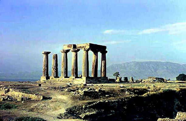
The columns of the Apollo temple (550 BC) and Mt. Helicon across the Gulf, RWFG 1953
In classical times, Corinth rivaled Athens and Thebes in wealth, based on the Isthmian traffic and trade. Until the mid-6th cent BC Corinth was a major exporter of black-figure pottery to city-states around the Greek world. Athenian potters later came to dominate the market.
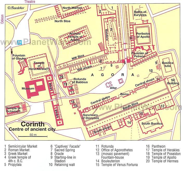
Plan of Classical-Hellenistic Korinth from Planetware
The remains of the classical city of Corinth lie just below Acrocorinthus, with which it was joined by a circuit wall about 6 miles (10 km) in circumference. The city was connected with its principal port, Lechaeum, by two parallel walls and a paved highway which led to the propylaea, the entrance to the agora (the city’s main marketplace).
When Rome demanded the dissolution of the Achaian League, Corinth, the leader, resisted and so Lucius Mummius, the Roman consul, leveled the city in 146 BCE, killed the men and sold the women and children into slavery. Some of the wealthier families escaped to the island of Delos. For the next 100 years, only a handful of squatters occupied the site. Julius Caesar refounded the city as a colony in 44 BCE, named it Colonia Laus Julia Corinthiensis and populated it with conscripted Italian, Greek, Syrian, Egyptian and Judean freed slaves. New Corinth, as Ancient Corinth, thrived.
Most of the substantial remains in
the agora are works from the Roman period, but it acquired its
present extent much earlier, in the 4th century BC, with the
construction of an enormous stoa (portico), 525 feet (160 metres) in
length, that enclosed its southern side. Immediately behind the south
stoa began the road leading to the city’s port of Kenchreae, on the
Saronic Gulf. On a small rise northwest of the agora stand seven
Doric columns, which are the remains of the Temple of Apollo (c.
550 BC). The remains of
other temples, villas, a theatre, shops, public baths, pottery
factories, a gymnasium, a large triumphal arch, and other buildings
dot the site, which since 1896 has been extensively excavated.
Text
from Britannica
and various other sources.
Korinthos,
Kenchreai
Eastern harbor of
ancient Korinthos
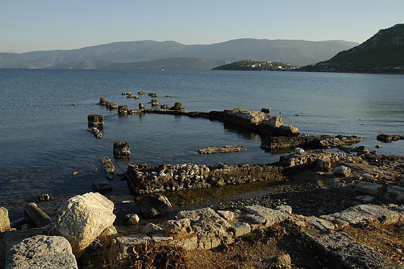
Harbor of Kenchreai, photo umich.edu
Kenchreai was one of the two ports
of the inland city-state of Corinth. While Kenchreai served the
eastern trade routes via the Saronic Gulf, Lechaion on the Corinthian
Gulf served the trade routes leading west to Italy and the rest of
Europe. SItuated on the eastern side of the Isthmus of Corinth,
Kenchreai sat at a natural crossroads for ships arriving from the
east and overland traffic heading north and south between central
Greece and the Peloponnese. The origin of Kenchreai is unknown, but
it must have been inhabited from early times, probably in prehistory,
on account of the deep natural harbor that was favorable for landing
ships.
Wikipedia
Korinthos,
Lenchaio-Assos
Western harbor
of ancient Korinthos
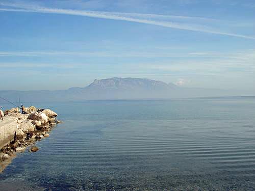
View of the mountains of Delphi
above the early morning fog on the Korinthian Gulf
from
Lenchaio-Assos, the former western harbor of Korinthos. Panoramio
Isthmia,
Poseidon Sanctuary***
7th cent-400 BC
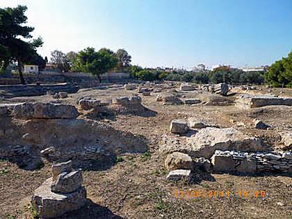
Poseidon Temple at Isthmia dontouristic.ru
The Temple of Isthmia is an ancient Greek temple on the Isthmus of Corinth dedicated to Poseidon and built in the Archaic Period. It is about 16 kilometers (9.9 mi) east of ancient Corinth. It appears to have been constructed in the 7th century BC though it was later destroyed in 470 BC and rebuilt as the Temple of Poseidon at Isthmia in c. 440 BC during the Classical period.
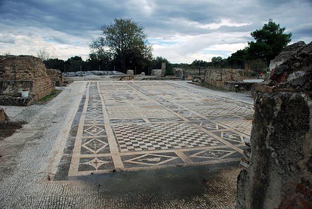
Mosaic floor of the Roman Bath, Mediterraneanworld
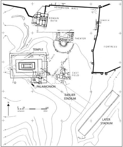
Plan of the sanctuary, Un.Chicago
Sikyon*
2000
BC-200 AD
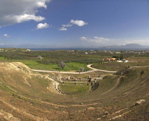
The Greco-Roman theater at Sikyon, Panoramio
Sikyon was built on a low triangular plateau about two miles from the Corinthian Gulf. Between the city and its port lay a fertile plain with olive groves and orchards. After the Dorian invasion the community was divided into the ordinary three Dorian tribes and an equally privileged tribe of Ionians, besides which a class of serfs lived on and worked the land.
For some centuries, Sikyon remained subject to Argos, whence its Dorian conquerors had come; as late as 500 BC, it acknowledged a certain suzerainty. However, its virtual independence was established in the 7th century BC, when a line of tyrants arose and initiated an anti-Dorian policy.
About this time, Sikyon developed the various industries for which it was noted in antiquity. As the abode of the sculptors Dipoenus and Scyllis it gained pre-eminence in woodcarving and bronze work such as is still to be seen in the archaic metal facings found at Olympia. Its pottery, which resembled Corinthian ware, was exported with the latter as far as Etruria. In Sikyon also the art of painting was supposed to have been invented. After the fall of the tyrants their institutions survived till the end of the 6th century BC, when Dorian supremacy was re-established,
The destruction of Corinth (146 BC) brought Sikyon an acquisition of
territory and the presidency over the Isthmian games; yet in Cicero's
time it had fallen deep into debt. Under the Roman empire it was
quite obscured by the restored cities of Corinth and Patrae; in
Pausanias' age (A.D. 150) it was almost desolate. In Byzantine times
it became a bishop's seat, and to judge by its later name Hellas it
served as a refuge for the Greeks from the Slavonic immigrants of the
8th cent AD.
Wikpedia
Pitsa,
Nymphaion Cave of Saphtoulis
700-500 BC
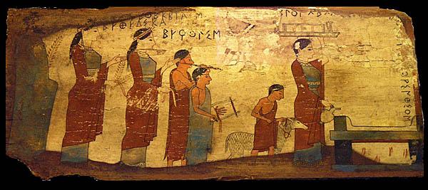
One of four panel paintings found in the Saphtoulis cave (nymphaion) near Pitsa
Pitsa is a modern village S of ancient Aigira on the N side of Mt. Chelydorea (Paus. 7.17.5) near the summit of which a rich votive deposit in a deep cave (Cave of Saphtoulis) has been excavated. Extending to a depth of over 20 m and divided into several chambers, the cave was a cult center for the worship of chthonic deities, especially the nymphs and possibly Demeter, from ca. 700 B.C. into the Roman Imperial period.
The finds, which remain largely unpublished, are in the nearby museum
of Sikyon and in the National Museum of Athens. They include numerous
terracotta figurines, votive pottery (mainly Corinthian), bronze
mirrors and jewelry, Corinthian and Sikyonian coins, wooden
statuettes, bone dice, etc. The cave is famous, however, for four
beautifully painted and well-preserved wooden plaques. Represented on
one plaque in free-style, polychrome technique of ca. 550 B.C. is a
sacrificial procession with dipinto name-labels and the incomplete
signature of a Corinthian painter in the epichoric Corinthian
alphabet. Dipinti on this and on another plaque also show that these
objects were dedicated to the nymphs. The four plaques from the cave
are stylistically dated to circa 540–530 BC, i.e., to the Archaic
period of Greek art. They supply almost unique evidence for
nonceramic Corinthian painting of this period.
Perseus.tufts.edu
The tablets are thin wooden boards covered with stucco (plaster) and painted with mineral pigments. Their bright colours are surprisingly well preserved. Only eight colours (black, white, blue, red, green, yellow, purple and brown) are used, with no shading or gradation of any sort. Probably, the black contour outlines were drawn first and then filled in with colours. A second well-preserved tablet also has a written dedication to the nymphs and shows three partially overlapping female figures, perhaps the nymphs themselves
The tablets are votive offerings, connected with the rural cult of the nymphs, which was widespread throughout Greece. Stylistically and technically, they probably represent rather low quality panel paintings of their time. This, as well as references to wooden painted or inscribed votives at other Greek sanctuaries (e.g. Epidaurus), indicates that the Pitsa tablets belong to the types of votives available to the lower, or poorer, sections of population. Such simple votives may have been far more numerous originally, but the fact that they are made of perishable materials, whereas richer votives were of stone, bronze or precious metals, has led to their near-total disappearance from the archaeological record.
Most ancient paintings that survived are either frescoes or vase
paintings. It is known that panel paintings were held in much higher
regard, but very few of them have survived. The best known examples
of ancient panel painting, the Fayum mummy portraits and the Severan
Tondo, are of Roman date. The Pitsa panels, probably preserved due to
the unusual climatic conditions inside the cave, are by far the
earliest examples of this technique to survive. As the only pre-Roman
specimens, they represent virtually all the evidence for a whole
style of art. Incidentally, the ancient Greeks believed that panel
painting was invented in Sicyon, not far from Pitsa.
Wikipedia
Nemea,
Zeus Temple***
330-235 BC
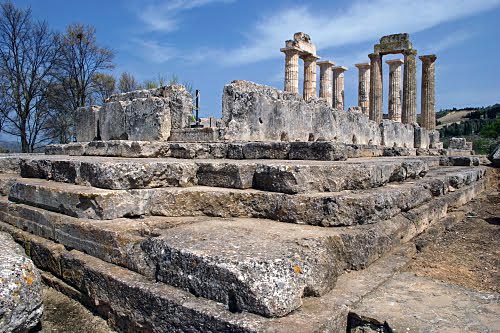
The reconstructed Zeus temple, Panoramio
Here in Greek mythology Heracles overcame the Nemean Lion, and here during Antiquity the Nemean Games took place every 11 years, in three sequences, ending about 235 BCE, celebrated in the eleven Nemean odes of Pindar.
Three limestone columns of the temple of the Nemean Zeus of about 330
BC have stood since their construction, and two more were
reconstructed in 2002. As of late 2007, four more are being
re-erected. Three orders of architecture were employed at this
temple, which stands at the end of the Classic period and presages
this and other developments of Hellenistic architecture, such as the
slenderness (a height of 6.34 column diameters) of the Doric columns
of the exterior. The site around the temple has been excavated in
annual campaigns since 1973: the great open-air altar, baths, and
ancient accommodations for visitors have been unearthed. The temple
stands on the site of an Archaic period temple, of which only a
foundation wall is still visible. The stadion has recently been
discovered. It is notable for its well-preserved vaulted entrance
tunnel, dated to about 320 BC - with ancient graffiti on the
walls.
Wikipedia
Ancient
Aigeira*
2000 - 200 BC
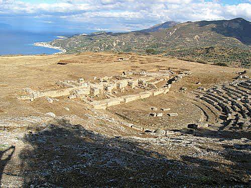
The Hellenistic theater of Ancient Aigeira, Panoramio
Settlement activity in Aigeira extends back to the late Middle Neolithic and Late Neolithic period, as the most recent excavations directly below (to the north) of the ancient acropolis on the excavation area ›Solon‹ have revealed.
The site had its heyday in the Late Mycenaean period in the 12th century B.C. In this period, a number of settlement phases can be differentiated on the acropolis and on the plateau located at a slightly lower level to the south. The remains found on the acropolis of a number of Mycenaean houses, storage rooms, a pottery kiln, and an enclosure wall indicate the significance of this settlement.
With the influx of the population from Aigai in ca. 350 B.C. and the
foundation of the Achaean League in 281/280 B.C., Aigeira experienced
a new heyday. The entire Hellenistic city was fortified by a city
wall; an aqueduct which ran partially underground guaranteed the
water supply. The most recent excavations have revealed an important
public building on the excavation area ›Solon‹; this was
erected in the 4th century B.C. and converted in the 3rd
century.
Austrian
Archeo. Institute
Paper by Eva
Alfram-Stern
GTP-Greek
Travel Pages
The locations of the various parts of Aigeira cannot be determined on GE (low resolution, confused coordinates in the cited references)
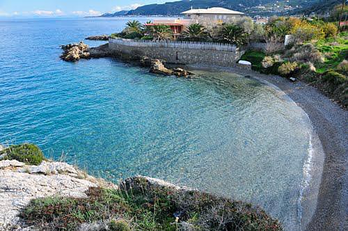
Harbor of ancient Aigeira, Panoramio
Aigeira, Upper Acropolis (Paleokastro)
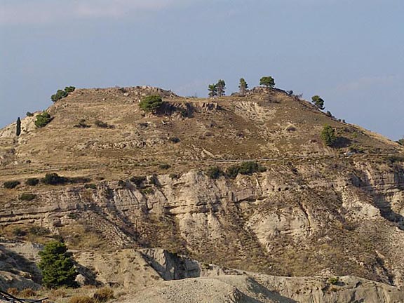
Aigeira Paleocastro, Austrian Archeolocial Institute
Ancient
Lousoi
8th cent BC- 4th cent AD
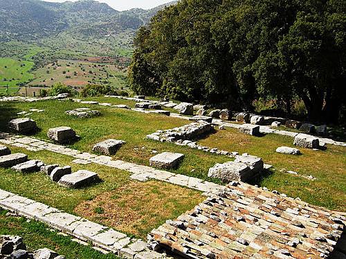
The Temple of Artemis Himera was discovered and first excavated by Wilhelm Dörpfeld 1897
In the area of the ancient polis of Lousoi, the extra-urban sanctuary of Artemis, the excavations in the public centre of Lousoi, and an excavated residential district attest to a continuous development from the Geometric epoch (8th century B.C.) until the Roman imperial period (at the latest till the 4th century AD).
The sanctuary of Artemis, significant due to the reports of ancient sources and from the finds associated with it, was set up on a rocky terrace and experienced its heyday with its monumental architectonic configuration, in the early 3rd century B.C.: during the course of a large-scale building programme, the Artemis temple as well as a fountain house and additional buildings, whose identification as a bouleuterion and a propylon is not completely certain due to their poor state of preservation, were constructed.
In contrast to the sanctuary of Artemis, which was abandoned in the Augustan period, the cult in the small cult buildings to the west of the peripteral temple can be traced until the mid-imperial period.
After the discovery of the sanctuary of Artemis Himera at Lousoi by
Wilhelm Dörpfeld and Adolf Wilhelm in 1897, the Athens branch of the
(OeAI) Austrian Archeological Insttute carried out the first
excavations in this sanctuary in 1898 and 1899 under the directorship
of Wolfgang Reichel and Adolf Wilhelm. The excavations which were
resumed in 1980 by the Athens branch of OeAI under the directorship
of Veronika Mitsopoulos-Leon (1980–2006) and G. Ladstätter (since
2007) are continuing today.
Austrian
Archeological Institute
Gremoulias/Kalavrita*
6th
cent BC
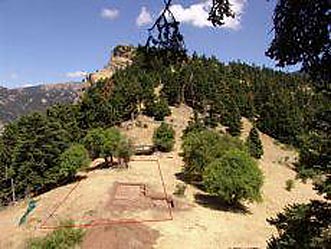
The excavation site at Gremoulias (Austrian Archeol. Institute)
The location is a guess.
The ancient site of Gremoulias/Kalavrita denotes a ridge of land at an elevation of ca. 1,400 m, approximately 4 km to the south-east of Kalavrita and 6 km to the north of the ancient site of Lousoi.
Although it is only partially verified archaeologically, the following architectural development can be deduced for the sanctuary on the saddle of Gremoulias.
In the late 6th cent BC, a monumental Doric limestone temple with a
Cor marble roof was erected. Since the plateau was too small to hold
several monumental buildings, this structure can be connected with
the foundations of the later limestone temple, the elongated
proportions of which may well belong to such an early date. The LAr
structure was thus a peripteral temple.
Austrian
Archeo. Institute