The Stones of Greece
The Peleponnisos
Argolis
Google-Map
Franchthi
Cave*
Paleolithic
~30 000-3000 BC
South
of Navplion, north of Porto Heli
See Google Map

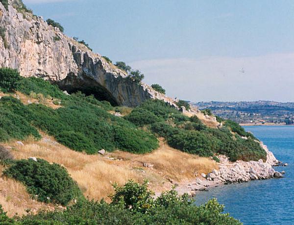
Franchthi Cave from the sea. In the foreground the Paralia cemetery area, Panoramio
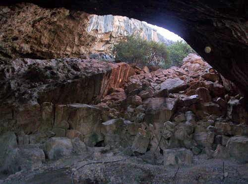
Inside the cave, Panoramio
Franchthi Cave is located on the coastline of the southern Argolid, in the Gulf of Koilada, 12 metres above the present sea level. During the last Glaciation it was seven km inland, while at the beginning of the Holocene its distance from the coastline was barely a kilometre. The depth of the cave was approximately 150 metres.
The cave was occupied from the Palaeolithic around 20,000 BC (and possibly earlier) through the Mesolithic and Neolithic periods, being abandoned about 3000 BC (Middle Neolithic). It is one of the very few settlements in the world that shows continuous human occupation for more than 20,000 years.
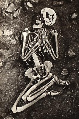
Burial of a woman Neolithic 8000 BC
From a detailed and informed
article on Paleo/Neolithic
Caves in Greece
Most importantly, the cave contains some of the earliest evidence for agriculture in Greece. The first inhabitants were probably hunter gatherers, but from around 11,000 BC almonds, pistachios, bitter vetch, and lentils all appear at the same time, while wild oats and wild barley appear from 10,500 BCE, and from 7,300 BC peas and wild pears also appear. None of these crops were native to the region, while two are certainly imported from Asia Minor (Anatolia). This would seem to indicate that the farming of legumes and nuts preceded that of grain in Greece, if not in Anatolia as well. This would make this area the oldest known agricultural site in Greece.
Obsidian items from the cave have been traced to the
island of Milos 80 miles away by sea, which indicates long-distance
sea travel. Around 6000 BC, evidence of domesticated animals and
plants (emmer and einkorn wheat) appears in the archaeological record
at the cave. Large fish bones have also been found, a characteristic
of deep-sea fishing.
Wikipedia
Mykenai****
2100-
1100 BC
northern Argolis
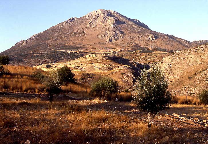
The Citadel of Mykenai under Mt. Zakas, RWFG 1985
Only scattered sherds from disturbed debris have been found datable to the Neolithic (prior to 3500 BC). The site was inhabited but the stratigraphy has been destroyed by later construction.
Mycenae was settled close to 2000 BC by Indo-Europeans who practiced farming and herding. Scattered sherds dating to 2100-1700 BC have been found, when Mycenae interacted with Minoan Crete. Other theories suggest the settling of Mycenae a thousand years earlier.The first burials in pits or cist graves began to the west of the acropolis at about 1800-1700 BC. The acropolis was enclosed at least partially by the earliest circuit wall. In the second millennium BC Mycenae was one of the major centres of Greek civilization, a stronghold which dominated much of southern Greece. The period of Greek history from about 1600 BC to about 1100 BC is called Mycenaean in reference to Mycenae.
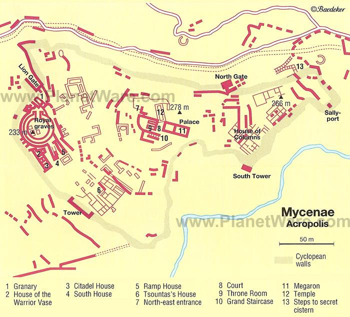
Plan of the citadel from Planetware
During the Bronze Age the settlement at Mycenae was a fortified hill surrounded by hamlets and estates, in contrast to the dense urbanity on the coast (e.g., Argos). Since Mycenae was the capital of a state that ruled, or dominated, much of the eastern Mediterranean world, the rulers must have placed their stronghold in this less populated and more remote region for its defensive value. Since there are few documents on site with datable contents and since no dendrochronology has yet been performed(!) upon the remains, the events are dated on the styles of pottery shards found at the place.
Helladic I-III (~2100-1100 BC)
Outside the partial circuit wall, Grave Circle B, named for its enclosing wall, contained ten cist graves in Middle Helladic style and several shaft graves, sunk more deeply, with interments resting in cists. Richer grave goods mark the burials as possibly regal. Mounds over the top contained broken drinking vessels and bones from a repast, testifying to a more than ordinary farewell.] Stelae surmounted the mounds
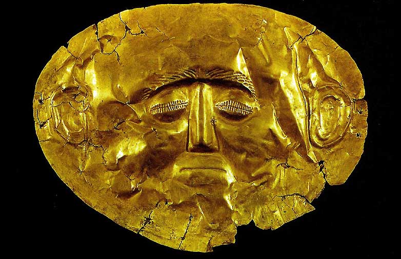
The socalled “Mask of Agamemnon” excavated by Heinrich Schliemann (Nat.Arch.Museum Athens) RWFG 1991
A walled enclosure, Grave Circle A, included six more shaft graves, with 9 female, 8 male, and two juvenile interments. Grave goods were wealthier than in Circle B. The presence of engraved and inlaid swords and daggers, with spear points and arrowheads, leave little doubt that warrior chieftains and their families were buried here. Some art objects obtained from the graves are the Silver Siege Rhyton, the Mask of Agamemnon, the Cup of Nestor, and weapons both votive and practical.
Around 1350 BC the fortifications on the acropolis, and other surrounding hills, were rebuilt in a style known as cyclopean. Within these walls, much of which can still be seen, successive monumental palaces were built. The final palace, remains of which are currently visible on the acropolis of Mycenae, dates to the start of LHIIIA:2. Earlier palaces must have existed, but they had been cleared away or built over.
By 1200 BC the power of Mycenae was declining;
during the 12th century, Mycenaean dominance collapsed. The
destruction of Mycenae is part of the general Bronze Age collapse.
Within a short time around 1200 BC, all the palaces of southern
Greece were burned, including that at Mycenae. This is traditionally
attributed to a Dorian invasion of Greeks from the north, although
some historians now doubt that such an invasion took place. Displaced
populations escaped to former colonies of the Mycenaeans in Anatolia
and elsewhere, where they came to speak the Ionic dialect.
Text
from: Wikipedia
Large,
albeit poor photos are found at: hamilton.sbc.edu
Tiryns****
2500-1050
BC
On the road to Argos 4 km north of Nafplion
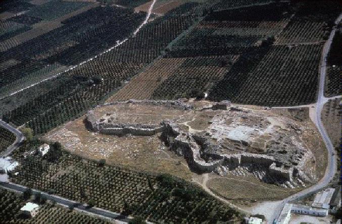
Aerial view of the acropolis of Tiryns. Photo: hamilton.arthistory.sbc.edu
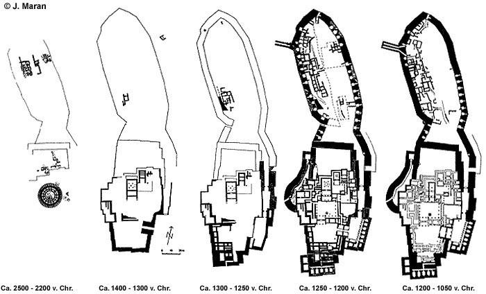
The 5 stages of Tiryns, Image Uni-Heidelberg
The Acropolis was first excavated by German archaeologist in 1831. In 1876, Heinrich Schliemann considered the palace of Tiryns to be medieval, so he came close to destroying the remains in order to excavate Mycenaean treasures. The next period of excavation was under Barbara's granduncle Wilhelm Dörpfeld,then the director of the German Archaeological Institute, this time the ruins were excaveted properly. The excavations were continued later by Dörpfeld with other German archaeologists, and continue to be the subject of ongoing excavations by the German Archaeological Institute at Athens and the University of Heidelberg
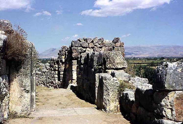
Gate to the upper level of Tiryns, RWFG 1953
The earliest human occupation on the hill goes back to the Neolithic period (about 5000 B.C.). It was followed by successive settlements but their remains have been destroyed almost completely by the extensive construction of the Mycenaean age. Enough evidence survived from the settlement of the Early Bronze Age (2500-2000 B.C.) to prove the existence then of a series of apsidal houses arranged around a huge circular building (diam. 28 m) on the summit of the hill.
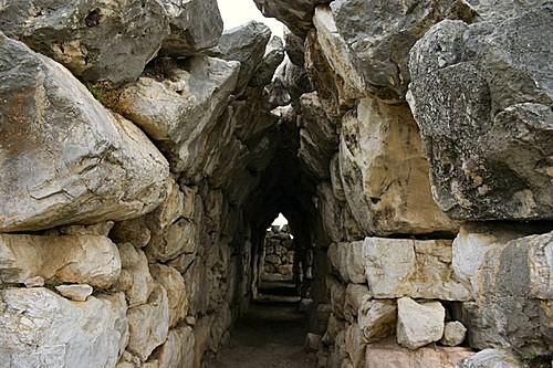
Tunnel in the cyclopaean walls, RWFG 1991
The building of the fortification of the hill began during the 14th century B.C. and was completed at the end of the 13th (Late Helladic IIIB period). The Cyclopaean walls which surround the Upper, Middle and Lower Citadel, have a total perimeter of approximately 750 m and a width between 4,50 and 7 m. Within the walls were the wall-painted palace, the remaining public spaces, the cyclopaean tunnels leading to the storehouses and the workshops. The town divided into blockhouses extended outside the walls and around the Acropolis
After the disintegration of the palatial system (about 1200 B.C.),
the Acropolis continued to be used mostly as a cult place. The site
had become deserted when Pausanias visited it during the 2d century
A.D.
Text from: odysseus.culture.gr
Wikipedia
Argolid Heraion***
7th
cent - 423 BC-2nd cent AD
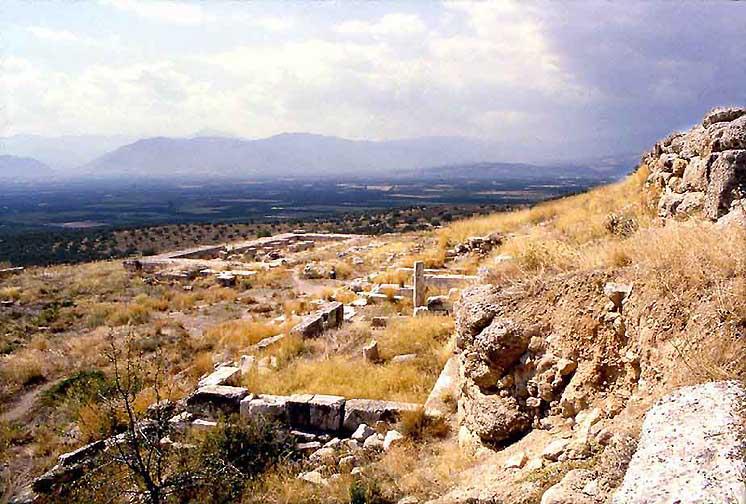
Argive Heraion, RWFG 1991
The Heraion of Argos (Greek: Ἡραῖον Ἄργους) was one of the oldest amd most important sanctuaries in the Argolid, dedicated to Hera, whose epithet "Argive Hera" (Ἥρη Ἀργείη Here Argeie), is familiar to readers of Homer. Hera herself claimed to be the protector of Argos in Iliad IV, 50–52: "The three towns I love best are Argos, Sparta and Mycenae of the broad streets". The memory was preserved at Argos of an archaic, aniconic pillar representation of the Great Goddess (see, e.g., Bassai and the Lion Gate in Mycene!). The site, which may mark the introduction of the cult of Hera in mainland Greece, lies northeast of Argos between the archaeological sites of Mycenae and Midea (Argolid), two important Mycenaean cities. The traveller Pausanias, visiting the site in the 2nd century AD, referred to the area as Prosymna (Προσύμνη).
The temenos occupies three artificially terraced levels on a site above the plain with a commanding view. The Old Temple (7th cent BC), destroyed by fire in 423 BC, and an open-air altar stood on the uppermost terrace. The famous ivory and gold-plated bronze sculpture of Hera by Polykleitos stood in the New Temple on the middle terrace, built by Eupolemos of Argos following the fire.
There were other structures, one of which was the earliest example of
a building with an open peristyle court, surrounded by columned
stoas. The lowest level supports the remains of a stoa. Ancient
retaining walls support the flat terraces.Close to the Heraion a
Mycenaean cemetery apparently a site of an ancestor cult in the
Geometric period was excavated by Carl Blegen. In Roman times baths
and a palaestra were added near the site.
Wikipedia
Argos**
Like in Thebes the ruins of the prehistoric and the Mycenean Argos are covered by a modern, dusty provincial town. However, unlike Thebes, the few excavated sites, are not intriguing. They range from the Archaic Greek period to Roman times. The castle, which hides the old acropolis, is Venitian from the 12th century, hardly worth the steep climb. Yet the old myths of Herakles and the Argolid kings let us expect more archeological discoveries. The museum provides a few shards to populate one's imagination with, not more.
Argos,
Sanctuary of Apollo Deiradiotes
6th-3rd cent BC
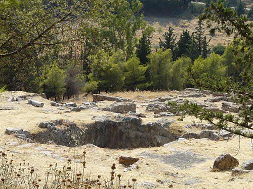
Sanctuary of Apollo Deiradiotes and Athena Oxyderkes, Panoramio
All that has survived of the sanctuary of Apollo Deiradiotes or Pythios is a monumental staircase cut in the rock and an altar. Remains of a Byzantine basilica are visible SE of the altar. On a higher terrace to the east, there is a rectangular building with an internal colonnade (an oracle ?) and on a third terrace, the foundations of a building with a covered cistern (Asklepieion?). Further south, on a lower terrace, are preserved the remains of a tholos, possibly identified as the sanctuary of Athena Oxyderkes. The sanctuary is locaded on the hill of Profitis Ilias, in Argos.
Evidence of religious activity at the site exists as early as the
Archaic period (6th century B.C.), but most of the surviving
monuments were built during the 4th century B.C. According to
inscriptions, the sanctuary was repaired twice, in the 4th-3rd
centuries B.C. and in the early Roman Imperial period (1st century
A.D.). The basilica SE of the altar was built in the Early Christian
period (5th century A.D.) and was replaced by a larger church in the
Byzantine period (10th century A.D.).
MCT
Odysseus
Argos, Archeological Museum
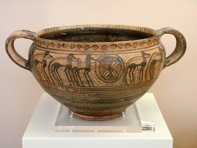
Argive Geometric kantharos with horses,
Middle Geometric II
(800-750 BC). Photo: flickr.com
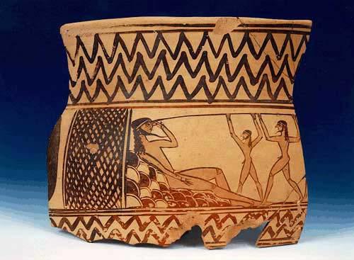
Odysseus blinding the Cyclops Polyphemos (7th cent BC)
The museum has two sections: the Kallergeio Museum, which was
inaugurated in 1957 and the new section of 1961. The French
Archaeological School, who also oversaw the building of the new
section, are responsible for the many items displayed in the museum
which were unearthed in Argos and the prefecture and date from the
Mid-Helladic period (about 2000 B.C.) until Late Antiquity (600 AD).
The bulk of the artifacts were discovered at the ancient agora, in
the area of the Roman theatre and at the Mycenaean grave in Deras.
The American School of Classical Studies were also responsible for
some excavations represented in the collection, particularly those at
Lerna.
Wikipedia
Argos,
Hellenistic and Roman Theaters
200 BC-400 AD
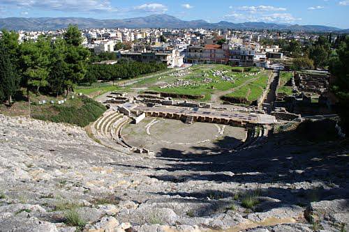
Argos the theater. Panoramio
The ruins of two distinct theater sites, situated just 100 meters
from each other, have been excavated in Argos. The first recorded
date for excavation of a theater here was 1892, when I. Kophiniotis
partially unearthed the larger, Hellenistic theater. Although it is
unclear when, exactly, the theaters fell into disuse, changes made to
the theater, the odeum, and other Argive sites point to sustained
activity as late as the fourth and fifth centuries A.D.
Princeton
Encyclopedia of Classical Sites
Argos,
Larissa Castle
13th cent AD on the old Mycenean acropolis
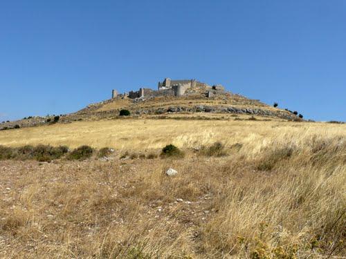
The Venetian Larissa Castle on the old acropolis of Argos, Panoramio
During the 13th century AD, a castle was built on Larissa Hill - the site of the ancient Acropolis - called Kastro Larissa. Argos was captured by the Crusaders, and belonged to the lordship of Argos and Nauplia. In 1388 it was sold to the Republic of Venice, but was taken by the despot of Mystra Theodore I Palaiologos before the Venetians could take control of the city ; he sold it anyway to them in 1394.
In 1397 the city was plundered by the Ottomans who carried off much
of the population, selling them as slaves. The Venetians repopulated
the town and region with Albanian settlers, granting them long-term
agrarian tax exemptions. Together with the Greeks of Argos, they
supplied stratioti (troops) to the armies of Venice. Some
historians consider the French military term "argoulet" to
derive from the Greek "argetes", or inhabitant of Argos, as
a large number of French stratioti came from the plain of Argos.
Wikipedia
Epidauros-Epidavros****
Epidauros,
Askleipion Sanctuary
2800 BC-
600 AD
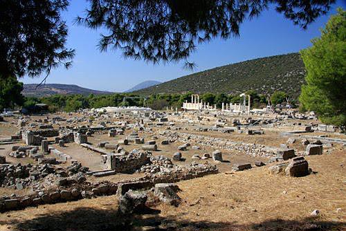
The ruins of the Askleipios Sanctuary - mostly late Hellenistic, photo Panoramio
The sanctuary was devoted to the healing deities since prehistoric times. A Mycenaean sanctuary dedicated to a healing goddess stands on the Kynortion hill, northeast of the theatre. It was founded in the 16th century BC over the remains of a settlement of the Early and Middle Bronze Age (2800-1800 BC), and functioned until the11th century BC. Unlike other sanctuaries of this period, it is unusually large.
This early sanctuary was replaced c. 800 BC by another, dedicated to Apollo, a god with healing abilities, worshipped here as Apollo Maleatas. The worship of Asklepios, the sanctuary's main healing god, traditionally considered as the indigenous son of Apollo and Koronis, granddaughter of Malos, king of Epidaurus, was established in the 6th century BC. Asklepios, protector of human health and personal happiness, was a very popular deity with an ever-increasing number of worshippers. The sanctuary at Kynortion was quickly overwhelmed by a great number of visitors, so a new sanctuary was founded in the plain, approximately one kilometre northwest of Kynortion Hill, on the site where, according to the myth, Asklepios was born. The two sanctuaries, one dedicated to Apollo Maleatas and the other to Asklepios, were subsequently known under the common name of 'Sanctuary of Apollo Maleatas and Asklepios'.
The new sanctuary developed around the Sacred Well, which was later incorporated into the portico of the Abaton, and in the area of Building E, where the first ash altar and the site of ritual feasting were located. The well played an important role in the healing process, which included cleansing and enkoimesis, or hypnosis, of the patients near its waters. The enkoimesis emulated the periodical death and rebirth of divine powers after they returned inside the earth - the source of life. The god appeared to a patient during his enkoimesis, which corresponded to periodic death, advising him on the treatment he should follow.
Continuous warfare and misery in the 4th and 3rd centuries BC led
people to seek even more the protection and help from Asklepios, the
philanthropist god, making the sanctuary one of the richest of its
time. Several important buildings were erected in both the mountain
and plain sanctuaries during this period: the Classical temple, the
altar of Apollo, the Great Stoa, the priests' residence and the
Temenos of the Muses in the former; the temple of Asklepios, the
Abaton, the Tholos, the theatre, the stadium, the Banqueting Hall and
the hostel in the latter.
Text from HMCT-Odysseus
Epidavros,
Sanctuary of Apollo Maleatas
21st cent+4th-2nd cent BC
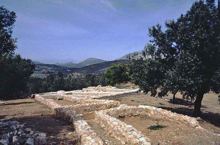
Late 4th cent foundations of the Apollo Maleatas Sanctuary, photo
The sanctuary of Apollo Maleatas is located on a low hill on Mount Kynortion, south-east of the theater at Epidaurus. At the peak of the hill was a small Early Helladic (~2100 BC) settlement, which was never built on in later periods. At the beginning of the Late Bronze Age (~1200 BC), an open-air altar was used where animals were sacrificed and votives deposited in the ash. Dedications include votive bronze double axes, bronze swords, and clay animal figurines. There is evidence for cult activity in the Geometric period.
Most of the structures on the site belong to the 4th century BC or to the 2nd century AD, when there was a major building campaign paid for by Sextus Iulius Maior Antoninus Pythodorus, an aristocrat from Nysa, Anatolia, and a Roman senator. Pausanias (2.2.7) reports that "everything about the sanctuary of Maleatas, including the cistern in which the holy water is collected, is a gift of Antoninus to the Epidaurians."
Remains on the site include Roman baths, an underground cistern, a
Roman fountain, a small Doric temple of Apollo (4th century BC,
hexastyle prostyle), an altar, a shrine of the muses, living quarters
for the sanctuary staff, a Roman gateway, and a stoa (late 4th
century BC).
Wikipedia
Epidavros,
The Theater****
400 BC
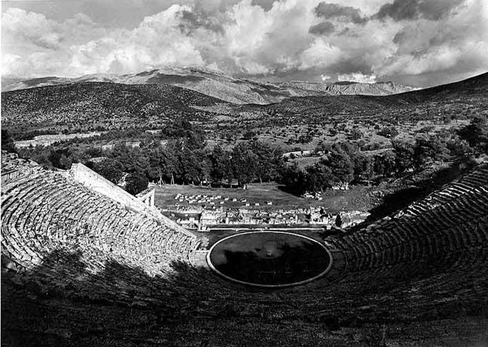
The Theater, the building for which Epidauros is and has been famous, RWFG 1953
"The Epidaurians have a theatre within their sanctuary, which
is, in my opinion, well worth seeing. For, while the Roman theaters
are far superior to those anywhere else in their splendor, and the
Arcadian theatre at Megalopolis is unequalled for size, what
architect could seriously rival Polycleitus in symmetry and beauty?
For it was Polycleitus who built both this theatre and the circular
building."
Pausanias
[2.27.5]
The theater was designed by Polykleitos the Younger in the 4th century BC. The original 34 rows were extended in Roman times by another 21 rows. As is usual for Greek theatres (and opposed to Roman ones), the view on a lush landscape behind the skênê is an integral part of the theatre itself and is not to be obscured. It seats up to 15,000 people.
The theatre is marveled for its exceptional acoustics, which permit almost perfect intelligibility of unamplified spoken word from the proscenium or skênê to all spectators, regardless of their seating. Wikipedia
Why such a huge theater in this health spa, - 15 000 people in such a remote place? we ask today. The answer does not only underscore the importance and popularity of Epidauros, it attests to the healing methods practiced there. Theatrical performances played an important role in the “dream-healings” practiced at Epidauros. An English-German article describes this early “psychotherapy” with many examples.
Nafplion*
1212-1821
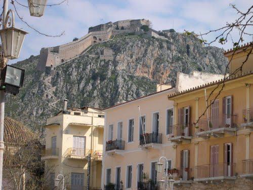
Navplion under the Venitian Palamidis Castle, photo: Panoramio
The Acronauplia (Modern Greek: Ακροναυπλία, Akronafplia,
Turkish: Iç Kale, "Inner Castle") is the oldest part of
the city of Nafplion in Greece. Until the thirteenth century, it was
a town on its own. The Acronauplia has walls dating from
pre-classical times. Subsequently, Byzantines, Franks, Venetians, and
Turks added to the fortifications. Nafplion was taken in 1212 by the
French crusaders of the Principality of Achaea, then in 1388 was sold
to the Republic of Venice. During the Greek War of Independence, it
played a major role. It was captured by Staikos Staikopoulos on 31
November 1821 and became the first capital of liberated Greece. Otto
from Bavaria was crowned Greek King here.
Wikipedia
There is a modern looking archeological museum in Nafplion, which I have not seen.
Nafplion,
the Palamidis**
1686-1715
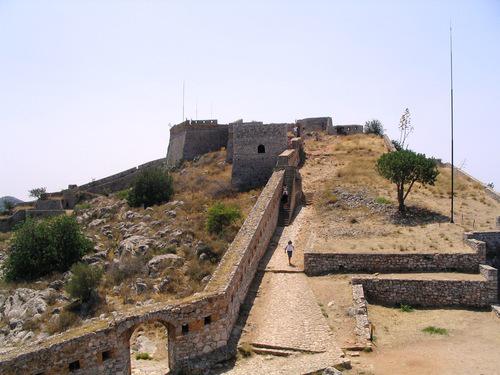
The steep Stairs to the Palamidi, photo: Panoramio
Palamidi (Greek: Παλαμήδι) is a fortress to the east of the Acronauplia in the town of Nafplio in the Peloponnese region of southern Greece. Nestled on the crest of a 216-metre high hill, the fortress was built by the Venetians during their second occupation of the area (1686-1715).
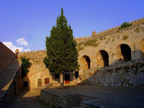
Inside the fortress, photo Panoramio
The fortress was a large and ambitious project, but was finished within a relatively short period from 1711 until 1714. It is a typical baroque fortress based on the plans of the engineers Giaxich and Lasalle. In 1715 it was captured by the Turks and remained under their control until 1822, when it was captured by the Greeks.
The bastions of the fortress were originally named after the Greek Proveditori. However, when the Ottoman Empire came around, they captured the castle and town and the bastions were given Turkish names. Lastly, when the Greeks overthrew the Turks the bastions were renamed after Greek saints. One of the bastions, called the "Miltiades," was used by the Ottomans as prison for Theodoros Kolokotronis, a hero of the Greek Revolution.
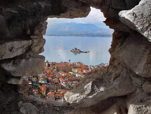
View of the Gulf, Vroutsi Island, and the Peleponnisos, Panoramio
The fortress commands an impressive view over the Argolic Gulf, the
city of Náfplio and the surrounding country. There are 857 steps in
the winding stair from the town to the fortress. However, to reach
the top of the fortress there are over one thousand. Locals in the
town of Nafplion will say there are 999 steps to the top of the
castle, and specials can be found on menus that incorporate this
number to catch a tourist's eye. Notwithstnding, for those who have a
car, there is a road from the easten backside of the
castle.
Wikipedia
Lerna**
5000
-1500 BC
On the Peleponnisian coast of the
Argolic Gulf
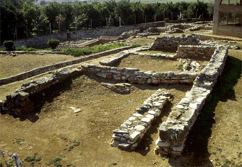
Lerna, House of tiles photo UTexas
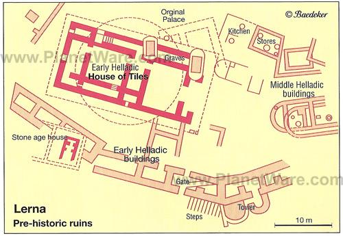
Plan of the prehistoric ruins from Planetware
Lerna is one of the largest (ca. 180 sq. m.) prehistoric mounds in S Greece and probably owed its importance to its position on the narrow strip of land between sea and mountains that formed the route from the Argolid to the S Peloponnese.
Early Bronze Age Lerna had substantial fortification walls and a palace or administrative center in a central building referred to as the "House of Tiles." This was a large two-story building with terracotta rooftiles and several storage rooms where clay sealings were found. In Classical times the area was claimed as home of the Nereids, place where Herakles slew the Hydra and location of the entrance to Hades (through the Aleyonean Lake).
After a long period of Neolithic occupation (Lerna I and II)(5000 BC) the site seems to have been deserted for a time before it was levelled off and reoccupied in the Early Helladic II period (Lerna III) (2500–2300 BC). The new settlement had a double ring of defense walls with gates and towers and a number of substantial buildings within. The largest building has been named the House of Tiles because of the unusual early occurrence of terracotta roofing tiles associated with the building. The walls of the large building are nearly 1 m thick and stairs indicate an upper story. The building was perhaps still under construction when the whole settlement was destroyed by fire.
In the Early Helladic III period (Lerna IV), the inhabitants (who supposedly destroyed the earlier settlement) covered the site of the House of Tiles with a low tumulus surrounded by a ring of stones, as though to mark off a sacred area.
In the Early Helladic III period Lerna was an open settlement of smaller buildings, some of them having an apsidal megaron floor plan. Bothroi, or "rubbish pits" were an unusual characteristic of this settlement. The Early Helladic III levels at Lerna produced, in addition to the typical pottery of that period, a few examples of a pottery type known as "Minyan" ware, which was sometimes wheel-made and is a common feature of the Middle Helladic period. The clearly defined Middle Helladic level at Lerna (Lerna V) follows without a break.
The settlement at Lerna continued to exist throughout the Middle
Helladic period, but does not continue into the Late Helladic or
Mycenaean period. At the end of the Middle Helladic period, 2
rectangular shaft graves were cut into the tumulus of the House of
Tiles, indicating that the meaning of that monument had been
forgotten
From Perseus
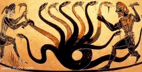
Herakles slaying the Lernean Hydra, photo theol.com
Lerna's site near the village Mili at the Argolic Gulf is most famous as the lair of the Lernaean Hydra, the chthonic many-headed water snake, a creature of great antiquity when Heracles killed it, as the second of his labors. The strong Karstic springs remained; the lake, diminished to a silt lagoon by the 19th century, has vanished.
Midea
Acropolis*
14th cent
BC
Northeast of Tiryns
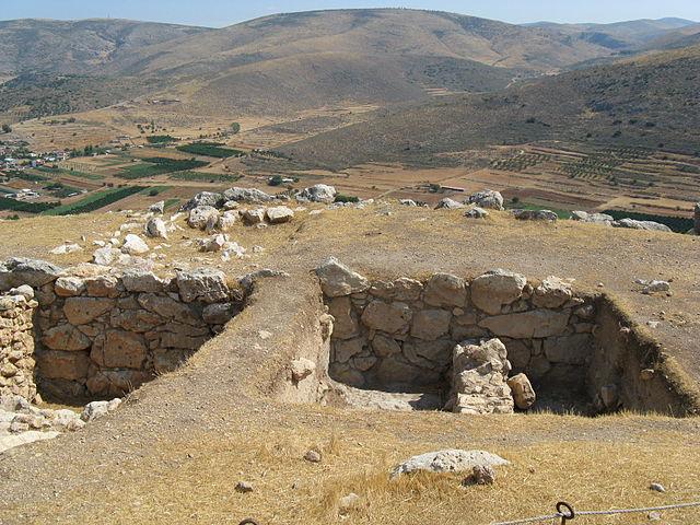
The acropolis of Midea
Midea is the name given to the bronze age citadel standing above the village of the same name in the Argolid in Greece. The citadel is one of the largest and best preserved Mycenaean sites. A tholos tomb and a cemetery of chamber tombs at nearby Dendra is associated with the site.
Excavations were started by the Swedish archaeologist Axel W. Persson and have been continued regularly by the Swedish School of Archaeology at Athens.
The site of Midea may be visited daily from 8:30am to 3pm. There is a
fine new restroom facility(!) at the site and the guard will provide
a brochure about the site if asked. As of May 2009, there was no
admission fee. The road to the citadel is narrow in places but paved.
The walls are quite well preserved and there is adequate explanatory
signage for all the ruins accessible to the public. As is common at
Greek archaeological sites, the weeds can be several feet tall so
wearing pants is recommended. The nearby Mycenaean cemetery at Dendra
is open from 8:30am - 3pm. Both ruins are signposted from the main
road. The signs are brown.
Text and photo: Wikipedia
Dendra,
Mycenian Necropolis*
1800-1380
B.C
near
Midea, northeast of Tiryns
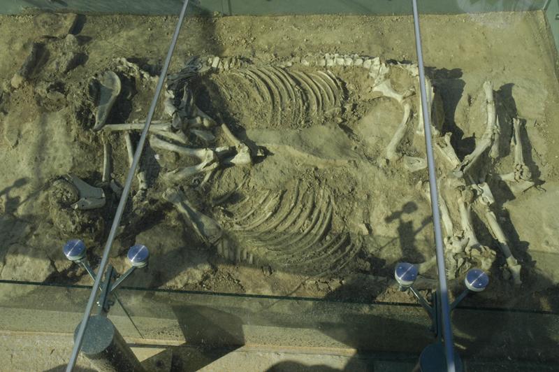
Sacrificial double-horse burial at Dendra, Photo U-Michigan
Dendra (Greek: Δενδρά) is a prehistoric archaeological site situated outside the village with the same name belonging to the municipality of Midea in the Argolid, Greece.
The site has a history stretching back at least to the early Bronze Age and is significant for the Bronze Age cemetery excavated by Swedish archaeologist Axel W. Persson in the first half of the 20th century. Persson excavated an unplundered tholos tomb and many Mycenaean chamber tombs, presumably belonging to the ruling classes having their dwelling at the nearby citadel of Midea.
Subsequent excavations (following partly successful attempts to
plunder the unexcavated tombs) unearthed the unique and exquisite
Dendra panoply of bronze armour, currently exhibited at the
Archaeological Museum in nearby Nafplio. Later excavations
also brought to light Bronze Age tumulus burials which included
sacrificed horses.
Wikipedia
Pyramid of
Hellenikon
669 BC
(?)
Southwest of Argos near Hellenikon
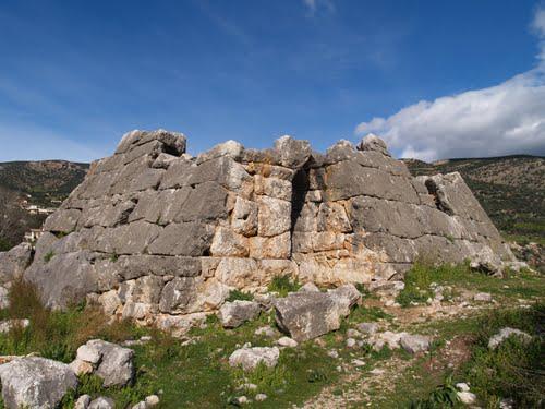
Tomb of the Argive heroes fallen in the battle against Sparta 669 BC
Kenchreai(?):
Probably to be identified with
a site SW of Argos near the village of Paleo Skaphidaki, where Frazer
saw marble fragments and foundation walls. Pausanias speaks of
several polyandreia near Kenchreai, mass graves of the Argives fallen
in the battle against the Spartans at Hysiai. The socalled Pyramid of
Kenchreai at Helleniko near Cephalan has frequently been proposed as
one of these tombs; it was apparently converted in antiquity to a
fort or guard post. About 8.6 x 14.7 m, the limestone walls are
preserved in some places to their full height of 3.4 m. The masonry
is polygonal, arranged more or less in courses; above a low vertical
base, the outer surface is dressed to a plane surface in the shape of
a truncated pyramid. The interior was divided into rooms with an
entrance passageway at one side; the outer and inner doors were
barred on the inside and there are cuttings at the top of the wall
for ceiling or roof beams.
Pausanias specifically describes another pyramid near the church of
Haghia Marina 1.5 km W of Ligourio on the ancient road from Argos to
Epidauros. There are only two courses remaining, also of limestone,
but both show the slope of the pyramid; the plan, about 12.5 x 14 m
overall, is similar to that at Helleniko. Pausanias says it was
decorated with carved shields of Argive (round) shape. The masonry of
both tombs has been dated in the 4th c. B.C. and the unusual shape
explained by the traditional close connection between Egypt and the
Argives from the time of their legendary conqueror Danaos, king of
Libya; that 3000 Argive mercenaries were sent to Egypt in 349 B.C. is
still more persuasive evidence.
From GTP.gr