
The Stones of Greece
Epiros
Google-Map
Dodona,
the Sanctuary of Dione***
7th
cent BC - 5th cent AD

The Theater of Dodona, (3rd cent. BC) RWFG 1991
The shrine of Dodona was regarded as the oldest Hellenic oracle, dating, according to Herodotus, to the second millennium BC. Situated in a remote region away from the main Greek poleis, it was considered second only to the oracle of Delphi in prestige. Priestesses and priests in the sacred grove interpreted the rustling of the oak (or beech) leaves to determine the correct actions to be taken.
Herodotus (Histories 2:54–57) was told by priests at Egyptian Thebes in the 5th century BC "that two priestesses had been carried away from Thebes by Phoenicians; one, they said they had heard was taken away and sold in Libya, the other in Hellas; these women, they said, were the first founders of places of divination in the aforesaid countries." - Egypt, for Herodotus and for the Egyptians themselves, was a spring of human culture of all but immeasurable antiquity. This mythic storey said that the oracles at the oasis of Siwa in Libya and of Dodona in Epirus were equally old, and similarly transmitted by the Phoenicians, and that the seeresses — Herodotus does not say "sibyls" — were women.
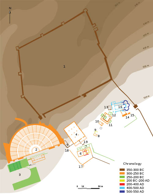
Plan of Dodona, from Wikipedia
Legend:
1: Acropole 2: Theater 3: Stadium 4: Bouleuterion 5: House of priests
6 and 7: Prytaneum and extension 8: Temple of Aphrodite 9: Roman
building 10: Temple of Themis 11: “Crowned House” (Ἱερά
Οἰκία) 12 and 13: New and old temple of Dione 14 and 15: temple
and altar of Heracles 16: Christian basilica 17: West wall 18 and 19:
New and old West gate
All features are clearly seen from outer
space on the GE Map.
Though the earliest inscriptions at the site date to ca. 550–500 BC, archaeological excavations over more than a century have recovered artifacts as early as the Mycenaean era. Archaeologists have also found Illyrian dedications and objects that were received by the oracle during the 7th century BC. Until 650 BC, Dodona was a religious and oracular centre mainly for northern tribes: only after 650 BC did it become important for the southern tribes
At Dodona, Zeus was worshipped as "Zeus Naios" or "Naos" (god of the spring cf. Naiads) — there was a spring below the oak in the temenos or sanctuary — and "Zeus Bouleus" (Counsellor). Originally an oracle of the Mother Goddess, the oracle was shared by Dione (whose name, like "Zeus," simply means "deity") and Zeus. Many dedicatory inscriptions recovered from the site mention both "Dione" and "Zeus Naios". Elsewhere in Classical Greece, Dione was relegated to a minor role by classical times, being made into an aspect of Zeus's more usual consort, Hera, but never at Dodona. Not until the 4th century BC, was a small stone temple to Zeus added to the site.
In c. 290 BC King Pyrrhus made Dodona the religious capital of his domain and beautified it by implementing a series of construction projects (i.e. grandly rebuilt the Temple of Zeus, developed many other buildings, added a festival featuring athletic games, musical contests, and drama enacted in a theatre). A wall was built around the oracle itself and the holy tree, as well as temples to Heracles and Dione.
From Wikipedia
Archea
Kalydonia**
7th- 1st cent BC
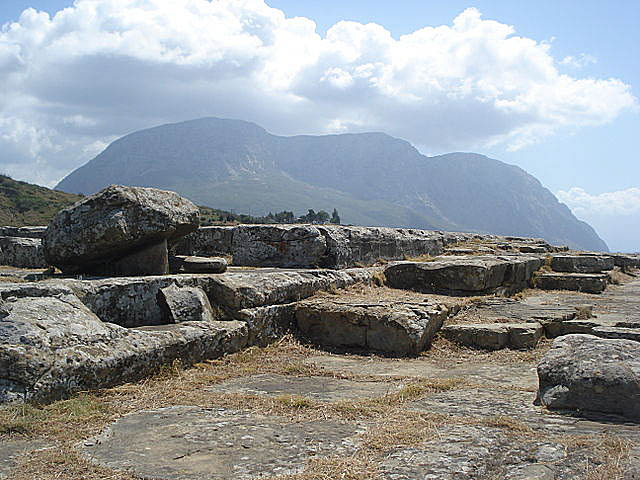
Acropolis of Kalydonia with Mt. Varasova in the background
Calydon (Greek: Καλυδών; gen.: Καλυδῶνος) was an ancient Greek city in Aetolia, situated on the west bank of the river Evenus. According to Greek mythology, the city took its name from its founder Calydon, son of Aetolus.
The Laphrion sanctuary was one of the most important Aetolian
sanctuaries, dedicated to the cult of Apollo and Artemis and lies to
the southwest of the Calydon acropolis enclosed by a circuit wall.
The site dates to the Geometric period, flourished in the 6th century
B.C and remained in use until the Roman period. The first temple was
built at the end of the 7th century BC and the last in 360 BC. Only
the foundations of the Temple of Artemis Laphriaare are preserved on
the summit of the precinct. The remains of a two-storeyed Stoa,
located in the north part of the precinct, dates from the 3rd-2nd
century BC. The site was identified in 1908 and excavations took
place in the 1920s and 1930. The 4th Century temple measured 32
Meters by 14 Meters and had 13 by 6 Columns.
Photo and Text
Wikipedia
Ancient
Elea (Thesprotia)*
5th cent BC

Megalithic walls, Panoramio
A large site high in the mountains south of Parmythia east of Igoumenitsa. Elea (today's Veliani-Chrysavgi) It identifies with the ruins of an ancient settlement south of Paramythia, east of Chrysavgi. It is about the most important settlement of Eleatida, that is the region between the Necromance and Paramythia, where the tribe of the Eleatean Thesprotoi lived. Fore some decades after its foundation (mid 4 century BC), it was the capital city of Thesprotia and the seat of the "Koino of Thesprotoi"
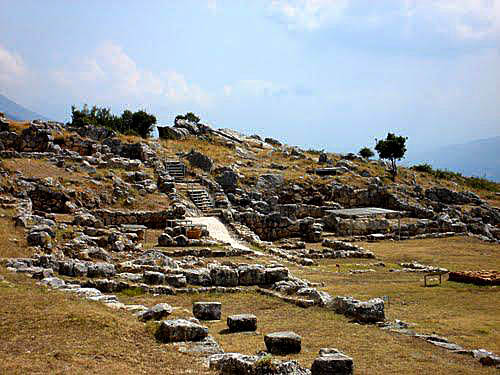
The construction of the walls and the gate at the NE/E side, is
megalithic. The thickness of its wall is over 4,5m and its height is
over 6m, even today. At the theater, a few seats and the ruins of the
walls of the stage survive in place. The large diameter of the hollow
was 45-50m, its height 8-9m and it had a capacity of 3-4 000
spectators.
From GTP
Nekromanteion*
not
earlier than 4th cent – 167 BC

The "Nekromanteion" in moon light, Photo Grigoris/Panoramio
According to Herodotus, the ritual use of the Necromanteion involved
elaborate ceremonies wherein celebrants seeking to speak to the dead
would start by gathering in the ziggurat-like temple and consuming a
meal of broad beans, pork, barley bread, oysters, and a narcotic
compound.
Following a cleansing ceremony and the sacrifice of
sheep, the faithful would descend through a chthonic series of
meandric corridors leaving offerings as they passed through a number
of iron gates. The nekyomanteia would pose a series of questions and
chant prayers and the celebrants would then witness the priest arise
from the floor and begin to fly about the temple through the use of
Aeorema-like theatrical cranes.
The Necromanteion functioned until 167 BC when it was looted and destroyed by the Romans.
However, the ruins at this location may just have fooled the excavators: The archaeological site, discovered in 1958 and excavated during 1958-64 and 1976-77, was identified as the Necromanteion by archaeologist Sotirios Dakaris based on its geographical location and its similarities to descriptions found in Herodotus and Homer. However, its topographical situation on a hill commanding the immediate neighbourhood does not fit this interpretation, and the ruins are now dated to no earlier than the late 4th century BC.
It is now accepted that the site was a fortified farmhouse of a sort
common in the Hellenistic period. Besides quantities of household
ceramics, the site produced agricultural tools and weaponry,
including Roman pila from the final destruction of the site by the
Romans in 167 BC. Most surprising of all were 21 washers (the
distinctive bronze modioli) from at least seven different catapults,
which Dakaris had mistakenly identified as components from a
crane....
Wikipedia
Kassopi**
4th-
2nd cent BC

Cornelius and the children in Kassiopi Panoramio
Fabulous
view of the Ionian Sea and Islands and a monument by Georgos
Zongolopoulos to the women of Soulis (1803) near by.
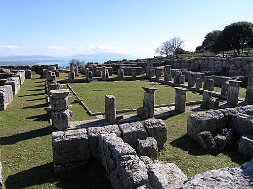
The city square.
A first settlement on this site is known from the Paleolithic,
however the prominent city of Cassope was founded in the middle of
the 4th century BC and served as the capital of the Cassopaeans, a
sub-tribe of the Thesprotians. It belonged to the Aetolian League. It
flourished in the 3rd century BC, when large public buildings were
built. Cassope also minted its own coins. It was destroyed by Roman
forces in 177-176 BC. Cassope was abandoned in 31 B.C. when the
remaining inhabitants resettled to Nikopolis.
Wikipedia
Stratos,
Temple of Zeus
4th - 2nd cent
BC
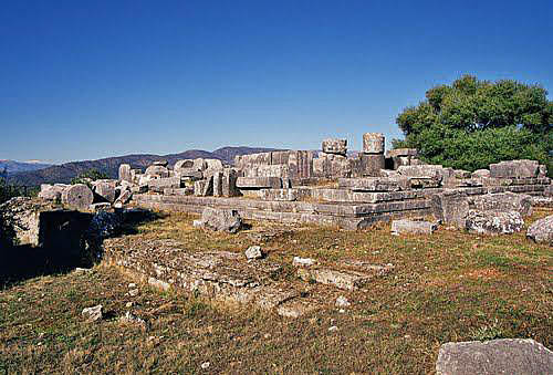
Temple of Zeus, 321 BC Panoramio
The Stratos temple dedicated to Zeus Stratios stands on the top of a fortified hill at the northwest end of the city, the ancient capital of the Acarnanians. It was hexastyle, built in the Doric order, with Corinthian columns in the cell, an unusual combination of architectural styles. The construction of the temple began in 321 BCE, but it was never finished, probably due to fights against the Aetolians. Excavations began at the beginning of the 20th Century and are still in progress. The temple measured 32 Meters by 17 Meters which had 11 by 6 Columns.
Stratos, Theater
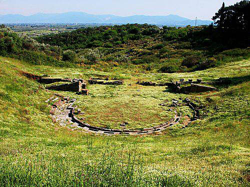
The theater in Spring, 2nd cent BC, Panoramio
Text: Wikipedia
Orraon
370-
1st cent BC
16 km north of Aarta
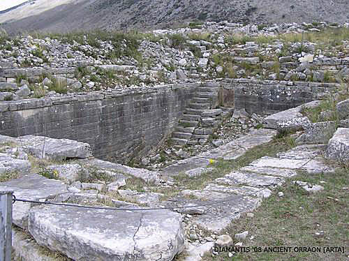
Ancient Orraon was founded and fortified around 370 BC, by Alketas, the king of the Molossoi. The settlement was destroyed by the Romans in 167 BC, subsequently rebuilt and was finally abandoned by its inhabitants in 31 BC. Photo Panoramio
Arta,
Panaghia Parigoritissa*
14th cent AD
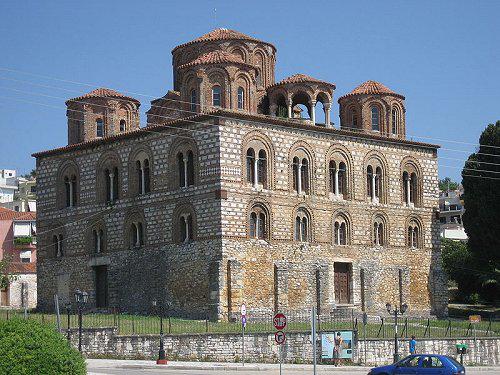
The Byzantine church, greece-travelguide
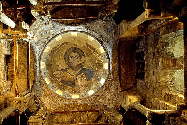
Pantocrator, Mosaic in the dome, Vanni/corbisimages