Maps
Click on the maps to enlarge them.
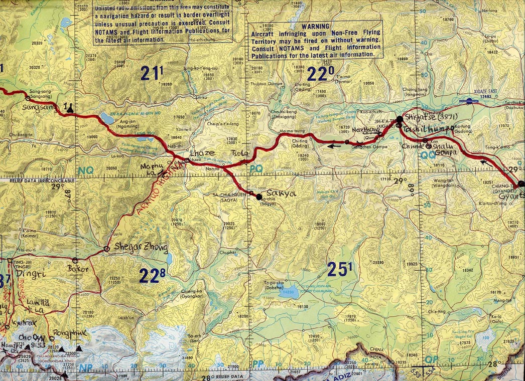
You will not find detailed maps of Tibet. The first one I drew, the others are US Air Navigational Maps (1:1000'000) which Cornelius and I "doctored" over many months to show all necessary details for our trip. They are unique and cannot be found anywhere.
Note: all places have several names, Tibetan, Tibetan translated into Chinese Pinyin, Chinese, and occasionally European. The "roads" are best guesses, the elevations in feet and meters, mostly from Sven Hedin's expedition maps, are accurate.
|
|
Map 1. Present-Day Autonomous Tibet.
|
|
Map 2. Lhasa, Ganden, Samye, Yamdrok Tso, Gyantse, and Shigatse
|
|
Map 3. Shigatse, Sakya, Sangsang
|
|
Map 4. Sangsang, Saga, Zhongba
|
|
Map 5. Zhongba to Mayum La
|
|
Map 6. The Sacred Lakes, Kailas, and Burang
|
|
Map 7. The Kailas Korla
|
|
Map 8. The Escape: Pelko Tso, Yarle Chung La, Nyalam, Zhangmu and Kathmandu