
|
Peleponnisos Bassai Olympia Mystras the Lousios Gorge and the Mani |
.
Google-Earth kmz-map The Mani 1991
Google-Earth kmz-map of our trip in 1991
Google-Earth kmz-map Mystras 1991
Arkadia
|
|
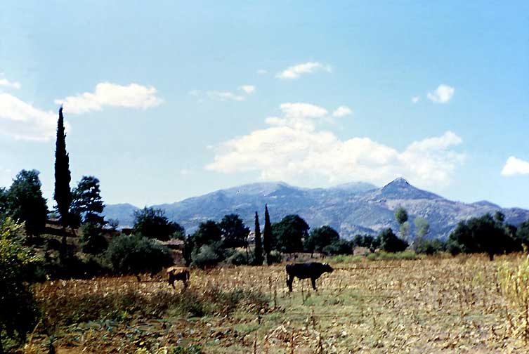
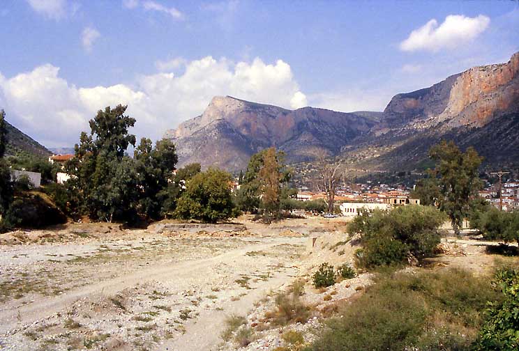
The plain of Megalopolis seen from Karytena (1953). In 1953 my brother Gerhard and I walked along the Alpheios valley through Arkadia from Megalopolis to Olympia. The main attraction was the temple of Bassai high in the mountains of Arkadia. Barbara and I explored the old route in 1991 as my 60th birthday celebration with a rental car.
The blue river is the Alpheios, the circular fields in the foreground are threshing grounds. Megalopolis is out of sight in the distance, the road is seen in the foreground. In 1953 the Megalopolis plain was an idyllic, rural area.
|
|
Notwithstanding the fierce bull we had lunch on this field near Karytena. (1953)
.
|
|
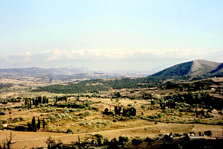
From Karytena (1953). The valley in the midle distance has now been scraped into an open lignite pit. The coal is converted into electricity in a power station the huge chimney of which would be just out of the picture to the right - were it not for the smog it lays across the landscape for miles....
|
|
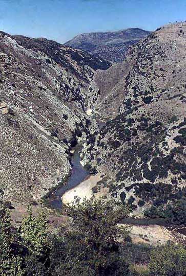
The Alpheios gorge below Karytena (1953). On our visit in 1991 we found that once pretty Karytena with its Villardouhin-castle had become a windblown ghost town. A cardbord sign in one window offered "Room for Rent". For a moment I considered to stay - a crazy temptation - but we drove on to Andritsena....
|
|
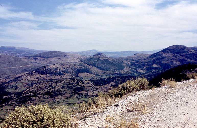
The Road to Andritsena (1953). Karytena is seen spread around its crusader castle on the conical hill in the distant center. In 1953 we walked this road for almost two days. Today it is asphalted. You reach Andritsena much too fast - the country is beautiful once you get far enough away from the power station.
Besides a tourist hotel there is only a very simple Xenodochion run by the owner of the gas pump in Andritsena. Andritsena was a vibrant market place in 1953. It has fallen asleep and lives mostly of the few tourists. Bassai is a strenous day's hike south of here, if you don't have a car you need to reserve the only taxi in town for the next day.
.
Bassai
|
|
View south from Bassai (1953). Pausanias describes the temple and its surrounding mountains, the old spring, Mount Kotillon. - Not much has changed. The road is carefully hidden. Tourists are few, the site is as lonely as one can find. And still as powerful as in Pausanias' time. We slept in the southern antis in 1953. In the morning a shepherd's girl brought us a bowl of fresh sheep's milk as a present for the Xenoi, guests and strangers, the same word. -
In the gap of the mountains you can see the jagged line of the Tayegetos. The huge block on the right is Mt. Ithome in Messeni, and the sea defines the horizon.
|
|
The Temple of Apollo Epikouros, the "Saviour" at Bassai (1953). Built by Ikthinos, the famous architect of the Parthenon and the Telesterion at Eleusis, it is full of mysteries: the orientation, the placement of the image, a first single, non-structural Korinthian column in Greek architecture, the name Epikouros connected to a story of a plague that never was, the fact that in antiquity as today the nearest place of habitation was a day's walk away - and there were wild wolves around... As usual all this information originates with Pausanias who visited Arkadia nearly 600 years after the temple was built. It was already partly in ruins. The Apollo image had been moved to the market square of Megalopolis. - Pausanias shudders, the frightening Goddess, who held sway in these mountains, had not been appeased by this Apollo temple - she still demanded human sacrifices - young men..... in the 2nd century AD!
Fascinated by these myths and misinterpretations and the brilliant but strange architectural quirks of this building, I made an attempt to write down what I know. (On the Way to Arcadia).
|
|
Two columns in the southern antis of the temple framing the Tayegetos in the distance.
.
|
|
To the West the Ionian sea appears in the morning. Both seas seen from this truly land-locked place in Greece! (1953)
.
|
|
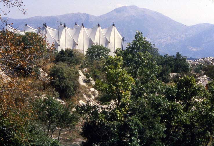
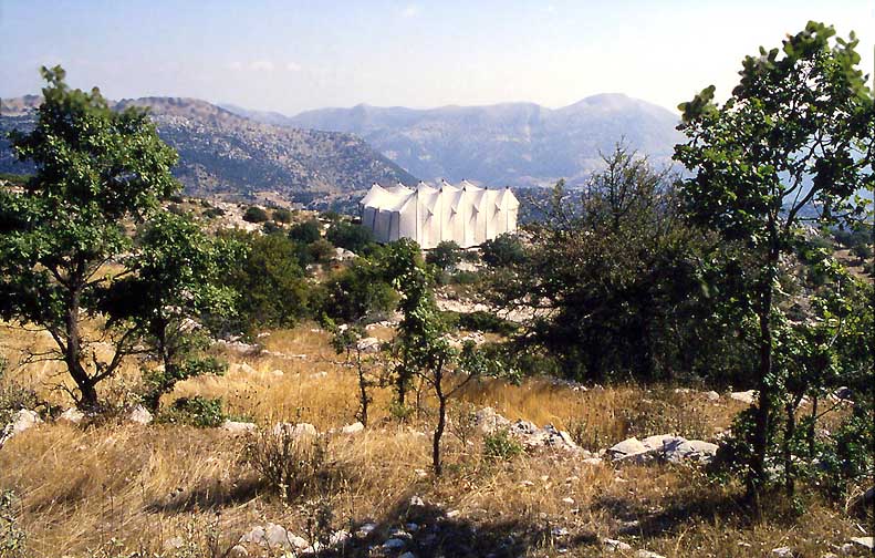
Well, in 1991 Barbara and I stayed in Andritsena and drove to Bassai early in the morning. I was very excited. Where would we first see the temple from 40-years of my dreams? It remained hidden until the moment we walked around a last rock from the parking lot and found ourselves face to face with this surrealist sculpture! - At first I thought it was an ultra-modern, ecology-minded Hilton Hotel...
|
|
.But no, under the tent hid the temple .... braced in an erector set of steel tubes. An earthquake had nearly destroyed the structure, and a grant from the European Union now held it together: - Of course, the money ran out and the temple is, to my knowledge, still unrestored, hidden under this tent! (1991)
A Pan-European, Five-Mast Olympic Sail-Ship Run Aground in Arkadia.
What a wonderful idea, what a beautiful metaphor! Christo would have been proud had he invented this wrapping!
|
|
.The Tent of Apollo the Saviour
.
|
|
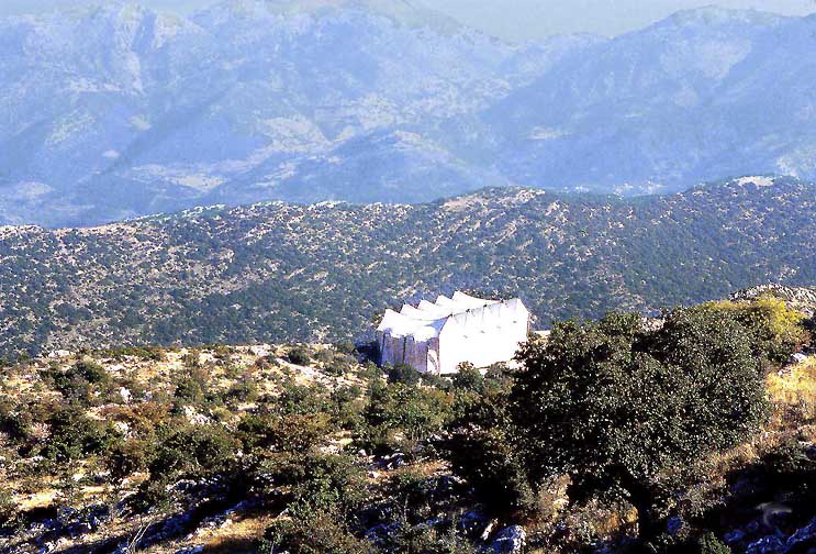
The mountain wilderness and the temple tent seen from Mt. Kotilon. (1991). According to Pausanias there was a small, much older Aphrodite-Artemis temple on modest Mount Kotilon, a hundred meter above the Apollo temple. In search of it we scrambled up the hillside.
|
|
And found its foundations and its altar plate. It lies in a perfect megaron (certainly no accident), and is also directed south (not east). The sight-line of Ikthinos' Apollo Temple and this older one meet on Mt Ithome in Messenia - where there was another powerful sanctuary of the Great Female Trinity.
|
. |
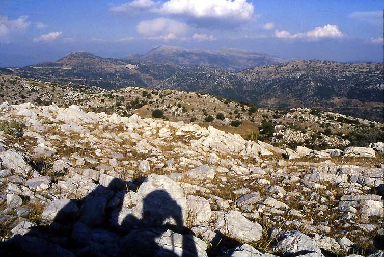
The view east from Mt. Kotilon is bounded by Mt. Lykaios, where Zeus had a sacrificial altar, which yielded archeological evidence of at least animal, but possibly also human "red" sacrifices... - In the Apollo temple there is a special door to the east, through which the venerable Apollo image had visual contact with Zeus Lykaios..... The power of the Female Trinity must have been disturbing - and Pausanias leaves not doubt of that.
|
|
Now that the goat herds, these scourges of the Mediterranean landscape, have all but vanished, the land begins to recover from centuries of exploitation. The mythical Arcadian oak groves are increasing again, and Gea, what irony of our progress, appears new and lovely dressed like a young bride - even in late September
.
Olympia
|
|
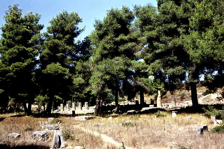
Hera termple at Olympia in September 1953. Overgrown with pine trees Curtius', Furtwängler's, and uncle Dörpfeld's excavations in the altis have become one of the loveliest archeological sites in Greece.
|
|
.The two columns of Hera's temple. Alone the smell of the pines in the hot afternoon will follow you forever.
.
.
The Lousios Gorge
|
|
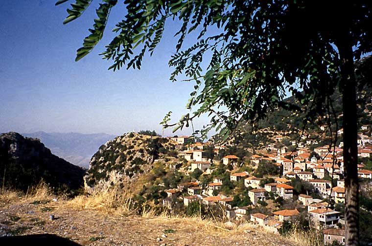
Below the lovely, proud village of Ypsous or Stamnitza (its Balkanic name), north of Karytena the gorge of the river Lousios cuts through the mountains.
.
|
|
The deep scar of trhe Lousios through the limestone formations. Difficult to reach its three monasteries were one of the breeding places of the national Greek uprising against the Turks in second half of the 19th century.
|
|
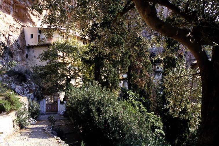
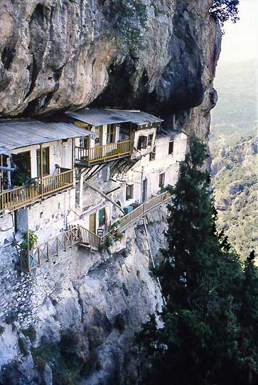
Accessible by a winding dirt road a few kilometers northwest of Ypsous is the Moni of Agios Ioannis Prodromou.
.
|
|
The World will end very soon and Christ will come to take us to heaven! Why have a permanent abode? Cells hanging over the precipice at Ag. Ioannis Prodromou.
.
|
|
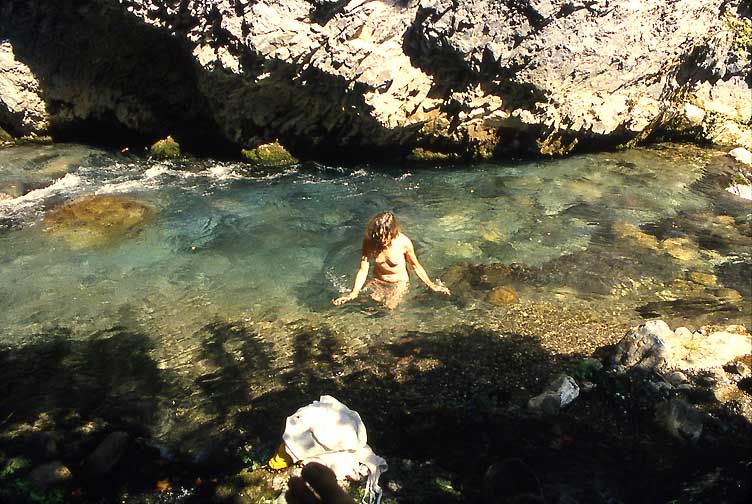
Barbara taking a bath in the frigid waters of the Lousios while I, sitting in the millenia-old karst cave of the local river nymph, expect Zeus the Swan to swoop down on her any minute. Pausanias calls the Lousios the coldest river in Greece that is not fed by snow melt. He may well be right.
.
|
|
Leonidion on the eastern coast of the Peleponnissos. We drove down the coast from Epidavros to Leonidion and from there across the mountains to Sparta. A beautiful drive with very few tourists.
.
|
|
.In the mountains above Leonidion hangs a nunnery on a montain side, Eloni, and a few kilometers further you pass the beguiling village of Kosmas - where I would one day like to stay for a couple of days. - Eventually you get to Geraki and Sparti.
.
Mystras
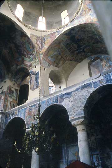
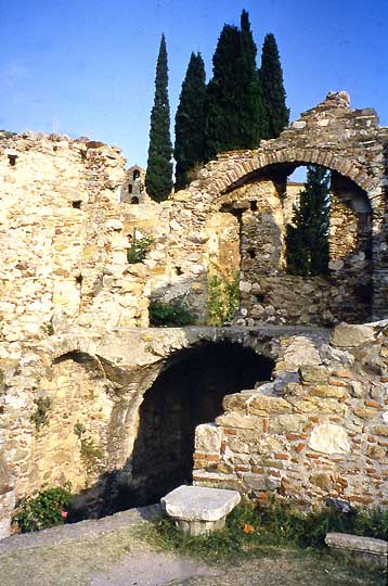
The Spartans have left us almost nothing to remember them by besides their famous austerity. To the south of Sparti are two minor archeological sites: the Menelaion and Amyklai. - However the place to spend at least a day near Sparti is Mystras. A steep hill crowned by a Frankish Crusaders' castle and the Byzantine churches and monasteries of the last capital of the Byzantine Empire. - Here Goethe's Faust met Helena (Faust II)
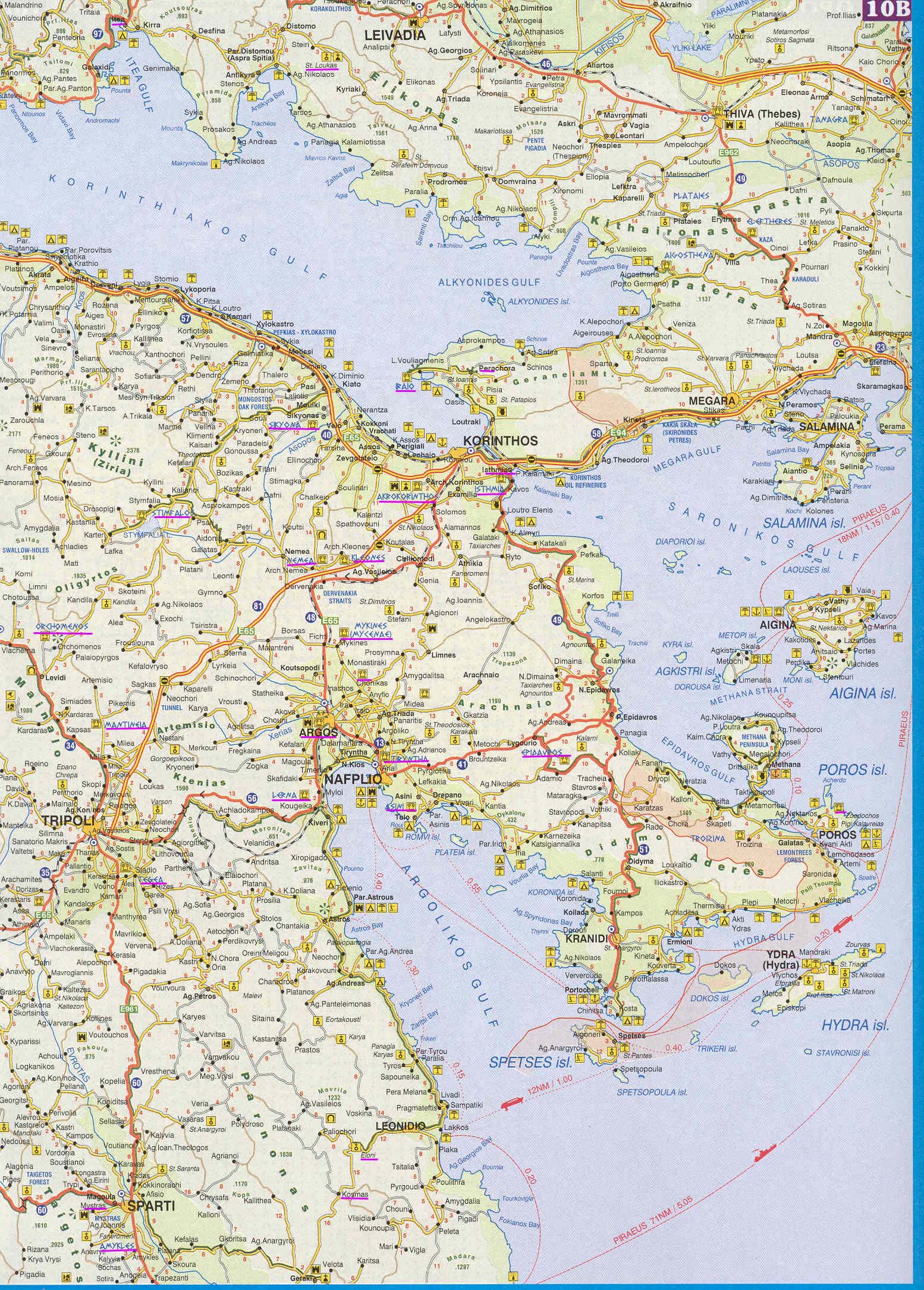
.Click here for a Map of Mystras
|
|
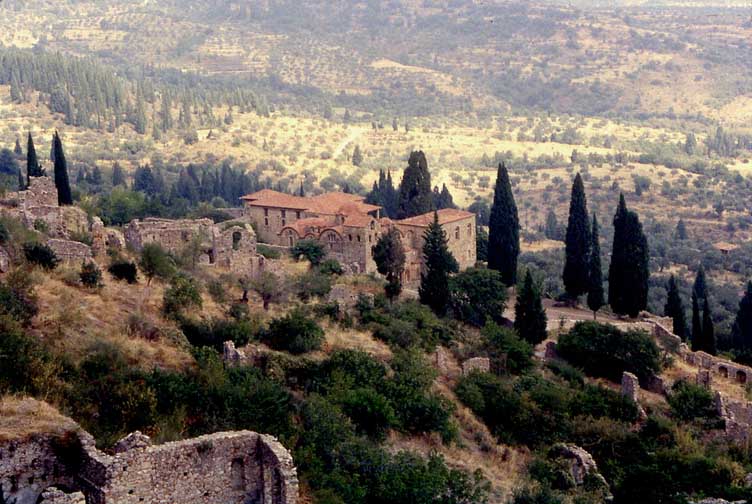
Marmara(?) Fountain and the hill of Mistras with its Villehardouin Castle, the Pantanassa Monastery on the left, and the Palace of the Despotes on the upper right.
.
|
|
The Eurotas Valley seen from the path to the Pantanassa, the Mitropolis and the Bishop's House (Museum) in the foregrond
.
|
|
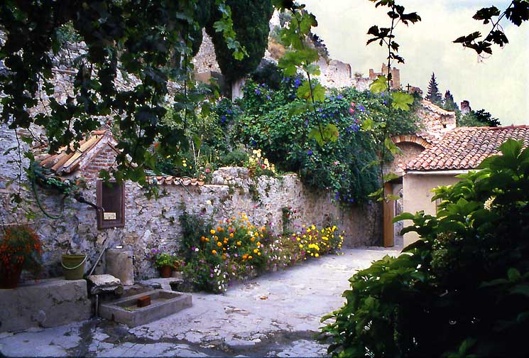
Pantanassa, the fountain and the garden of the nuns.
.
|
|
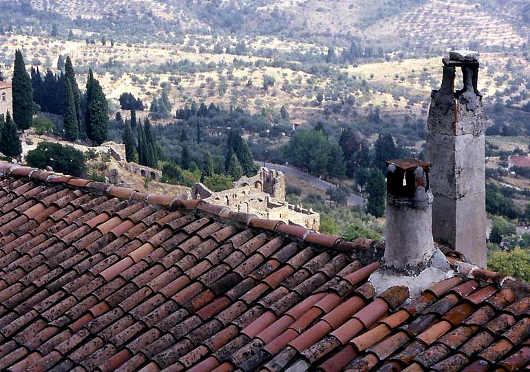
Pantanassa. View into the valley across the roof and chimneys of the nuns.
.
|
|
.The Mitropolis (1309, but with earlier precursers). Coronation church of the last Byzantine Emperors (Katakousinos, Paleologoi)
|
|
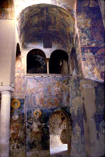
The Perivleptos (Outside the Walls) Monastery is partrially inside the mountain. Built in the middle of the 14th cent, it has some of the most beautiful frescoes in Mystras. The belltower is an addition from the 15th cent.
.
|
|
.Perivleptos 14th century
.
|
|
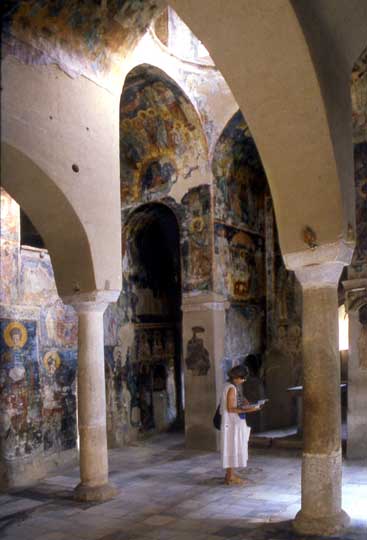
Barbara in the Perivleptos. The frescoes are from the 15th cent. Renovated in the 1980s.
.
|
|
Frescoes in the Perivleptos
.
|
|
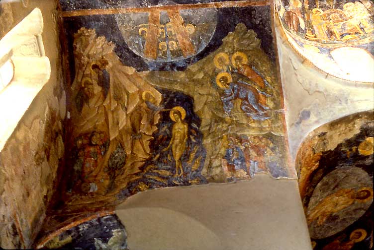
Pantanassa(?), best frescoes of the 15th cent. related to the later Cretan school: Christ's Baprtism, lower left Metamorphosis,
. .
|
|
.Pantanassa(?) (same as above) continuation to the right: top left: Baptism, next to it : Nativity, the center I cannot read.
.
|
|
Pantanassa(?), top right Metamorphosis, below center Last supper(!), center left Entry into Jerusalem, below Sermon on the Mount(?), 15th century
.
|
|
.Mitropolis (?) early 14th cent
|
|
.Upper entry (?)
The Mani
Click here for Map of the Mani
An internet search has turned up a new, ultimate site for the Mani : John Chapman, Mani A Guide
|
|
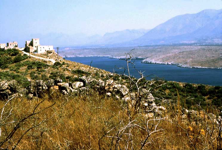
Ag. Kyriaki near Mezapos. From here one reaches two of the hottest and most romantic spots in Greece: Agitria and Tigani. Agitria is a tiny church literally glued to a vertical wall above the sea with a stupendous view and murals from the 13th and 19th century. And Tigani is a mysterious castle and a settlement (est. 600 souls, nobody can tell whether from the 9th or the 15th century!)) on the tip of a fantastic panhandle-peninsula. Cornelius and I walked there and nearly lost each other in the stalacmites and salt ponds along the access path. Take plenty of water along, there is not a drop.
|
|
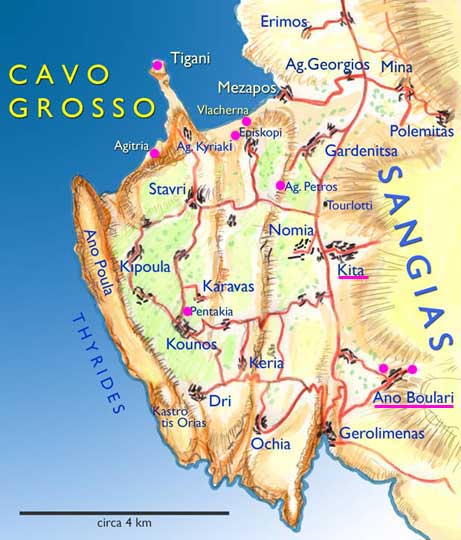
Map of the Cavo Grosso from Chapman, Mani, showing Mezapos, Agitria, Ag. Kyriaki, and the Tigani peninsula - and in the south Ano Boutari with its 2 early churches near Gerolimenas. Gerolimenas boasts a couple of spartan "hotels", water is measured by the bucket..... Kita is one of the best preserved examples of the tower villages (like Tuscany) of the Mani..
|
|
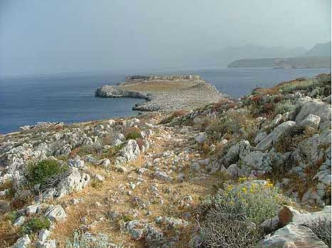
The Tigani peninsula from Agitria (Chapman photo)
.
|
|
The path Cornelius and I walked down to Tigani from Ag. Kiriaki in 1985. (Photo from Chapman)
.
|
|
The tower village of Kitta at the foot of the Sangias Mountains.
.
|
|
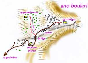
Ano Boulari is a short distance east of Gerolimenas. It is well known for two very early churches
.
|
|
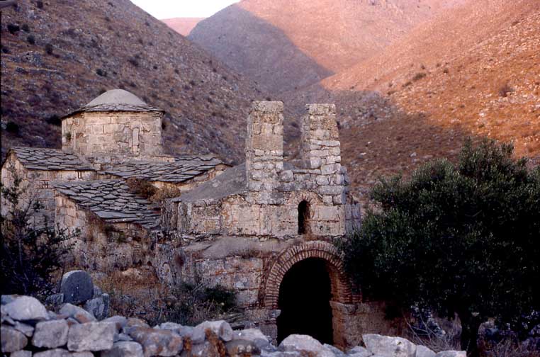
Ano Boulari, Aghios Stratigos (St. Michael), early 11th cent with with extensive and interesting murals but so dark that Cornelius refused to enter it for fear of snakes. Bring a powerful flashlight. It is now locked and the key is found with elusive Dimitris Kolokouris in Aeropolis (!) (tel. 0733 052953) (2004).
|
|
Ano Boulari, Ag. Panteleimon Map and Photos by Chapman, Mani |
|
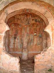
Ano Boulari, There is a second, much older, better preseved church which has no door in Ano Boulari : Ag. Panteleimon, which is hard to find (we didn't find it), but well worth the search. Return to the bridge. Just uphill of the bridge walk north (left) on top of a low, cement-topped wall for a kilometer or so (a distance commensurate to that to Ag. Stratigos from the bridge. See Chapman's sketch map ) This highly exciting church and murals are probably from the 8th or 9th cent.
|
|
Ano Boulari from the road to Gerolimenas in the evening light
.
|
|
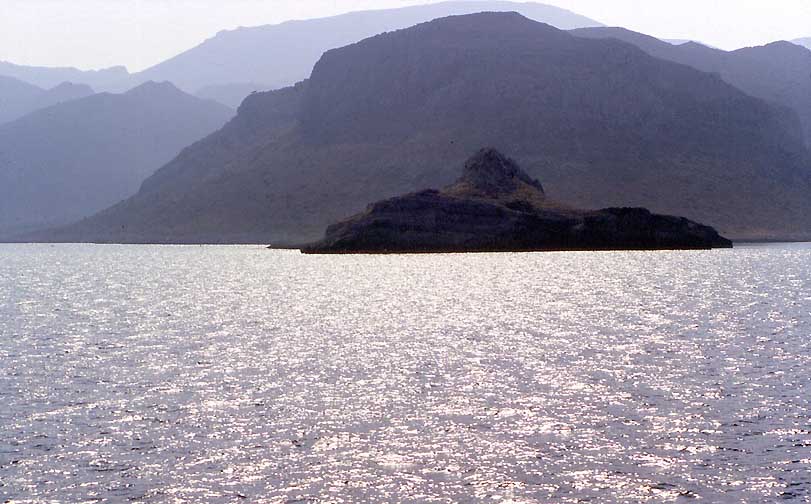
The eastern coast of the Peleponnissos from the boat we took from Piraevs to Gythion in 1985.


