
|
2000 Miles Through the Indian Country
To Denver and Back October 2006 |
.
|
|
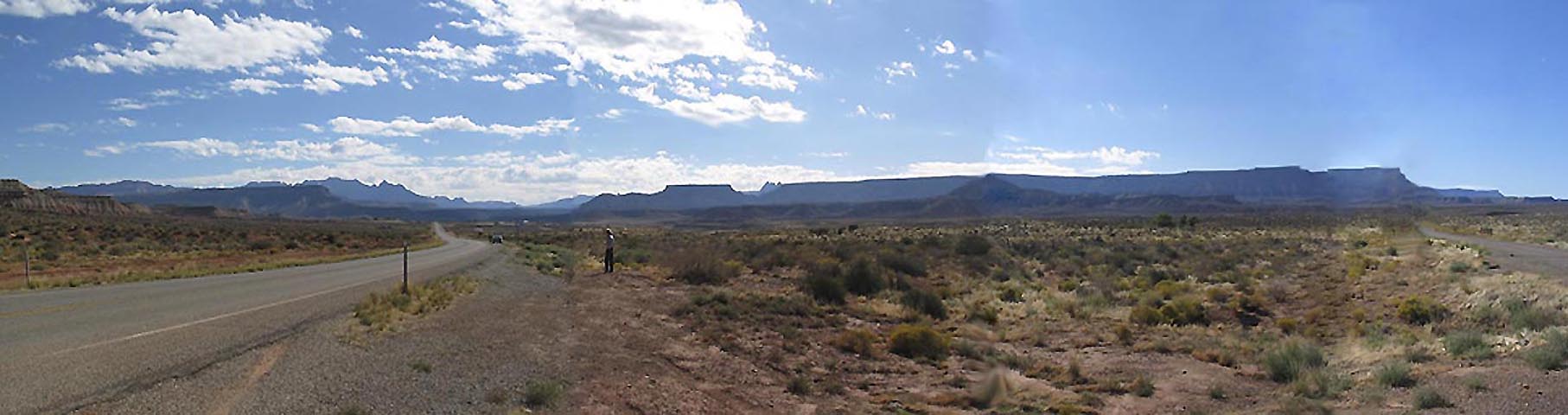
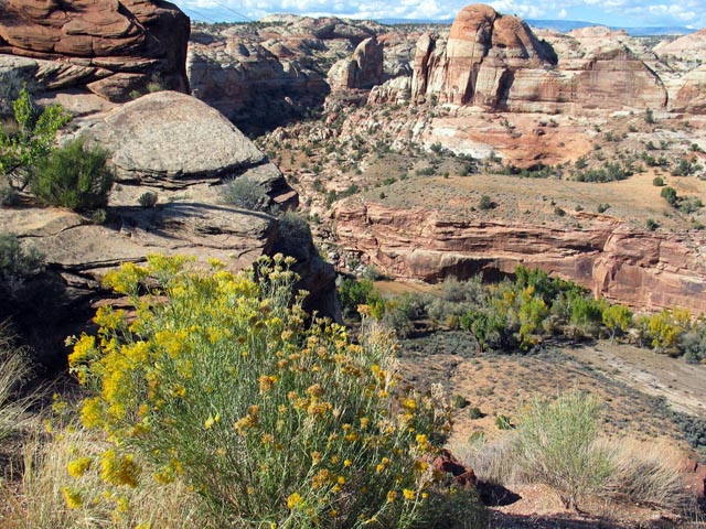
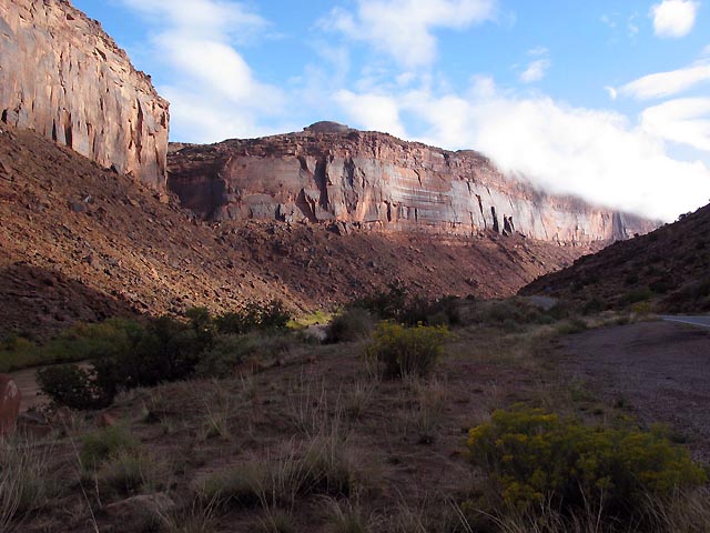
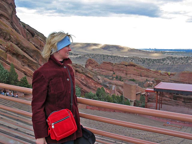
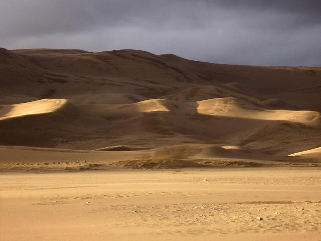
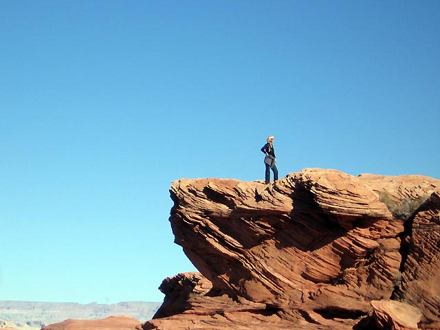
Marsh Pass and the road into Monument Valley
Click here for Map (1.2 Mby)
This long trip fulfilled Barbara's old wish to show me the Southwest where she had spent twenty years guiding German tour groups and friends: Margit May from München and Jutta Micheuz from Austria. I had visited this area last in 1984 with her, three German children, and Cornelius. Many places she knew I had never seen. In addition, in March 2006 Susanne and John had, after 12 years in Atlanta, moved back to Denver, and bought a new house. They expected Marc and Monique from Holland, long standing friends of Cornelius and us. We decided that we would take the two back to Los Angeles and see the Indian Country on our way. As it turned out Marc had been to most places there and wanted to see some we had not even heard of! So, I designed the return trip following his wishes: Great Sand Dunes, Chaco Canyon, Antelope Canyon near Page, and the Hualapai Lodge in Pear Springs near Flagstaff.
Barbara drove the entire way to Denver through Nevada, Utah, and Colorado, north of the Grand Canyon : Zion National Park, Escalante, Arches, the Upper Colorado River Valley, and the Rocky Mountains. Often she seemed to be absent, hanging after her memories and seeing ghosts I could not see: Margit painting, and Jutta swimming hour-long laps in the motels' swimming pools. Or a night spent in a hospital at the bedside of an older German tourist who had collapsed from the altitude.
The weather was mostly splendid, the aspens and willows golden - except to Barbara's great chagrin a frost had already killed the Fall foilage above 2000 m in the Escalante.
I hope that these photos will give you an inkling of the vast emptiness and beauty of this country.
On the first day we drove some 400 miles from Los Angeles to St. George, Utah, one of the oldest, loveliest, newly spruced-up towns of Mormony. We by-passed all places along the road (Barstow, Baker, and Las Vegas) and had only a lunch break in a gaudy casino in Primm at the Nevada Stateline.
Next morning we set out early. Puffs of clouds sailing on a blue sky. Near Hurrican, Utah we turned off Interstate 15 into smaller and smaller roads : UT9 through Zion, US89 passing Bryce Canyon, and UT12 through the Grand Staircase-Escalante National Monument.
.
Zion National Park
|
|
Click on the image to enlarge
The wide horizon and the mountains of Zion in the background at the turn-off of UT9 from I15. Gray-brown desert shrubs as far as the eye can see. Barbara is seen standing by the road photgraphing a rock formation, left out of my picture.
.
|
|
For a while the road follows the Zion river: a few forgotten villages populated by diligent Mormon farmers. Somewhere near here we once took a swim in the river with little Susanne on our way to Julia's island in Upper Michigan.
.
|
|
Click on the image to enlarge
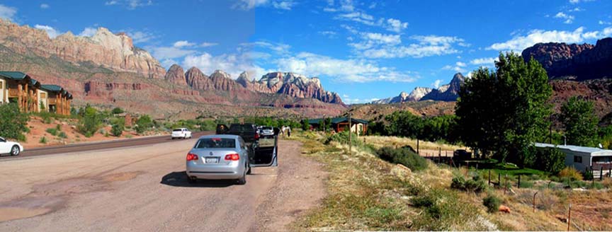
Our car at the entrance to Zion National Park. This was our first long tour with the new VW Jetta 2.5 -2006, the most comfortable and quiet car we ever owned.
.
|
|
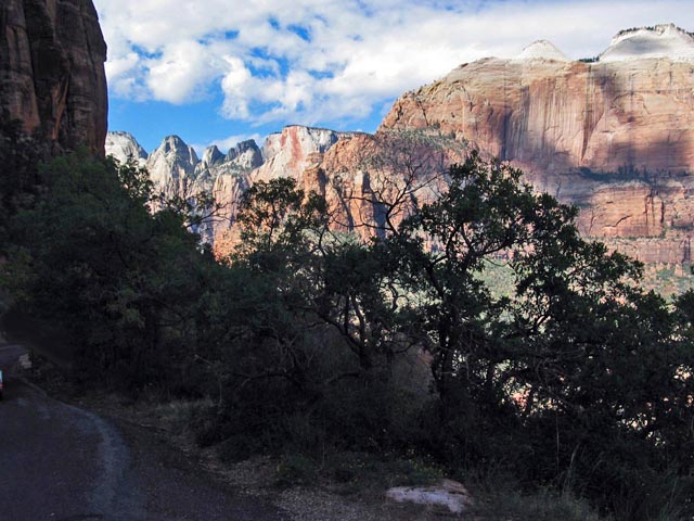
The road winds through the formidable red-gray-white granit rock domes of Zion to soon disppear in a tunnel.
..
|
|
Red rocks in the eastern part of Zion border a grassy plateau in which hides Brice Canyon and the Escalante.
.
|
|
The road follows the northern border of the Escalante which is cut by the modest canyon of the Escalante River.
.
|
|
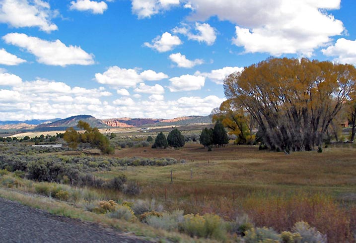
A willow tree in the Escalante River Valley. Between the valleys the road climbs to nearly 3000 meters. Ponderosa pines mixed with large, now bare aspen stands grow around 2000 m. Edless curves. From the pass one has a sweeping view. In the early evening we reached the small town of Torrey.
.
|
|
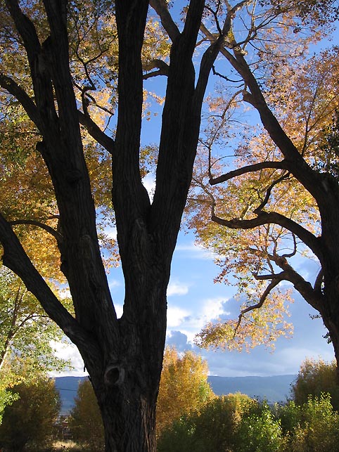
Torrey, Utah. Big yellow beech trees shade the secluded motel in wich Barbara had stayed with Jutta. On the western horizon brewed a storm which would overtake us next afternoon.
Arches National Park
|
|
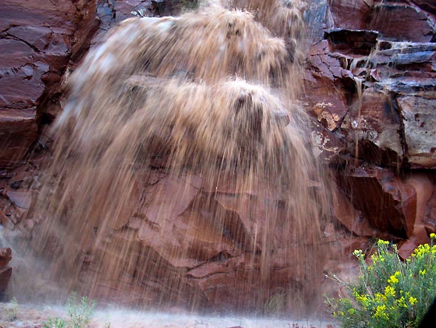
We found a cheap motel in the forlorn Mormon town of Moab at the entrance to Arches National Park. Late in the afternoon we drove into the park. It poured. A myriad of waterfalls cascaded reddish-brown across the road.
..
|
|
A spooky cascade by the road.
.
|
|
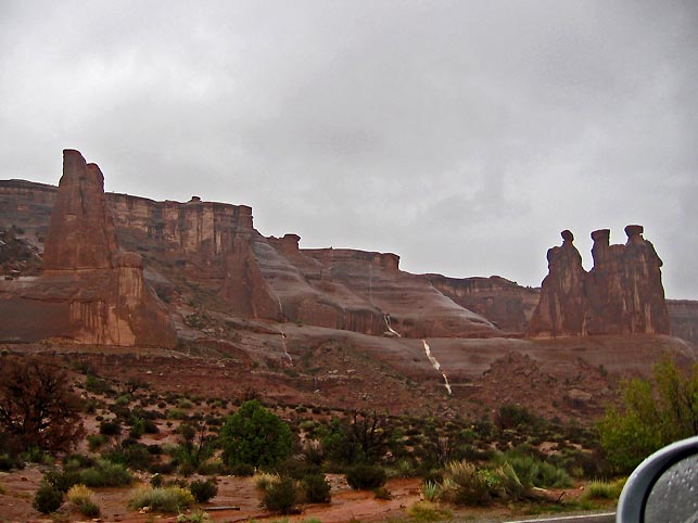
At the end of the road the rain let up. We found ourselves surrounded by ominous rock formations which resembled giant people, sculpture galleries, and fairy castles.
.
|
|
The view northwest from the end of the road.
Upper Colorado River Valley
|
|
Barbara knew a "secret" road, UT128, which curves northeast around Arches Park. It follows the upper Colorado River Valley. A few clouds remained from the storm of last night. Fog hung in the rocks.
.
|
|
.
|
|
..
|
|
Eventually the road joins I70. A few last red boulders mark the border of Utah and Colorado. From here a grassy plain extends to the foot of the Rockies. As the road climbed, still following the Colorado River, into the mountains behind Grand Junction it got noticably colder. We were following the tail of yesterday's strorm. The pass east of Vail is over 3000 m high. The temperature sank to below freezing and soon we found ourselves surrounded by drifting snowflakes. But Denver was only 50 miles further, a precipitous drop of 1500 m. Following John's instructions and maps we easily found their house in Denver-Lakewood. Kelly was the only one home.
Denver, Susanne's and John's House
|
|
Susanne, tired from a long day's work at Bed & Bath, wearing the pendant by Juschka's friend which Marga gave her.
. .
|
|
John and Susanne after dinner. John was relaxed and happy to be back in Colorado. He took us to Golden where he and his friend Rick have set up a well appointed photo studio. He and Rick are doing very well and had just returned from a boondoggle photo shoot in Bora Bora!
..
|
|
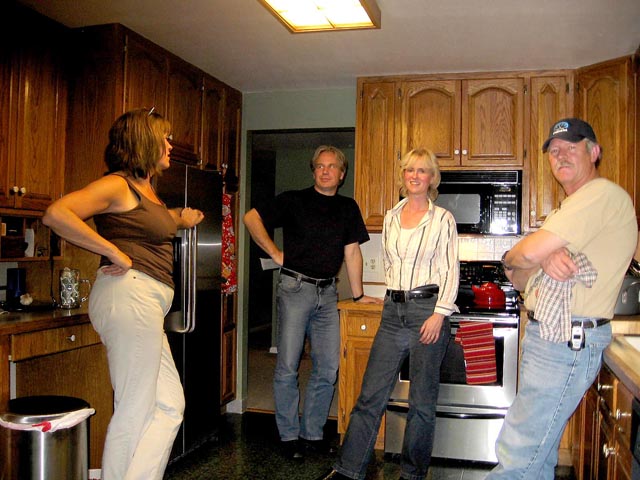
Two days later Marc (in the door) and Monique arrived. Susanne on the left and John doing the after dinner clean-up of their kitchen. I was pleasantly surprised by the house and its neighborhood. John's pictures from last spring had shown a much bleaker landscape. Of course, they had worked very hard for several months to renovate the interior and the garden.
..
|
|
The greatest pleasure and surprise was Kelly (15) who has emerged from a period of boredom and contrariness turned into a vibrant girl of infinite curiosity. She is taking German at school, and I had to teach her the rudiments of the Russian alphabet. Her German vocabulary was growing in jumps during the next five days. Marc and Monique, and Susanne speak German too. Here she seeks for her favorite songs on her laptop for Marc to approve of.
.
|
|
Kelly bright and smiling.
.
|
|
Monique, Barbara, and Marc at the dinner table. Kelly and Monique had endless giggling attacks over stories they could not describe.
..
|
|
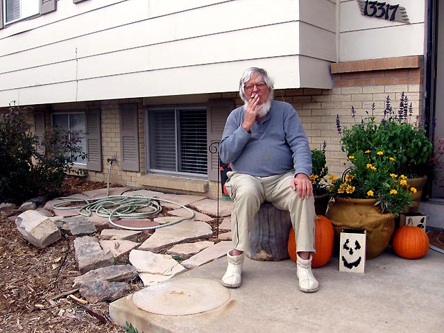
Grandpa would occasionally retire to a tree stump in front of the house for a smoke - half a cigarette at a time - because of the altitude.
.
Jeep Tour around Golden
|
|
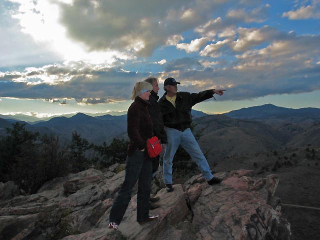
John had bought a brand-new fire-engine-red Jeep, open for the fun of it. Eager to show it off, he took us on a ride - on perfectly good roads - through the hills above Golden. Here he shows Marc and Monique the sights of Golden from a promontary above town - Coors' Brewery, the School of Mines, and his studio.
.
|
|
Monique looking out over the arena of the nearby amphitheater where famous rock bands perform in summer. John and Marc share an ardent enthusiasm into rock music.
.
Cultural Highlights of Denver
|
|
The newest cultural monument of Denver is an extension designed by Libeskind to the castle-like Denver Museum of Art. Barbara, eager to see contemporary art, had inspected it with Susanne a few days earlier. She was impressed by the stainless-steel cladded building: a grand architectural sculpture. But the inside had disappointed her. The interior has no vertical walls and many irregular cubicles stuffed into the irregular shell. The architecture completely defeats the exhibited paintings. She took us there once more on Monday. The place was closed. I only looked into the foyer: a space barely twice my hight with three ticket window at the opposite wall. After the grand outside a claustrophobic entry hall? - That night I had dreams of ripping all exhibition cubicles out, hanging the paintings in free-space and installing a number of elevators, pullies, and balconies to move the visitors past the art - straight after Piranesi! - This was the one and only intellectual visit of our trip. A great disappointment. It is not easy to copy Gehry's soaring architectural fantasies.
.
|
|
Across the street this glass front of an office building stole my interest: reflecting the sky, clouds and sunspots.
.
From Denver to Great Sand Dunes National Monument
|
|
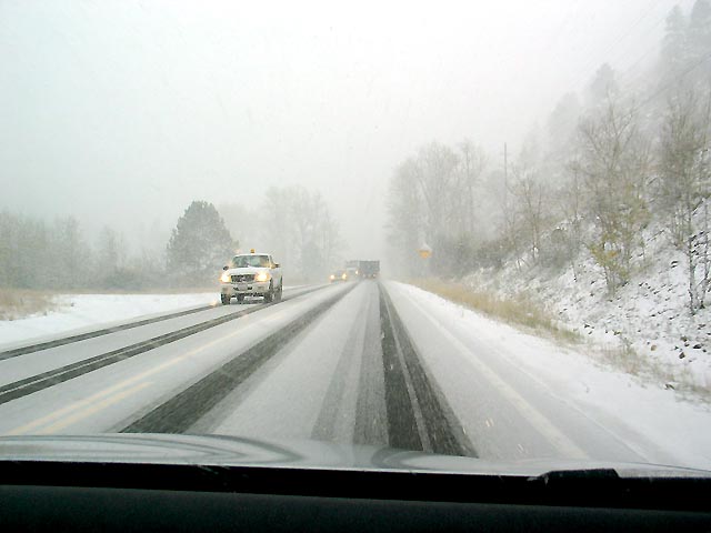
The four of us snugly tucked into our faithful Jetta set out from Denver on a cloudy morning. Soon we were back at 10'000 ft (3000 m) in a driving snowstorm! At 25 km/h Barbara gingerly followed a skidding pick-up truck south for a couple of hours. Afterwards the road (US285) dropped to 2000 m. It stopped snowing, but we remained at high altitude - three more passes above 3000 m - all day long, cold and variable weather.
.
|
|
Near Porich's Springs we were looking for warm place to have lunch - and found a small Thai(!) restaurant run by two sisters from Chang Mai who had followed American GI's to Colorado.
.
|
|
A delicious home-style Tom Ga Kai soup and spicy vegetable dishes restored out spirits.
.
Great Sand Dunes National Monument
|
|
We arrived at the Great San Dunes Lodge under heavy clouds late in the afternoon. A distinguished Indian gentlemen from Calutta received us - the owner! The room was nice and expensive. A congenial group of hunters in orange vests occupied three more rooms. I talked to them and soon appeared 4 stag patties prepared by their women. A wellcome addition to our supper. There was no resstaurant within 40 miles. I lay down to sleep and Barbara and M&M drove off to explore the dunes. The following pictures were taken by Barbara and Marc.
.
|
|
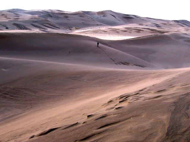
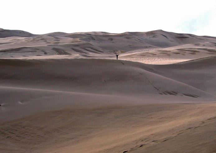
Marcus climbing the dunes....
.
|
|
...the victor.
.
|
|
Monique bundled up against the cold wind. We were again at 8000 ft (2400 m).
.
|
|
Barbara loved these struggling trees before the setting sun.
.
|
|
When I woke the scene was bathed in a golden light - for a couple of minutes. Before I could get my camera, it was over.
..
|
|
A fantastic sunset followed - seen from the lodge.
.
|
|
Clouds over the plain.
..
|
|
The dunes in the first light next morning.
That day Marc drove us through mountainous country to the indifferent town of Aztec where we stayed in a cosy motel with flowery wall paper and black lace curtains on the showers. On our way we stopped at Mark and Jenifer Forrest's house - Carolyn's brother - in Durango. Barbara and M&M got caught by a sleet and hail storm when they explored the old wild west town.
Aztec and its Ruins
|
|
In the morning Barbara led us to the "Aztec Ruins" at the edge of town. The ruins of a pre-Chaco Anasazi pueblo are misnamed for the Aztecs, who did not come that far north. Although later trade connections to Mexico must have exsisted.
...
|
|
M&M and Barbara at the edge of the large kiva - the ceremonial place of all these old pueblos.
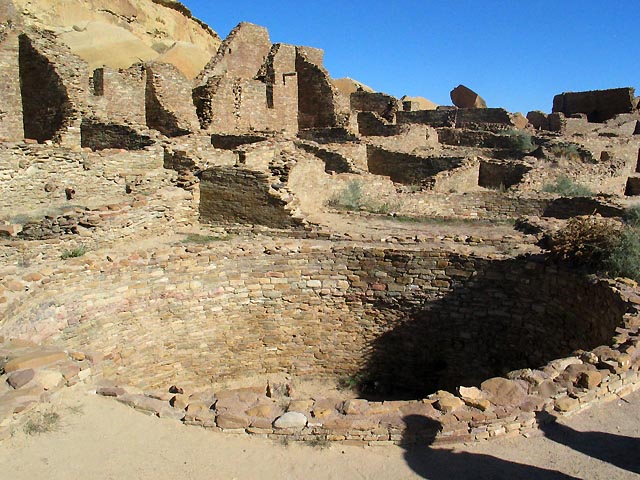
Chaco Canyon
|
|
Click on the image to enlarge
Chaco Canyon had eluded us for several years. Even Barbara had visited it only once with a German bus group. The access roads are murderous and impassible in rain and during the winter. The canyon is rather shallow as this Goggle-Earth picture shows. There are ruins of some 10 pueblos in the canyon and its surroundings. Two, Chetro Ketl and Pueblo Bonito are most impressive and easily accessible. But they are hard to see from the ground.
We know very little of the people who lived there and their eventual disappearance. Dated by dendrochronoloy, which was developed here, it was populated around 900 AD. An estimated 2000-5000 people must have lived in the area in some 400 settlements by 1000 AD. A political and economic powerspot, it had road connnections to as far as the Mesa Grande Culture of Northern Mexico. Its settlements were planned and not a haphazard collection of houses as in other Anasazi villages (a Mesa Grande influence?). Between 1130 and 1180 Chaco declined rapidly. As elsewhere in this region a major draught is blamed for its disappearance. The people suddenly dispersed, drifting into other, better-watered pueblos.
This state of knowledge was disturbed during the last ten years by a portentious find. Archeologists discovered human feces in a number of fire places which revealed by DNA analysis that the producers had eaten human proteins! A storm of indignation arose, cannibalism! The analyses are not open to doubt. There are numerous examples. The anthropologists who made the discovery proposed an hyposis that superior invaders occupied the Chaco pueblos in the 12th centurty and slowly ritually slaughtered - perhaps as a tribut - the Anasazi population. - Of course, this theory cannot be proven otherwise, and the present day guides of the Park Service question it vigorously. They simply wave away any questions for a better theory of the decline of Chaco as mere fantasy. "We simply don't know."
Chaco Canyon, Chetro Ketl Pueblo
|
|
Click on the image to enlarge
This satellite view shows Chetro Ketl. What appers as round "buttons" are actually depressions, the various kivas of the settlement.
.
|
|
From the ground the ruins are much harder to visualize than from outer space. These are a stack of rooms at the rear wall of the pueblo and the rock face protecting it toward the north.
.
|
|
The main kiva at Chetro Ketl is not only very large but contains several unusal "rooms" the original purpose of which is unknown (besides the common fire place and a "wind pipe" for the spirits).
.
|
|
In other pueblos the entry into the rooms is from the roof with ladders, at Chaco exist well articulated doors and carefully constructed walls.
.
|
|
A second-floor door or window through which the rock-wall is visible.
.
Chaco Canyon, Pueblo Bonito
|
|
Click on the image to enlarge
Pueblo Bonito barely hundred meters west of Chetro - but hidden in a fold of the terrain and hence nearly invisible from the ground - is much larger and better organized. The large number of kivas is clearly discernible, its semi-elliptic layout is unique and famous.
.
|
|
One of the smaller kivas imbedded into the ruins of the three-story "appartment" rooms.
.
|
|
The elegant rear wall of the pueblo is high and an exemplary piece of masonry - without mortar.
..
.
Canyon de Chelly
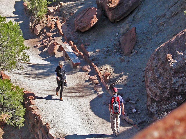
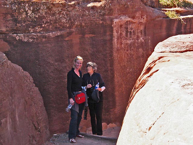
Barbara wanted very much to return to Canyon de Chelly - which we had all seen previously - and to take M&M down the steep hike to White House Ruin which she had made with Jutta. It lay conveniently on our way to Kayenta where we had reserved two rooms.
|
|
Click on the image to enlarge
This is the view of the valley from White House Overlook showing the meandering trail.
.
|
|
The few buildings of White House Ruin are visible in the cave at the foot of the 120-meter rock-wall. In front of it runs the river, which in 1984 had lots of water but is now dry most of the year. I waited at the top listening to the noise of chain saws in the canyon. Barbara later reported that the Indians who live in the canyon were removing all cottonwood trees and poplars because they sucked so much water from the ground level that their crops died in summer. Apparently the trees were planted by the "White Man" and were not indigenous.
..
|
|
A photo Barbara took of the look out from the canyon floor.
.
|
|
Two spacemen or conquerors on the way down.
.
|
|
Two hours later I spied the three hiking up the trail.
..
|
|
Barbara seems to run up - actually she very carefully and deliberately put one foot before the other. Considering that Barbara had had a serious physical breakdown in August-September this hike into the canyon was a major triumph for her.
.
|
|
Barbara and Monique emerging from the tunnel at the upper end of the path.
.
Monument Valley
|
|
Cathedral Rock near Kayenta. From Chinle we drove northwest through real Indian Land - Many Farms and the Black Mountains - into the waning day to our hotel in Kayenta. And then Barbara and Marc had the spontaneous idea to drive to Monument Valley, which had not been on our plan, for the sunset. It became an unforgettable experience.
.
|
|
Shadows on the road into Monument Valley.
.
|
|
This was the view when we arrived at - and had paid for - the Tribal Look Out Point.... In the shadow you see Marc and Barbara climbing out of the car. The people are strangers who had arrived earlier.
.
|
|
Monique taking a picture. Our long shadows stretching behind her.
..
|
|
Rolf emerging from the underworld. Shot by Marc with his cell-phone camera!
.
|
|
Two whales in the last sunlight.
.
Page: Glen Canyon Dam and Lake Powell
It took only two hours to drive to Page and Lake Powell, where Marc had wanted to walk into Antelope Canyon, a place we had never heard off. It could not be found on any map - including Google Earth, but the internet told us that it could be visited on an Indian-guided tour albeit for a substantial amount of money. - It now appears that the Indian Park Service runs a cheaper tour.
|
|
Our tour was to start at 11:30, to fill the time Barbara took us to a promontory in Page below the dam and overlooking the emerging lower Colorado River. Monique posing on a rock, which had the shape of a Bavarian Baroque Cloud - or a petrified cow dropping....
.
|
|
Glen Canyon Dam with very little water. Since 1984 the level of Lake Powell behind it had dropped by at least 50 meters. The "cable" spanning the river is the shadow of the separate car bridge on the curved wall of the dam.
.
|
|
The Canyon of the Lower Colorado.
.
|
|
Our heroine moping and Marc passed out.
.
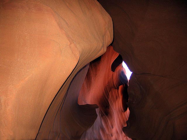
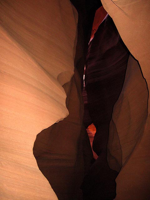
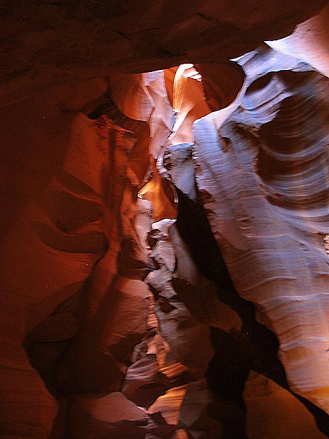
Antelope Canyon
|
|
Rolf and our Indian tour guide. The perky woman drove the 4-wheel truck (20 min) to the entrance, lead our way into the darkness of the 50 m deep and often barely 2 m wide crack in the sandstone rocks, and gave excellent advice to the photographers - who for a while saw nothing. She took a special liking to me. She offered me the job of herding her sheep and asked to take my picture. At which I balked. - Like an old Indian once told me, I told her that by doing so she would take a piece of my soul away. She was baffled and became serious: "people photographe me all the time!" "Yes," I said, "but you are a tough lady who can take it." - Barbara took this picture at that moment. "Is this your wife?" she whispered, and when I nodded she apologized for flirting with a married man....
The inside of this rock slot is a fantastically twisted surrealist landscape. - I will show you these photos without comments - often it was too dark to focus or hold the camerea steady enough - so some pictures are badly blurred.
.
|
|
.
|
|
.
|
|
.
|
|
.
.
|
|
..
|
|
.
|
|
.
|
|
Monique in a rare sunspot.
South Rim of Grand Canyon National Park
Grand Canyon was also not on our tour. It was Barbara who suggested to take AZ64/US180 to Williams instead of Flagstaff, but then she passed all the wellknown lookouts along the South Rim until I protested. M&M got out of the car and happily looked at the view. Suddenly Barbara said to me, "would you agree, if I gave Marc and Monique a flight over the Grand Canyon as a present?" The idea had earlier also occurred to me. I had no objections. We had to act quickly, and I went to look for them - and found Marc kissing his companion of many years.....
|
|
Now, that would be no surprise, had it not been the first time that I saw him kiss her in 20 years of our close friendship.... - They were very excited by Barbara's offer and Barbara Tour Guide found them a one-hour-long flight at the airport.
On Marc's wish we spent the night at the Hualapai Lodge in Pear Springs, not a place worth a detour. We had "Hualapai tacos" for dinner and next day drove all the way home to LA.


